Sauvik BiswasComics enthusiast, Musician, Programmer and Traveller2024-03-16T17:30:53Zhttps://sauvikbiswas.com/wp/feed/atom/WordPresshttps://sauvikbiswas.com/wp/wp-content/uploads/2020/07/cropped-site-favicon-32x32.pngSauvik Biswas<![CDATA[A tryst with B+Trees: Part I]]>https://sauvikbiswas.com/?p=62412024-03-16T17:30:53Z2024-03-14T15:24:23Z[Read more...]]]>Previous Post: A naive implementation of file-based storage
It was impossible to not come across B-Trees or any of the variants (B+Trees) if I had to implement a database. I hadn’t studied this data structure before.
Understanding the use case
At its core, B-Trees are multilevel indices for data stored in a database. A good introductory video of its structure and usage can be found here: https://www.youtube.com/watch?v=aZjYr87r1b8. I found Mr. Abdul Bari’s explanation easy to follow. A slightly discussion-oriented exposition can be found on Hussein Nasser’s channel: https://www.youtube.com/watch?v=UzHl2VzyZS4
Here is the crux of the problem— Let’s say I need to retrieve data for some id=1008. How can I effectively get to the data?
The brute-force approach is to read page by page. If our page-size is 1000, we will find our data on page 2. This is known as full-table scans.
We can definitely optimise full-table scans by taking one or more of these approaches—
Run multiple threads that scan for each page.
Partition the table. For a given id, data resides in a smaller sub-table.
Instead of scanning data tables, scan a metadata table (also known as index-table) and jump to the location. It is not efficient to do full-table scans, and is downright impossible if the data is huge. The trick is to reduce the search space, not work with large dataset at all.
One option is to traverse through multiple layers of an m-ary tree, where each layer reduces the search space. B-Tree is one of the implementations of an m-ary tree where certain rules ensure that the tree is always balanced under mutation. The leaves, where the data is stored (or the pointer to the data), are disjoint. This poses a challenge while doing range queries. To traverse from one leaf to the next leaf, one must jump to its parent(s) and traverse the children(s).
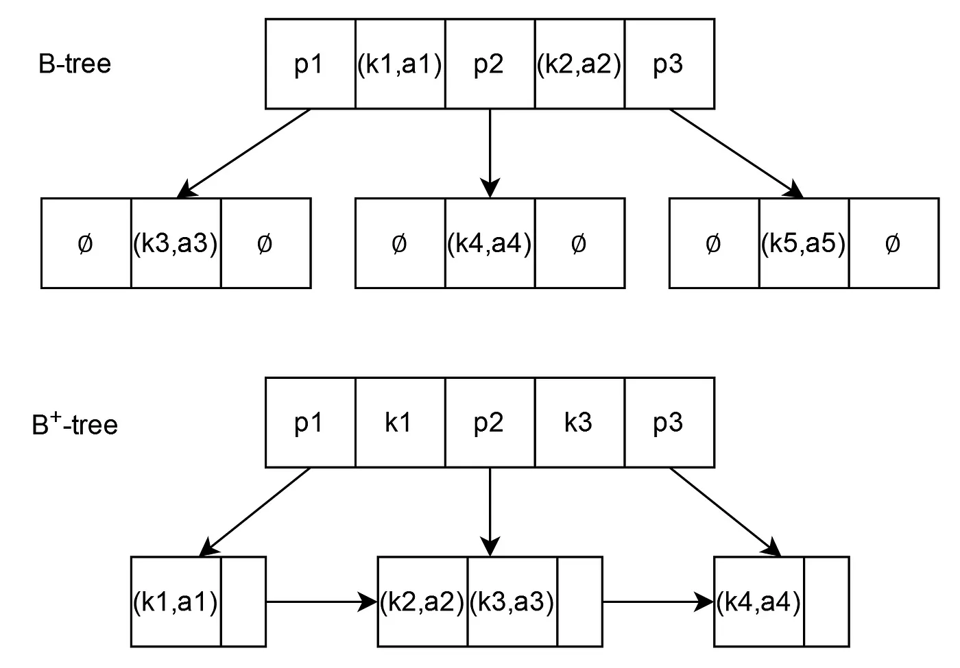
B+Trees is an augmentation of B-Trees that connects one leaf node to the next one directly. It may seem trivial, but range-based queries are so ubiquitous that even MongoDB made a switch from B-Tree to B+Tree (WiredTiger) as its storage engine from version 3.2.
Comparison between a B-Tree and a B+Tree. The connected leaves help with range queries. Image courtesy: Gianluca
Studying B+Tree algorithm
I wanted to take a shortcut and use a ready-made B+Tree Go library. Unfortunately, there isn’t one publicly available that I could rely on. I found an implementation by Collin Glass that is translated from Prof. Amittai Aviram’s C code. The translation had bugs. I ended up fixing the core functions after studying both codes side-by-side. The good part of this exercise was that I understood the implementation.
The key thing is that having a B+Tree library is not enough. Having a B+Tree that is closely coupled with the storage schema and disk page is what enables efficient IO. This is where another book came to my rescue—James Smith’s Build Your Own Database from Scratch. Right as I dived into Chapter 04, I realised how important designing the low-level storage-schema (a.k.a wire-format) will be.
I took the idea and wrote a page library that is heavily inspired from James Smith’s book. Go’s builtin encoding/binary library did most of the heavy lifting in implementing trivial operations over a page’s serialised byte array.
]]>0Sauvik Biswas<![CDATA[Tintin chases a plot for the first time in The Broken Ear]]>https://sauvikbiswas.com/?p=62182024-03-05T16:21:36Z2024-03-05T16:21:36Z[Read more...]]]>The Broken Ear is the first book with a preconceived plot. In the previous serialisations, Hergé had covered the four cardinal directions—Soviet in the North, Congo in the South, America in the West and China in the East. His approach to stories had changed much after his chance encounter with a fellow artist, Chang. He started using a notebook to jot down plot points, notes, sketches and references.
Breaking down a plot
Hergé had to still serialise the story, at a rate of two pages per week. He had to pack enough excitement and pace in those two pages while keeping some semblance of an overarching plot. He came up with a solution. The characters follow—or chase—the fetish until the mystery is solved. Each situation is still a compartmentalised event. Thus, dividing the story into smaller arcs, each with their own setup, environments, actions and gags. I could count eight of them.
The book opens in a relatively low-key fashion in Brussels. The stealing of a South American tribal fetish is the MacGuffin. It’s disappearance, and the subsequent restoration of a counterfeit in its place prompts Tintin to investigate.
Hergé then goes on to introduce the main villains Alonso and Ramon as well as Balthazar and his pet parrot. Balthazar is the supposed creator of the counterfeit and has been found dead. Subsequent pages mostly focus on our main characters chasing around the parrot in hopes of finding out who killed Balthazar and took the original fetish.
This is followed by Alonso, Ramon and Tintin’s adventures on a ship bound for South America. They are after Tortilla, the prime suspect of Balthazar’s murder. Alonso and Ramon dispose him off but are caught by Tintin and handed over to the police.
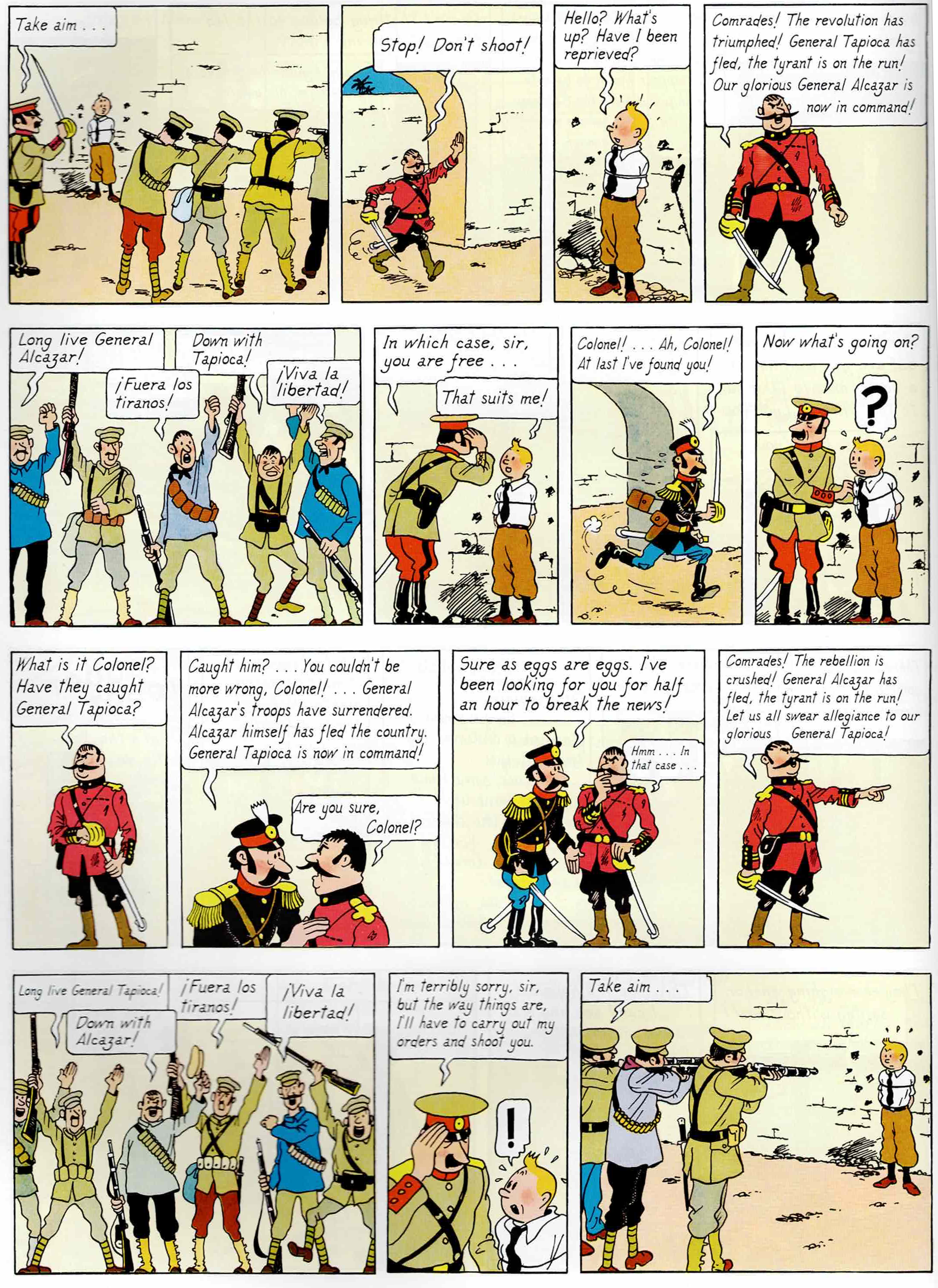
Tintin is asked to give testimony against the culprits, but it turns out to be a setup. He is caught by the police. He becomes a prisoner of General Tapioca, immediately followed by being a free man under General Alcazar, and again, immediately followed by becoming a prisoner General Tapioca again without moving an inch. The armed police force changes their alliance based on who is in power.
Tintin is rescued by General Alcazar’s revolutionaries. We are introduced to Alcazar as an egoistical, impressionable and downright incompetent leader. Tintin is appointed a colonel. We are re-introduced to Alonzo and Ramon, who are also caught up in the political turmoil and are part of General Alcazar’s troops. There is a running gag where Diaz, a colonel-demoted-to-corporal tries to kill Tintin and always fails because of his incompetence. In the end, Tintin is imprisoned by General Alcazar for treason.
Tintin escapes the prison with some help. He is chased by General Alcazar’s troops, gets caught by General Tapioca’s troops again, and is able to escape again. He canoes along River Coliflor and rows into the forests of South America.
Hergé introduces us to the Arumbaya tribe and their enemies, the Rumbaba tribe. He also introduces a European explorer Ridgewell, who has made the Arumbaya his home. Ridgewell mostly acts as an interpreter in this sub-plot and an exposition device for the story—thus giving some meaning behind the fetish and its materialistic importance in the plot. It turns out that the fetish contained a diamond stolen from the Arumbaya tribe. There is a scuffle between Tintin and Alonzo and Ramon, but neither of the parties claim victory.
The final arc brings us back to Brussels. Balthazar’s brother has started to make much more accurate replica of the fetish. These replicas are available everywhere. Tintin (as well as Alonso and Ramon) trace down the current owner of the original. A showdown ensues that damages the fetish. Alonso, Ramon and the diamond are lost to the sea. (This is also one of the two Tintin albums where the antagonists die!) The original fetish is all patched up and is placed back in the museum.
Portrayal of a conflict
When the serialisation of The Broken Ear began, Bolivia and Paraguay had just declared ceasefire on Chaco War. The fictional nations of San Theodoros and Nuevo Rico are based on these two countries, respectively.
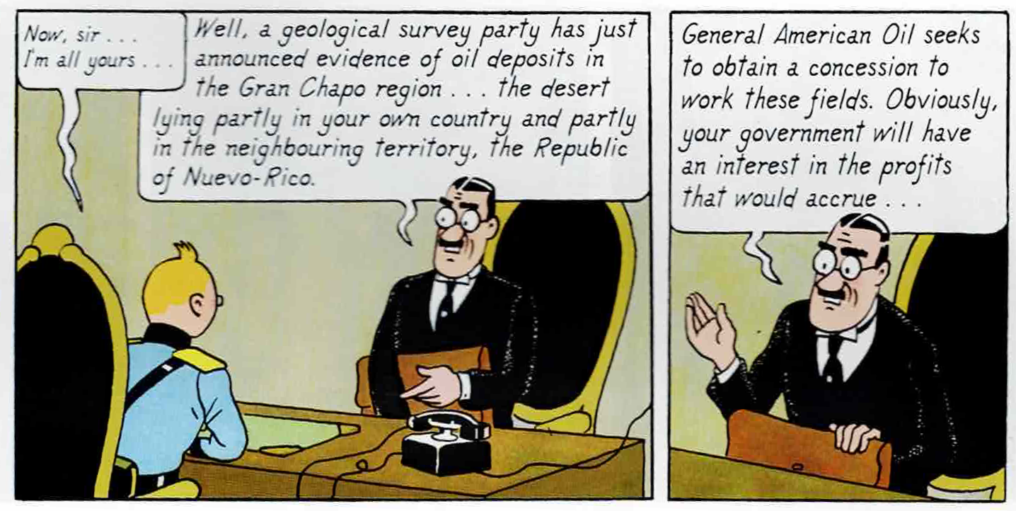
In The Broken Ear, General American oil tries to make a deal for oil in Nuevo-Rican territory. We even see a representative trying to bribe Tintin in exchange for concession over the territory. One of the main triggers of the real Chaco War was the conflict between oil companies who wanted exploration and drilling rights in the Gran Chaco basin; Royal Dutch Shell supported Paraguay, while Standard Oil supported Bolivia. The countries signed a border treaty in 1938 with the majority of Gran Chaco going towards Paraguay—much after the serialisation of The Broken Ear had ended.
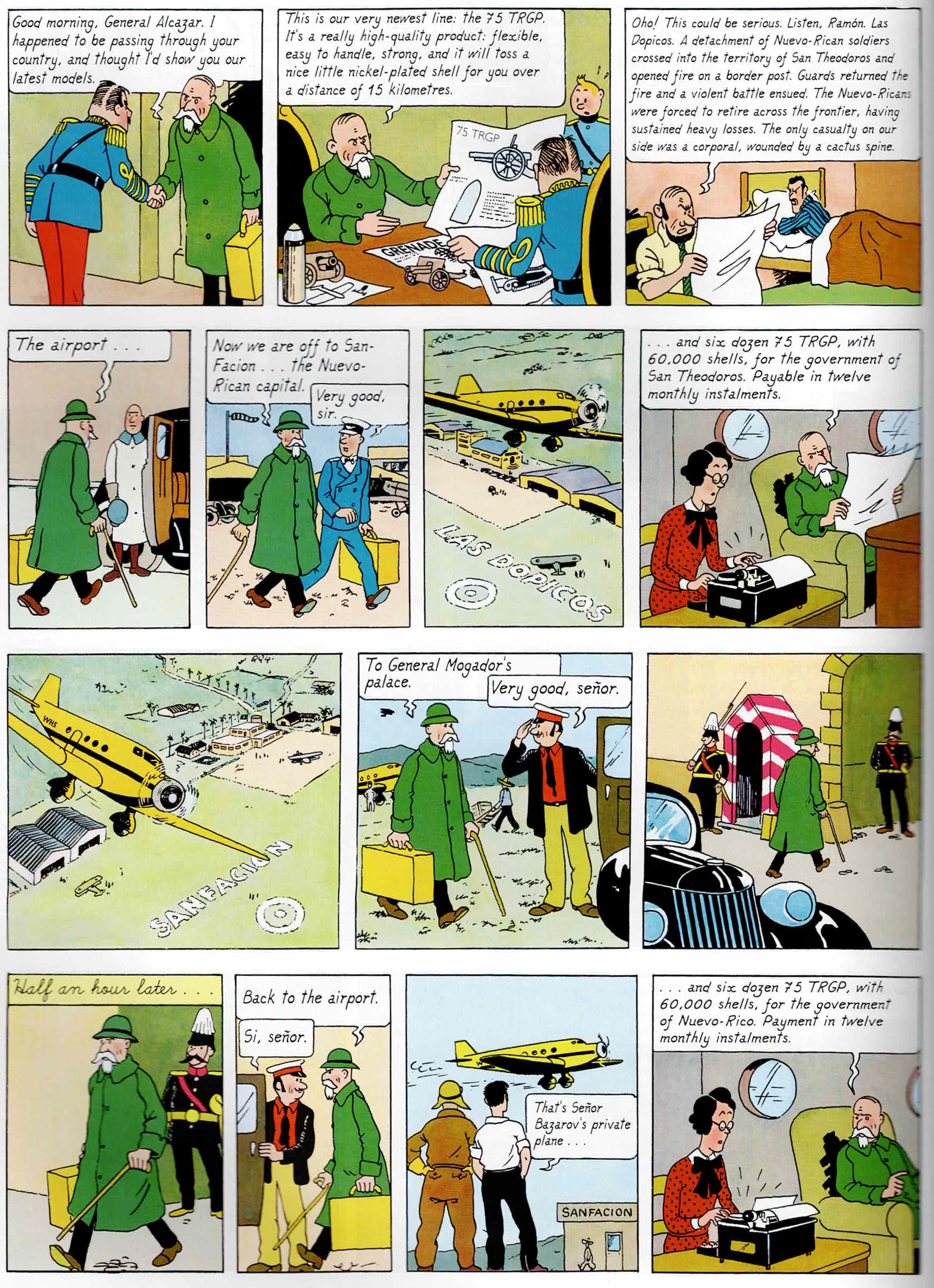
A fictional arms company—Korrupt Arms GmbH—sells weapons to both parties. Hergé doesn’t shy away from satirising our current world where geopolitical conflicts are fuelled by corporations that supply war materials to both parties. Note how Bazarov manages to strike the same deal with both sides of the war. The character Basil Bazarov is modelled after Basil Zaharoff—a Greek arms dealer—who profited by supplying arms to both Paraguay and Bolivia.
The armed police who catch Tintin changes their alliance based on who is in power. This is a caricature, almost a parody of sorts, that shows how those at the lowest level are least bothered about who is in power.
General Alcazar is portrayed as an incompetent and impressionable leader. He prefers playing chess and massaging his ego over managing the actual affairs of the state. Although General Tapioca doesn’t make an appearance, we can almost deduce that he is no better than Alcazar.
The conflict between the two groups would later resurface in Tintin and the Picaros.
Inventing a language
The English translators of the Tintin album—Leslie Lonsdale-Cooper and Michael Turner did a fabulous job in translating the “mock” language that the Arumbaya’s spoke. They are basically English phrases—to be precise, Cockney slang broken after every one or to syllables. For example, the phrase, “Ahw wada lu’vali bahn chaco conats!” can be read as “Oh, what a lovely bunch of coconuts! Ha! Ha! Ha!”, and “Goh’ blimeh! Wa’ samma ta, li li li va?… Lem eshohya!” is phonetically equivalent of “Oh, blimey! What’s the matter, lily-livered? Let me show you!”
I have read that in the original French, Hergé used Brusselian dialect of Dutch language. In the Bengali edition, the dialogues are merely transliterated from English to Bengali script, retaining the Cockney pronunciation.
The serialisation of The Broken Ear began on December 5, 1935. (During serialisation, it was not known as The Broken Ear but simply The New Adventures of Tintin and Snowy. That name would be given to the collected edition, published by Casterman two years later.) During this time, Hergé was simultaneously working on The Adventures of Joe, Jet and Jocko that started serialisation in Couers Vaillants on January 19, 1936 as well as Quick and Flupke. This is a testament to Hergé’s work-ethic. This album, along with The Black Island, King Ottokar’s Sceptre make up for the second phase of Tintin comics—marked by plot-driven stories that are rooted in reality. As Le Petit Vingtième folded, so ended Tintin’s solo stint.
]]>0Sauvik Biswas<![CDATA[A naive implementation of file-based storage]]>https://sauvikbiswas.com/?p=62092024-02-26T15:53:57Z2024-02-26T15:53:57Z[Read more...]]]>Previous Post: YetiDB: an academic exercise
We have a basic implementation of four interfaces—
Record. This is the unit of data that can be written or retrieved. Since we are using protobufs, a protoc plugin protoc-gen-go-yeti generates the additional methods that will conform a protobuf to adhere to the Record interface.
Driver. A driver holds the connection to an underlying database engine. At present, it only supports local file system.
Session. A session can run multiple transactions. At present it is only an abstraction layer to run managed transactions. Once we have a distributed architecture, having this abstraction would allow us to implement session-based consistency models.
Transaction. A transaction can read or write Records, can be committed or rolled back.
The core idea is to have the interfaces defined and write a number of good test cases. This will help me when I get to serious implementations of db engines.
Implementation
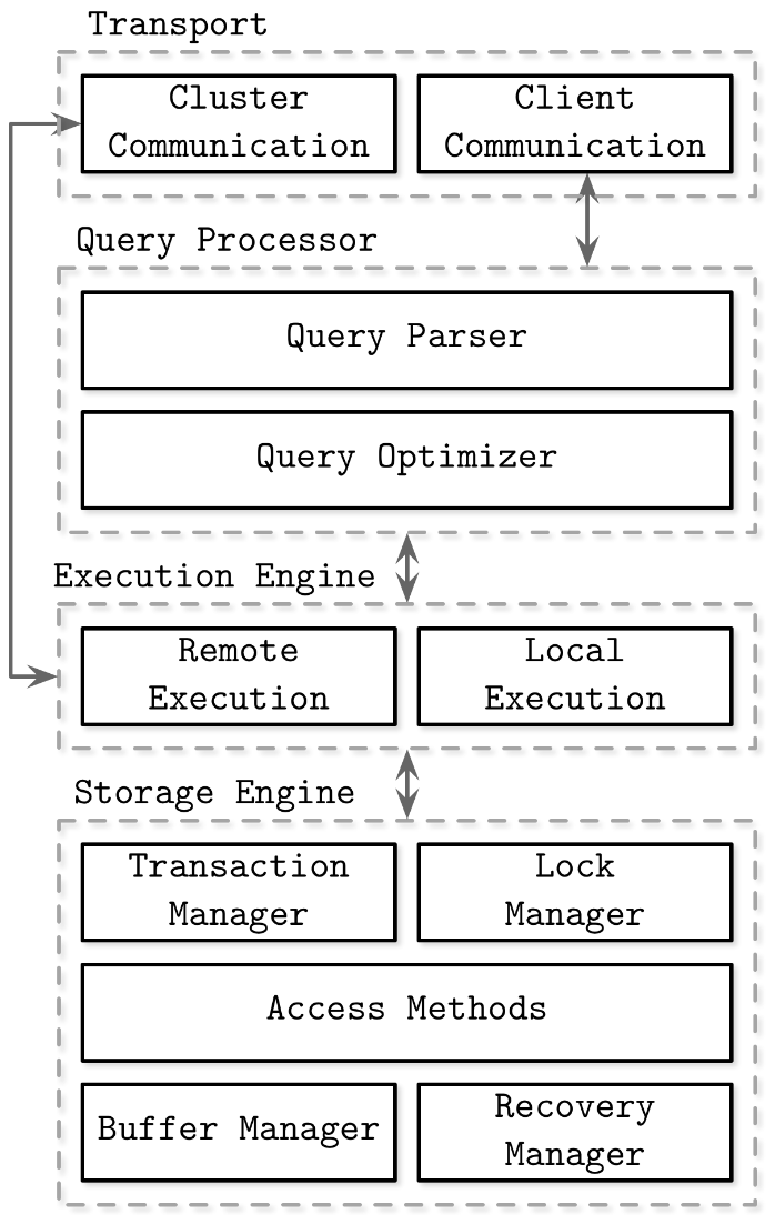
Block-level implementation of a generalised database. Ref: Database Internals by Alex Petrov
From an implementation standpoint, the Query Parser is rudimentary and the Query Optimizer is non existent. Sending a Record to the Write method analyses the underlying Type and constructs a unique filename based on the Primary Key. For reading data we have to send a Record to the Read method and it fetches all records that match the Type; in that sense, sending an empty Record to Read works as well. This is good enough for the skeletal implementation of a Query Processor.
Also, since the proof of concept is to work with human-readable files, the Storage Engine relies on transaction-based isolation, thereby allowing me to write a Transaction Manager and Access Methods the relies on common methods found in Go’s os package. I don’t need a Lock Manager as transactions happen in isolated folders. On top of it, file-based read and write locks are intrinsically taken care by os package. I have also decided to forego any implementation of Buffer Manager and Recovery Manager at this stage.
These files being local, the Transport section is not needed, as are any Remote Execution systems of the Execution Engine.
Isolation levels
The current file-based system implements a variation on read committed isolation level. Here is the definition from Database Internals—
… we can make sure that any read performed by the specific transaction can only read already committed changes. However, it is not guaranteed that if the transaction attempts to read the same data record once again at a later stage, it will see the same value. If there was a committed modification between two reads, two queries in the same transaction would yield different results. In other words, dirty reads are not permitted, but phantom and non-repeatable reads are. This isolation level is called read committed.
In addition to this, any write that is performed by the transaction, even-if the transaction is not committed, is read back.
]]>0Sauvik Biswas<![CDATA[YetiDB: an academic exercise]]>https://sauvikbiswas.com/?p=62042024-02-22T14:20:27Z2024-02-22T14:20:27Z[Read more...]]]>Over the last couple of years I have seen protobufs being used not only as a means to serialize and deserialize data for transport over network but also as a means to implement a type system, business logic, version control, storage schema, and what not. These often require authoring some sort of custom options (extensions) for the protobuf messages, and writing code that can parse these options and implement some sort of business logic that would use the data contained in the protobuf.
One of the most common usecase is to define storage schema using protobuf. Infobolox’s protoc plugin for GORM comes to my mind. I have seen being used by many folks, although it is a bit restrictive. One of my teammates wrote his own Python/Jinja-based parser to churn out custom code for our application. Needless to say, he has automated the hell out of our system.
There is always a middle layer that prohibits us from transacting with the database as protobufs. However, if we look at a protobuf’s core use case, it is for serializing and deserializing data. This is something that can—in theory—be used for storage and retrieval as well. Most middlewares essentially translate protobufs into language-specific queries. My teammate did it for GORM which in turn generated SQL queries for Postgres, and I did it for generating Cypher queries for neo4j.
Three days ago, I wrote a primary requirement in terms of building a protobuf-centric database—
User chooses:
A storage system
One Record / File
B-Tree based
LSM tree
Non-indexed sequential
A host of servers
User interacts with db:
Write as protobuf
Read into protobuf
It is first-and-foremost an academic exercise. I know very little of how a database really works. This can be an excellent gateway to understanding the fundamentals of a storage system.
There are two books that I will use as my starting point—
Database Internals by Alex Petrov
Designing Data-Intensive Applications by Martin Kleppmann
I call it YetiDB. I was reading Tintin in Tibet for the nth time just before I had to give the repository a name. Anyways, here it is— https://github.com/sauvikbiswas/yeti
P.S. The answers of this question on SoftwareEngineering.StackExchange gave me a lot of confidence.
]]>0Sauvik Biswas<![CDATA[That one time we actually trekked to Goecha-La]]>https://sauvikbiswas.com/?p=60442023-07-11T12:30:08Z2023-07-09T08:45:28Z[Read more...]]]>Goecha-La was my first trek. Back in 2008, me and my friends made an attempt to reach there. Poor planning, poor fitness and general lack of awareness of what a trek entails resulted in a hilarious and failed trip. I haven’t shied away from documenting that embarrassing piece of history. If you are interested, please have a read.
Some of my friends (Rajdeep, Akash, Mayank—all ex-colleagues from Airbus) wanted to do this trip. Having known that I had some experience of the route and aware of my wish to successfully complete the trek, they approached me sometime in October. There are independent trek operators and local guides who still operate on this route just like they used to do it in 2008. However, things have changed in the last fifteen years. Nowadays, we have a couple of big organised trek operators (Trek the Himalayas or TTH, Indiahikes, Bikat Adventures) who are much more operationally reliable and much more safety focused. They charge a small premium for that but the experience is generally better.
I had done Kedarkantha with Indiahikes before and liked the experience. Some of my friends spoken well of TTH, too. It all boiled down to what slots would be available to us in April. Being one of the first seasons after the COVID restrictions were fully revoked, these organisations had opened up only a few slots for the September-October window (Autumn 2022, when we were weighing our options) and another few in April-May (Spring 2023, when we intended to do the trek). After some deliberations, we chose Indiahikes and booked their second batch that on 8th. There were only 9 batches that Indiahikes had planned for the Spring 2023 season; and if I remember correctly, TTH had planned 8 batches.
This was the itinerary—
April 8th: Drive from Siliguri to Yuksom, stay at the basecamp lodge. April 9th: Trek from Yuksom to Tsachen. April 10th: Trek from Sachen to Tshoka via Bakhim. April 11th: Trek from Tshoka to Dzongri via Phedang. April 12th: Trek from Dzongri to Dzongri La and back, acclaimatize at Dzongri. April 13th: Trek from Dzongri to Thansing via Kokchurang. April 14th: Midnight trek from Thansing to Viewpoint 1 via Lamuney and back; stay at Thansing. April 15th: Trek from Thansing to Tshoka via Kokchurang and Phedang. April 16th: Trek from Tshoka to Yuksom via Tsachen. April 17th: Drive from Yuksom to Siliguri.
Now contrast this to the six-day itinerary we had made in 2008 to cover the same distance!
Chapter 6: A real preparation before reaching Yuksom
Most of these big organised tour operators require some proof of fitness for being a part of the group. I didn’t have them to tell me. I knew it first hand from my earlier experience. I started hitting the gym to do some strength training and tackling long-distance cycling trips to build my endurance. Multi-day cycling trips like the Udupi-Bangalore one I did with Mittal in December also kept me fit and motivated.
This map by Indiahikes is more informative than the ones we had in 2008.
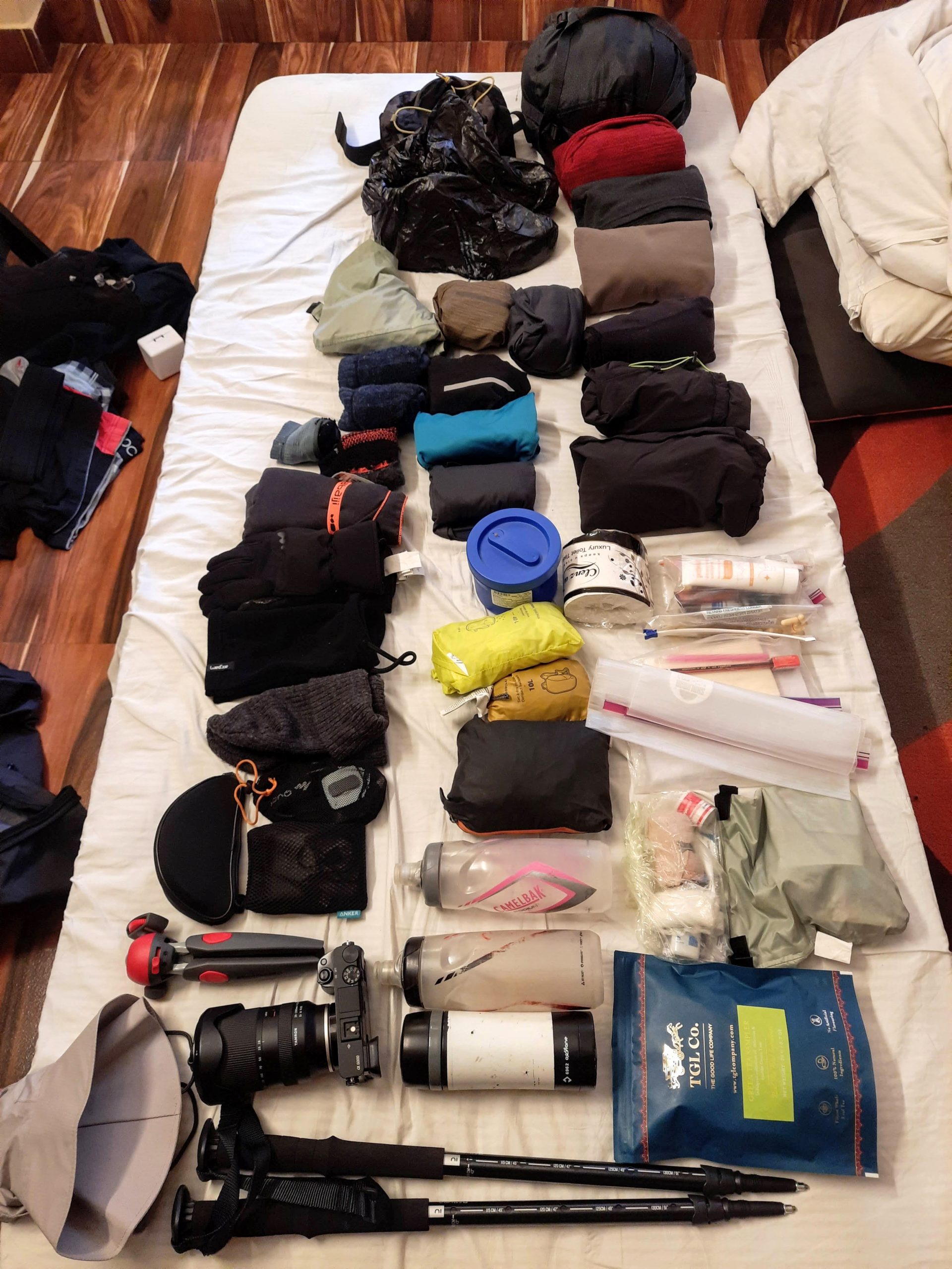
I had learned another lesson during my Nepal trip in 2019. I suffer from a weak lower back. I had sprained it because I was carrying a heavy backpack. As a result, I had to cut my trip short that year. For this trip, I deliberately wanted to keep my backpack small and lightweight. If you have done any kind of travel, you would know that most of us have a tendency to fill up any available space with items that would only be needed for “what-if” situations whose probability of occurrence is really low. I wanted to minimise carrying such items. There was an option of offloading my backpack to a mule or a yak but I reckoned that it would be more fun to be as self-sufficient as possible.
This is all that I carried in my 34 litre Osprey Talon 36 backpack. You can contrast that to all the fluff I had carried in 2008. Back then, I even had an additional smaller bag hung the other way over my chest.
Sometime during March, Akash had to drop his plans due to work-related reasons. Mayank and I booked an early flight for 7th April to Bagdogra while Rajdeep booked an afternoon one.
We stayed at a hotel near the 2nd mile checkpost in Siliguri and had the entire day to go around. It was also a long time since I had set my foot in North Bengal. Having grown up in that area (in Cooch Behar, pretty close to Siliguri), I had fond memories of that place. I had visited Siliguri a number of times when my father was posted there as well as to give a number of entrance examinations during and after my Class 12th. Things had changed a lot in the last 20 years. Among other things, the perimeter of the city had increased. That evening we went around Bidhan Market and sampled some baro-bhaja (literally twelve fries; it’s an assorted mixture of roasted and fried crisps processed with some onion, chilies and spices), chop (deep fried patty), momos, followed by biryani at Arsalan.
The four SUVs to Yuksom came at around 10 next day. This is where we met some of our co-trekkers. We would be spending the next ten days with them. Apart from us three, we had a couple from Bangalore in our vehicle—Ashwin and Sweatha. They were both into birding.
Sweatha, Ashwin, Mayank, and me at Hotel Doklam. All the vehicles stopped here for lunch.
By the time we reached Yuksom, it was 5.30 pm. It gets dark pretty quickly in the hills.
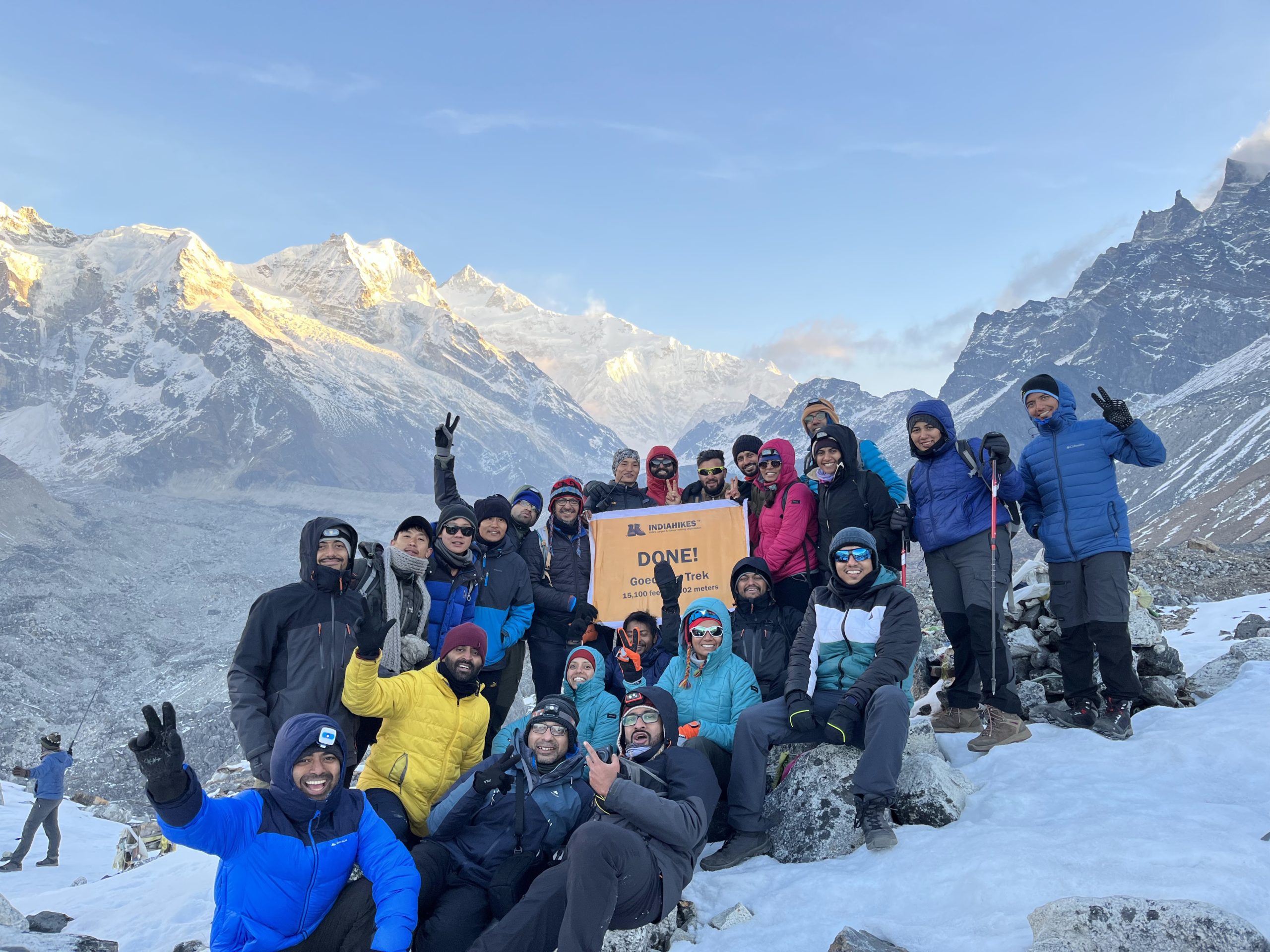
That evening, we had a long briefing after our dinner. The team comprised of the trek lead—Gagan, assistant trek leads—Pasu, Yu Hang, and Sancha, two kitchen staffs—Mohan and Harsh Mohan, twenty-two trekkers and two mule herders. Apart from getting introduced to each other (barring the kitchen staff and mule herders, whom we would meet later during the trek), we were given a small briefing about the route, what to expect, Indiahikes’ philosophy, and safety protocols in general. Most of us had done a number of treks before; and barring a couple of trekkers, almost everyone had experience with Indiahikes.
Chapter 7: The cover of foliage
I remembered the unassuming entrance to the route. It had not changed at all. The accommodation that Indiahikes had leased for that season, was right next to it. We had our breakfast—eggs, idly, and an apple; packed some pulao for lunch and gathered outside. Everyone was brimming with excitement. There was no cell-tower coverage beyond Yuksom. I called up my wife, mom and sister and asked them not to worry. We wouldn’t have any contact for the next eight days. I also shared the contact of the ground coordinator of Indiahikes. The trek leads and slope managers usually keep the ground coordinators up to date about the team’s movements.
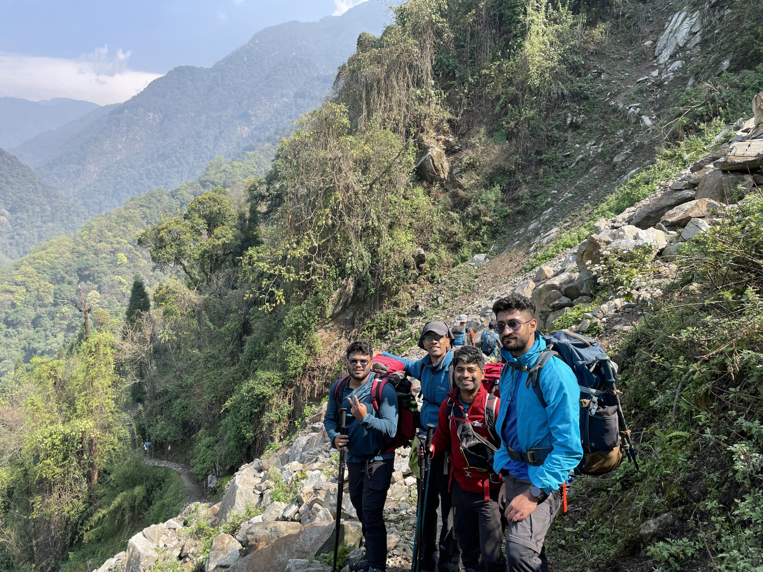
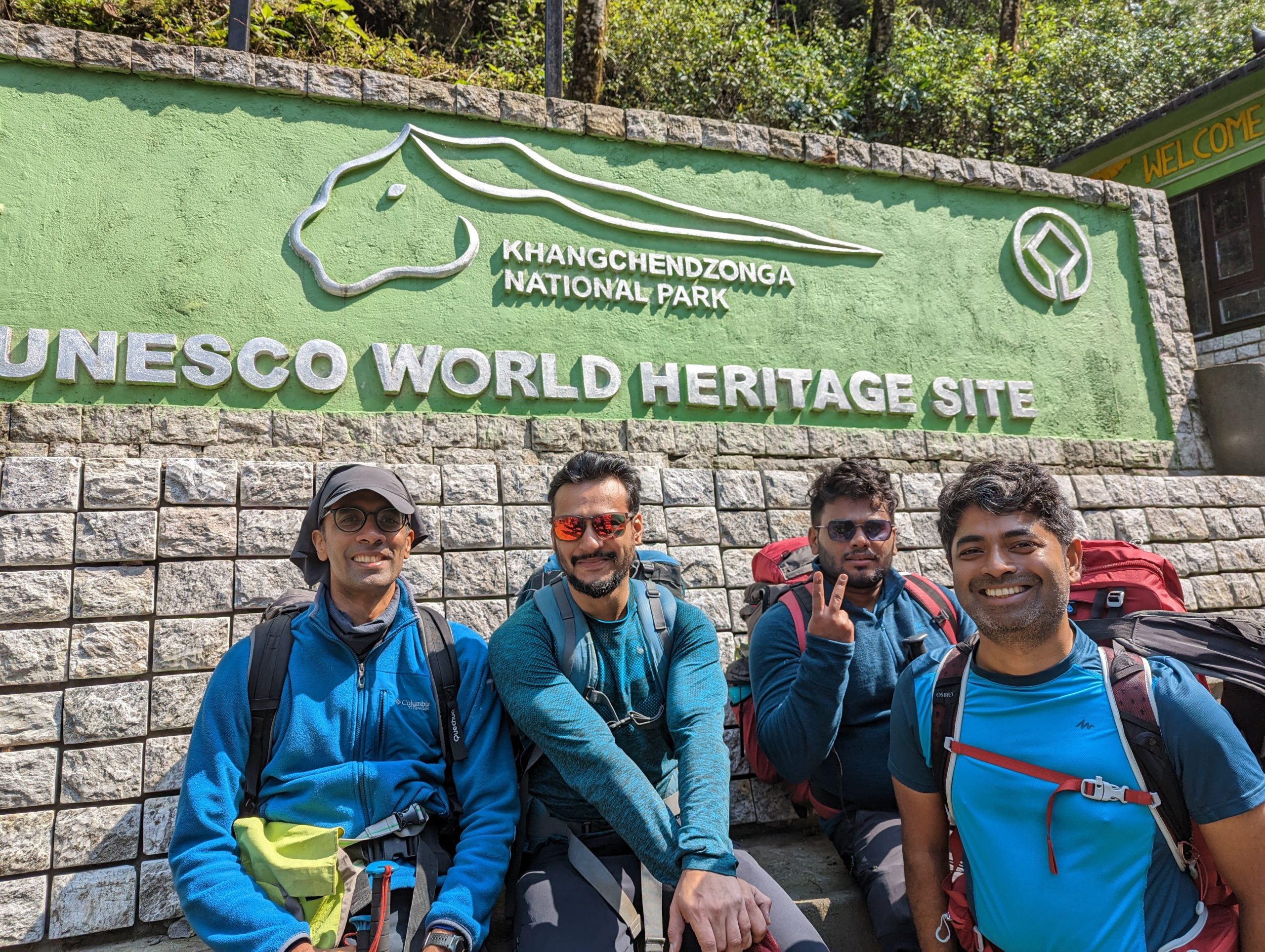
We left at 8.30 am and walked through the backyards of many houses, past a shade dedicated to the memory of a young girl, and made our way through the stony route that had seen a number of landslides in the past couple of years. When a route gets destroyed by landslide, the locals usually carve out another route above or below the older route and fix some support to prevent further landslides. The trail until the Kanchendzonga National Park entrance is exposed on one side to the Rathong Chu river through which we had a clear view of the green hills across the valley.
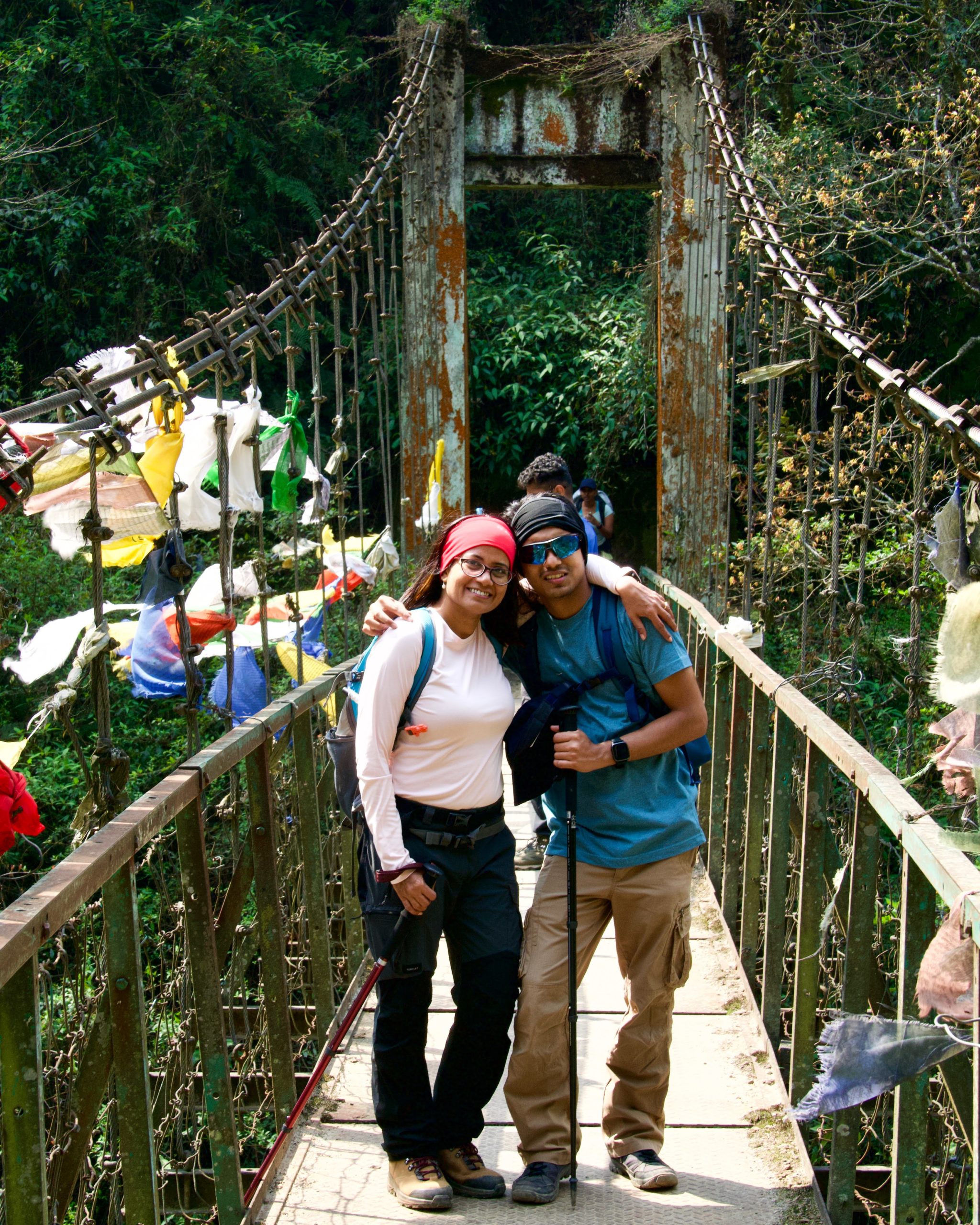
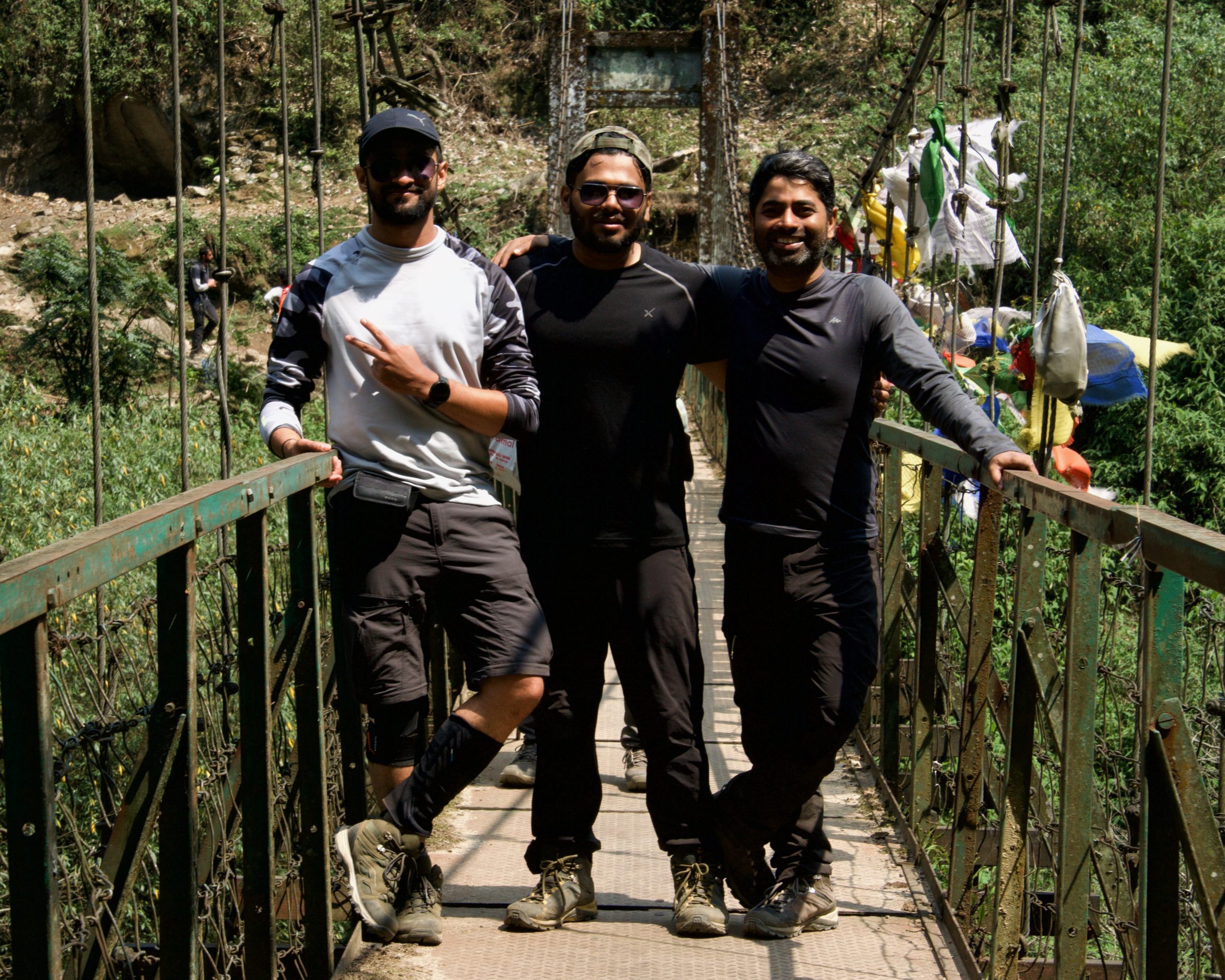
On our way to Kanchendzonga National Park entrance. L-R: Rajdeep, Ashwin, me, Mayank (Pic: Ashwin)At Kanchendzonga National Park entrance. L-R: Ashwin, Aditya, Rajdeep, me. (Pic: Shweatha)
We reached the entrance at around 9.15 am. As soon as we entered the national park, we were greeted by the cover of a wet temperate forest. This would last until Bakhim—a place we would reach the next day. The weather got more humid as the day progressed and as we entered deep into the forest. We crossed three waterfalls. Mayank and I stopped at one of them to refill our water bottles. We even met the guys from the first batch who were making their way back to Yuksom. They had great luck with the weather. I hoped we also had lady luck’s blessings.
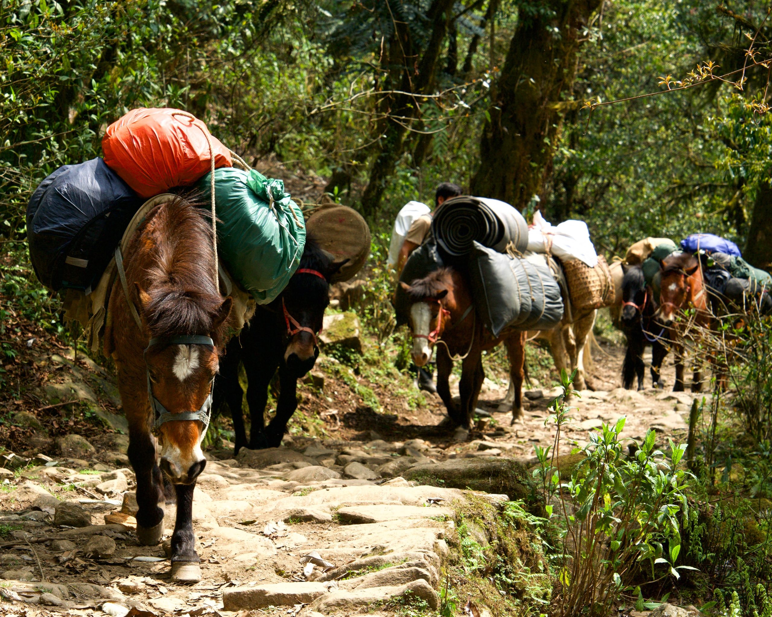
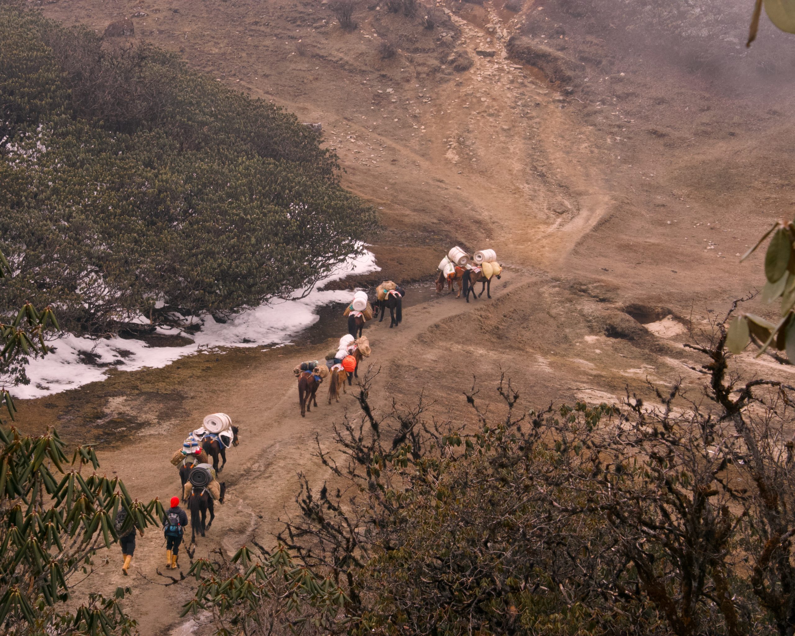
Me, Mayank, and Sourav—an IT professional and a photography enthusiast from Kolkata—reached Tsachen at 12.50 pm. There were four trekking groups at Tsachen, including us. The mules hadn’t reached yet, so we did not have our tents. The other three teams had already called dibs on their camping spots. The trekker’s hut where I had stayed in 2008 was being used as a kitchen by all four groups. They had built a new shade where the groups could take turns to have their meals. That evening, we had some pasta for our snacks and dal, rice, and cauliflower sabji for dinner.
Mules carrying our supplies to Tsachen.
Rajdeep, Mayank and I shared a tent for the entirety of the trek. Before going to bed, I made a note of a couple of things. Firstly, I was carrying my camera in a waist-bag that was hung like a sling. I could as well keep the camera at the top of my bag and take it out if I saw something interesting. That way, I would be able to walk much comfortably without a dangling weight. Secondly, I had to stay ahead of the pack. This would give me ample opportunities to stop, unload my backpack, and take out my camera if I encountered something interesting. Thirdly, I had to make sure that I did not have anything that could even be mildly upsetting to my stomach—like milk or cheese. My digestive system wouldn’t be able to handle any stress arising from my intolerance to lactose or overeating at higher altitudes.
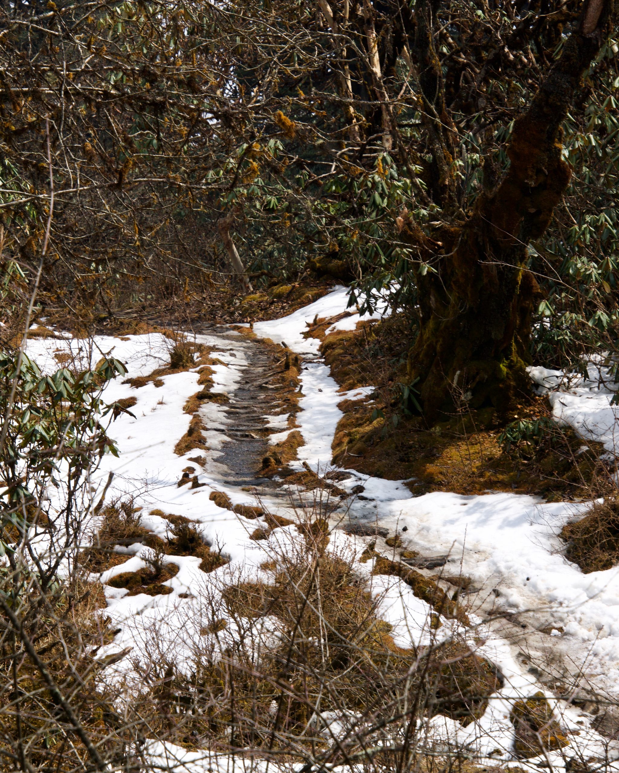
The next day we had our breakfast—roti and cabbage—and packed our lunch—paratha and potato—before leaving for Tsoka at around 8.00 am. This stretch had the steep, two-kilometre long descend followed by an equally-steep and equally-long ascend across Prek Chu river. It was just like I had remembered from fifteen years ago. This wouldn’t be the last time I would cross Prek Chu. This entire stretch was jammed by trekkers, staff and mules from all the four groups as well as those who were descending back. As I approached Bakhim, the foliage cover slowly disappeared.
Prek Chu riverMumtaz (an entrepreneur from Singapore) and her nephew, Riaz, on the Prek Chu Bridge.
There was a new canteen at Bakhim. Some of us—Shankar (a marathoner), Trilochan (a retired employee of the Income Tax department), Bibhas (a geologist currently residing in the Netherlands), and Mayank sat inside and had some dry Wai Wai and omlettes along with our packed lunches. I got some batteries for Rajdeep’s headlamp as well. After we were done with our lunch, Mayank and I went around. The trekker’s hut where I had stayed back then was in tatters and the Forest Rest House got destroyed a couple of years ago.
Trekker’s from different groups stopped at the Bakhim. The canteen owner had a hard time keeping up with the orders. (Pic: Mayank)Bakhim offers one last view of the dense wet temperate forests.The dilapidated trekkers hut at Bakhim.
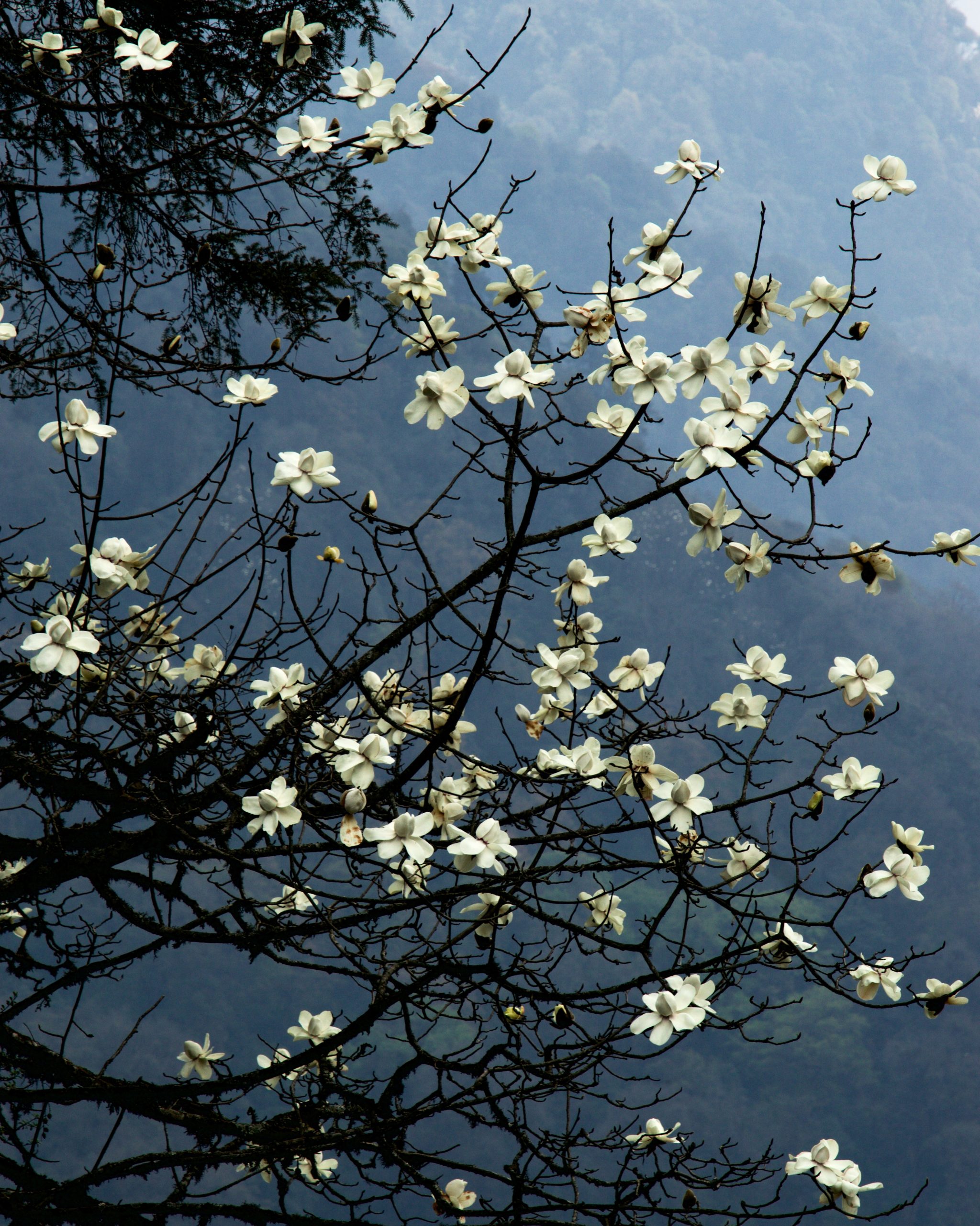
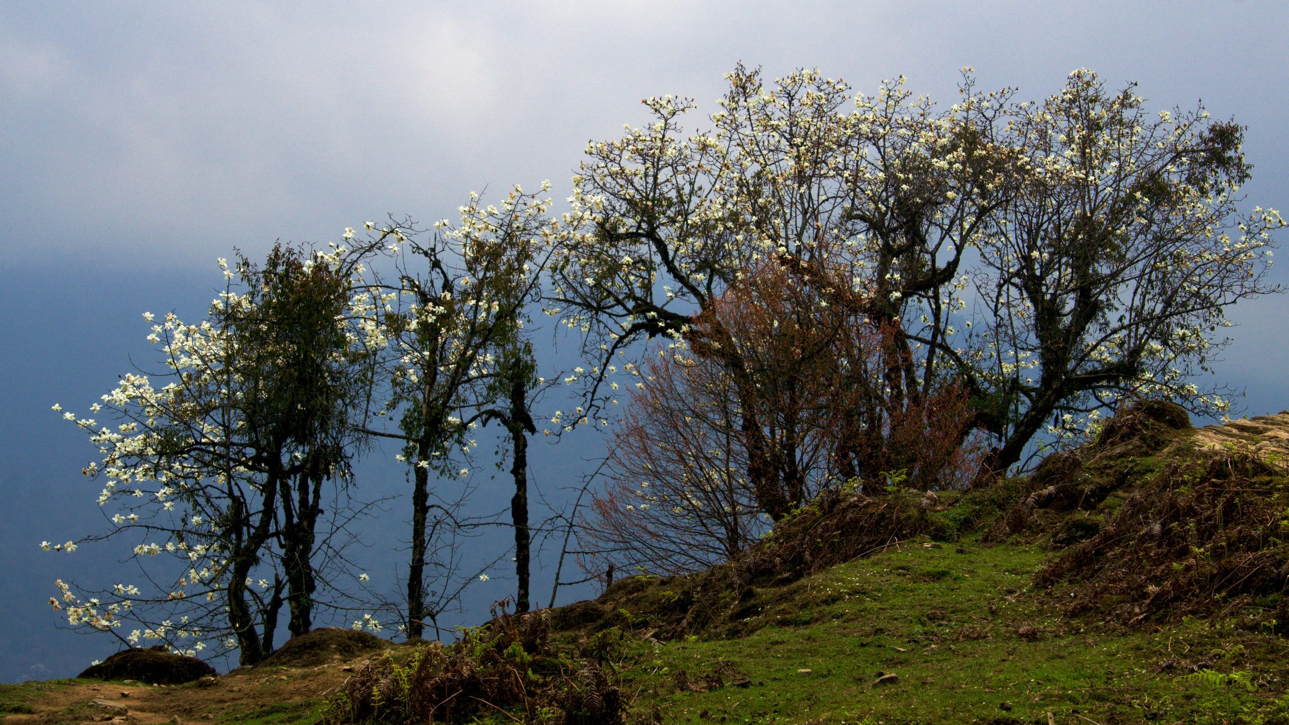
Chapter 8: Magnolias, Rhododendrons all the way to Dzongri
The day wasn’t over yet, we still had a couple of hours to go before we could reach our second camp at Tsoka. There is a beautiful meadow about a kilometre from Tsoka that is flaked by magnolia trees and interspersed by some occasional rhododendron ones. The entire group stopped here for an extended period of time to take photographs.
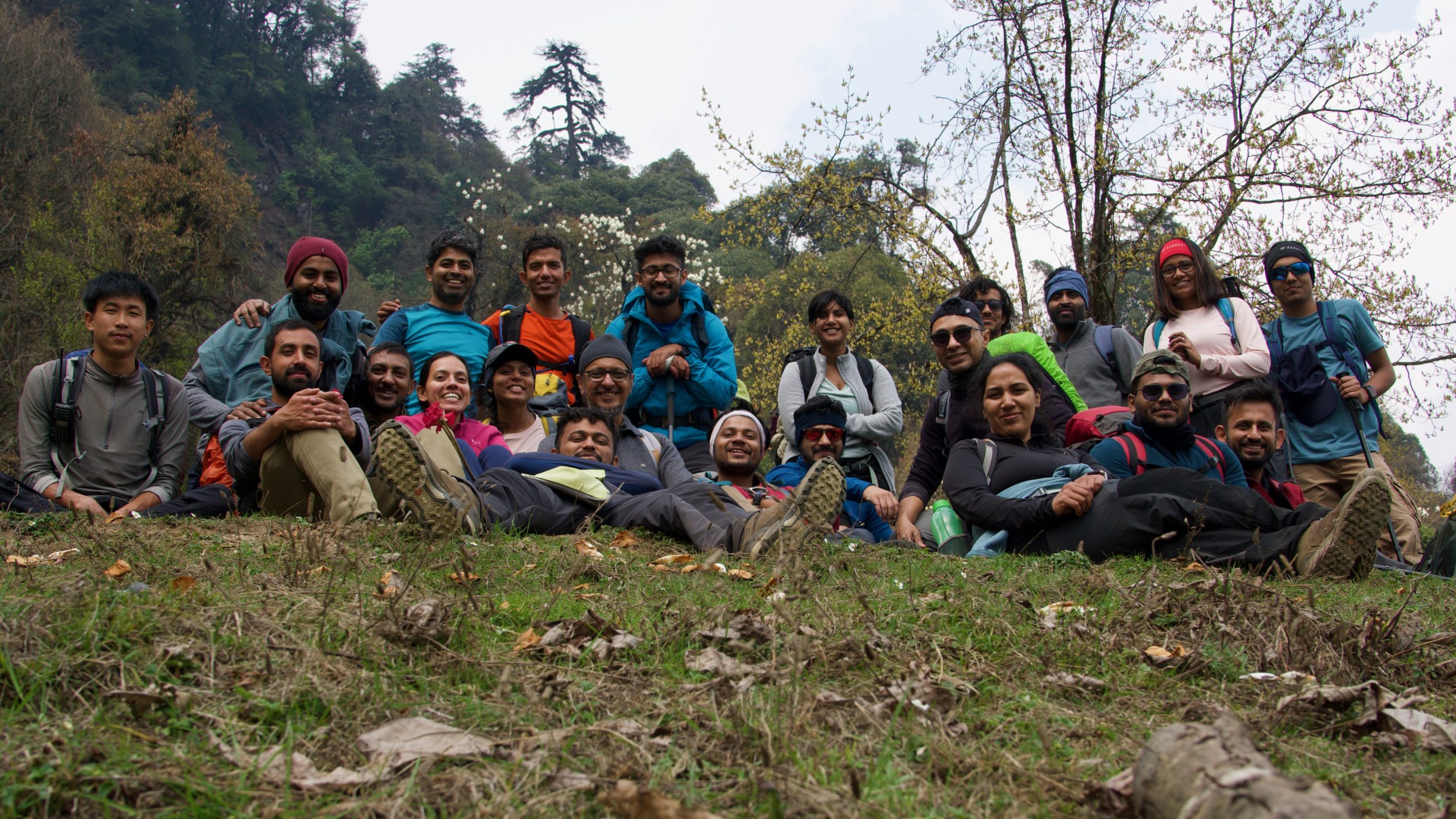
Magnolia: This is one of the best clicks I have taken during this trip.An array of Magnolia treesTrilochan Singh—one of the most energetic trekkers—posing in front of the magnolia (white) and rhododendron (red) trees.Sitting L-R: Pasu, Gagan, Koushik Paul, Sneha Dinakar, Rasika S., Virul Agarwal, Trilocahn Singh Khalsa, Bibhasvata Dasgupta, Aditya Agnihotri, Sourav Dhar, Sweatha Nageswaran, Rajdeep Shil, Puneet Kumar. Standing L-R: Ajay Manoharan, me, Dipankar Paul, Mayank Singh, Yazhini Thangavel, Shankha Saha, Shankar Kurella Bhanu, Mumtaz Pachisa, Riyaz Kagzi,
I reached Tshoka at around 2.30 pm. That evening we all sat down in our dinner tent and shared stories. I also broke my vow regarding not eating anything that wasn’t easy on my stomach by gulping down some onion fritters.
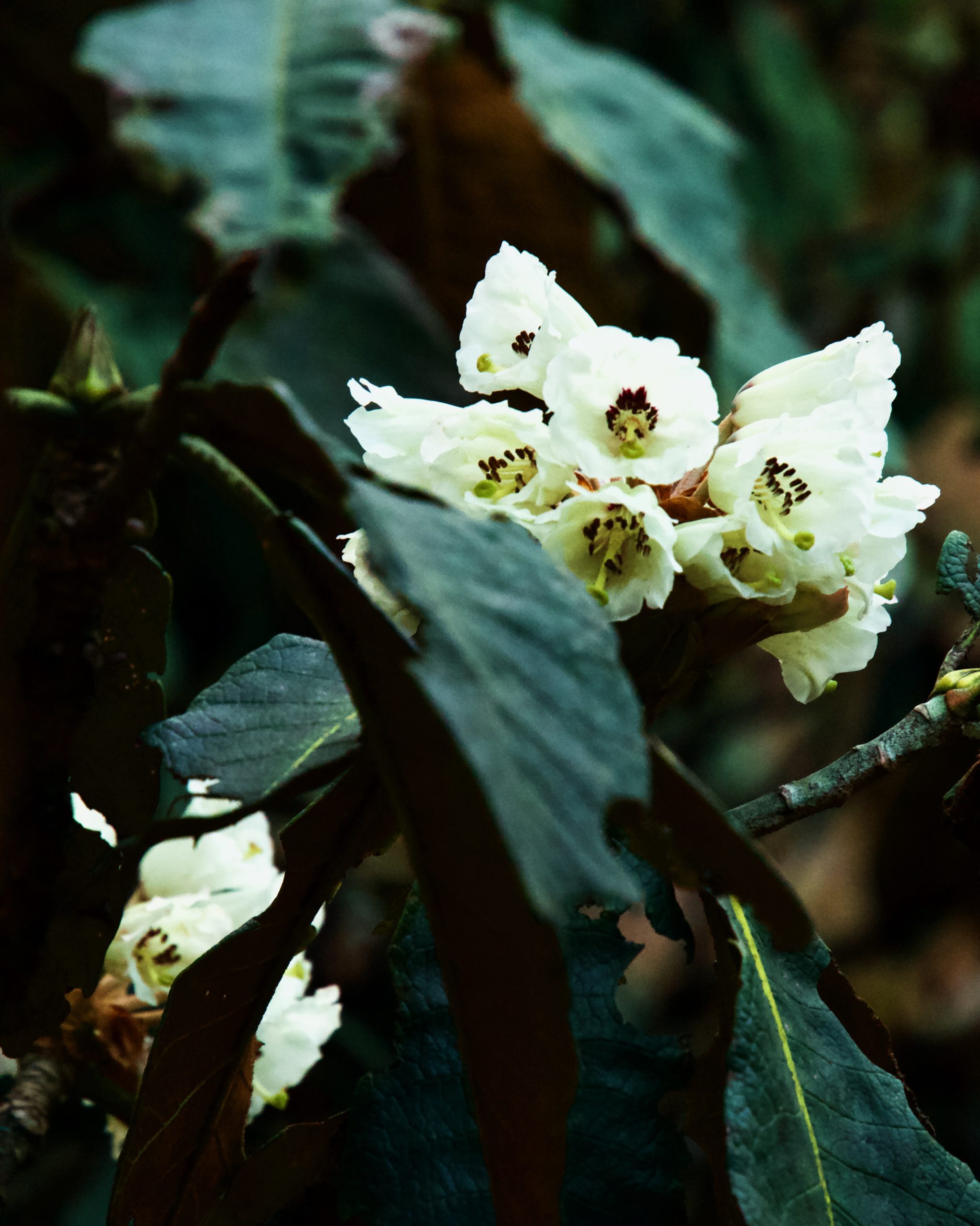
The next morning, I woke up to clear skies and beautiful vista of hills covered in temperate forests. We were served poori-chana for breakfast and some vegetarian biryani for our packed lunch. Of the four groups, we were the last to leave. I crossed a number of TTH folks while climbing the steep trails covered with large deodar trees. A couple of kilometers into the trail, there is a small flat opening that had a large number of rhododendron trees. Most of them were in full bloom and bore red flowers. Most of us stopped to take a break and enjoy the colourful surroundings.
The early morning view from Tshoka.Colourful prayer wheels at Tshoka monastery.
Rajdeep was not feeling well. I stayed back and accompanied him as Bibhas, Rajdeep and I slowly ascended to Phedang. Bibhas was one of the most experienced trekkers. His field of work in Earth Sciences took him around most of the places in Himalayas. I guess chatting alleviated Rajdeep’s exhaustion quite a bit.
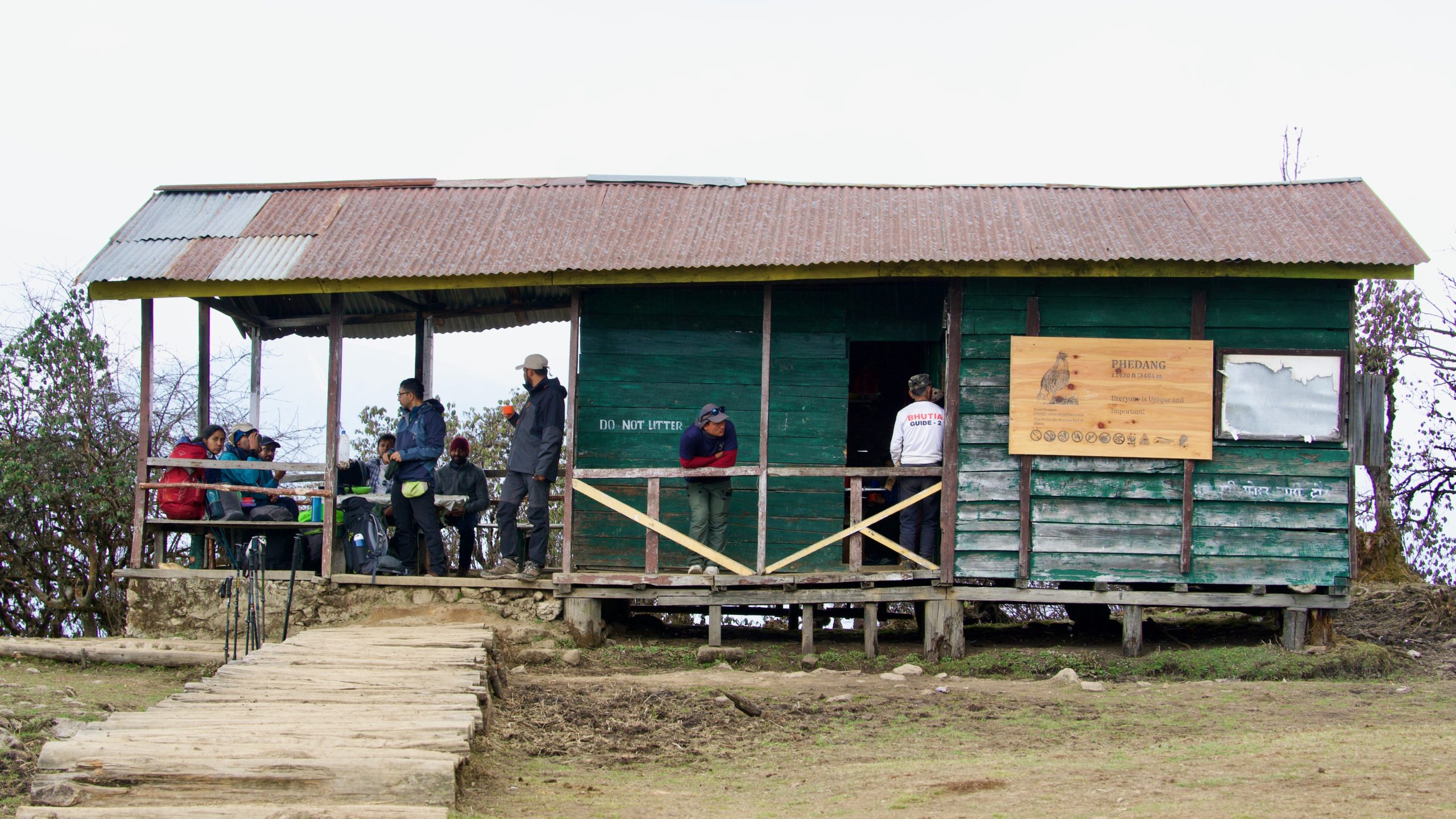
Gagan wanted all of us to leave together from Phedang. I finished the biryani that I had packed while waiting for the others. There was a shop that sold Maggi, momos, tea and omlette. I filled my flask with some black tea so that i could sip later.
The route from Phedang forked into two trails—one led towards Dzongri via Deorali, and the other led to Kockchurang. The latter would be the route we would take a couple of days later on our way back. Despite Gagan’s instructions, I left early with Mayank, Bibhas, and Ajay. The trail from there was very gentle and was covered with rhododendron trees. A large section of this was paved with wooden planks. Spring had arrived a lot later that year. As a result, those rhododendrons trees did not yet bloom.
These beautiful paved trail passing through rhododendron forests start somewhere before Phedang. (Pic: Dipankar)
Once we were out of the rhododendron forest, we were greeted by the trail to Deorali. It was covered in loose gravel. It was also very steep. I had completely forgotten about this section from my 2008 trip. But as soon as I started crossing sections, I recalled the bends, the sunken route, the juniper bushes, and the occasional stepped ascends. Nothing had changed in the last fifteen years.
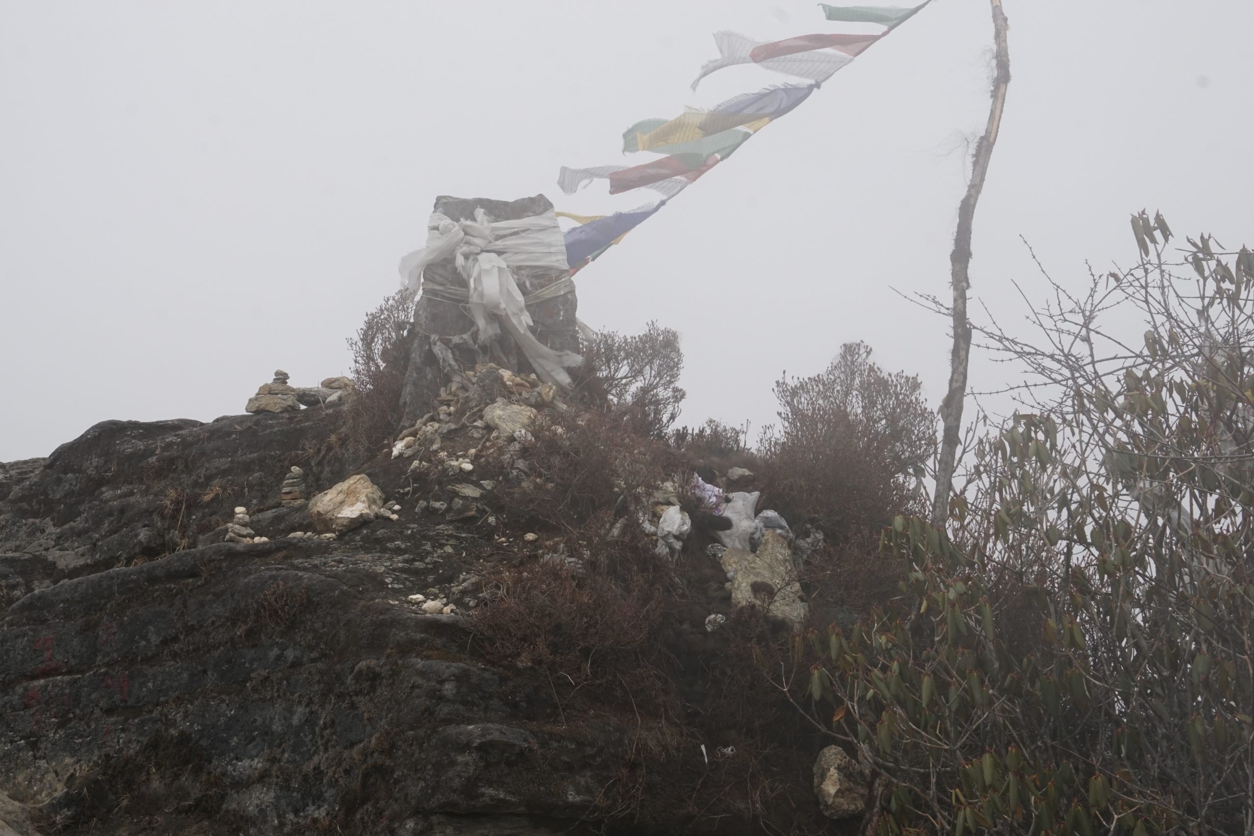
Bibhas went out of the trail to give way to the mules.Mules crossing a valley on their way to Dzongri. At times it got foggy. These prayer flags fluttered in the chilly wind. There was a bundle of hairs placed as offering. I couldn’t figure it out if they belonged to human beings or yaks or mules.
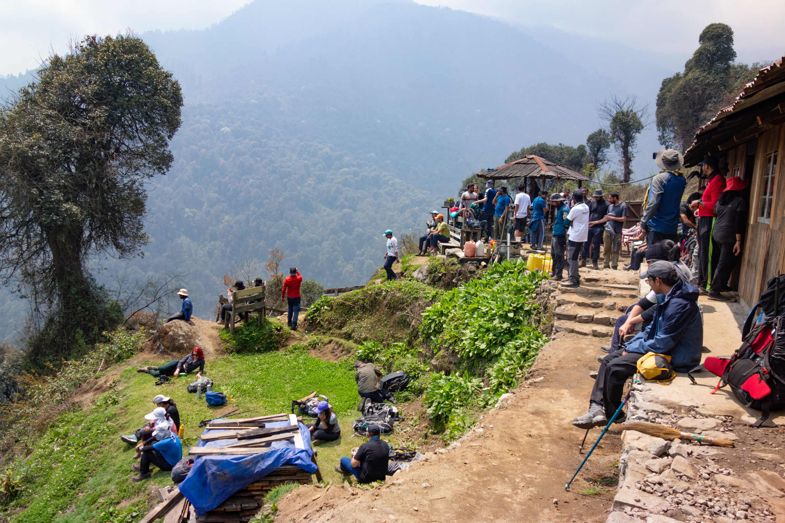
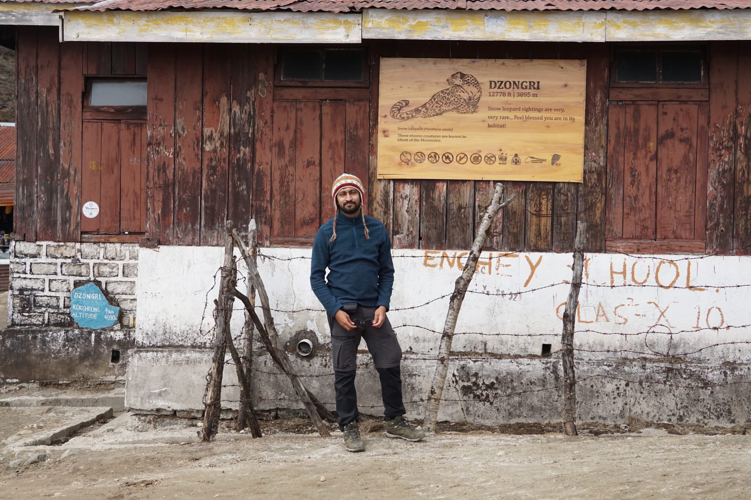
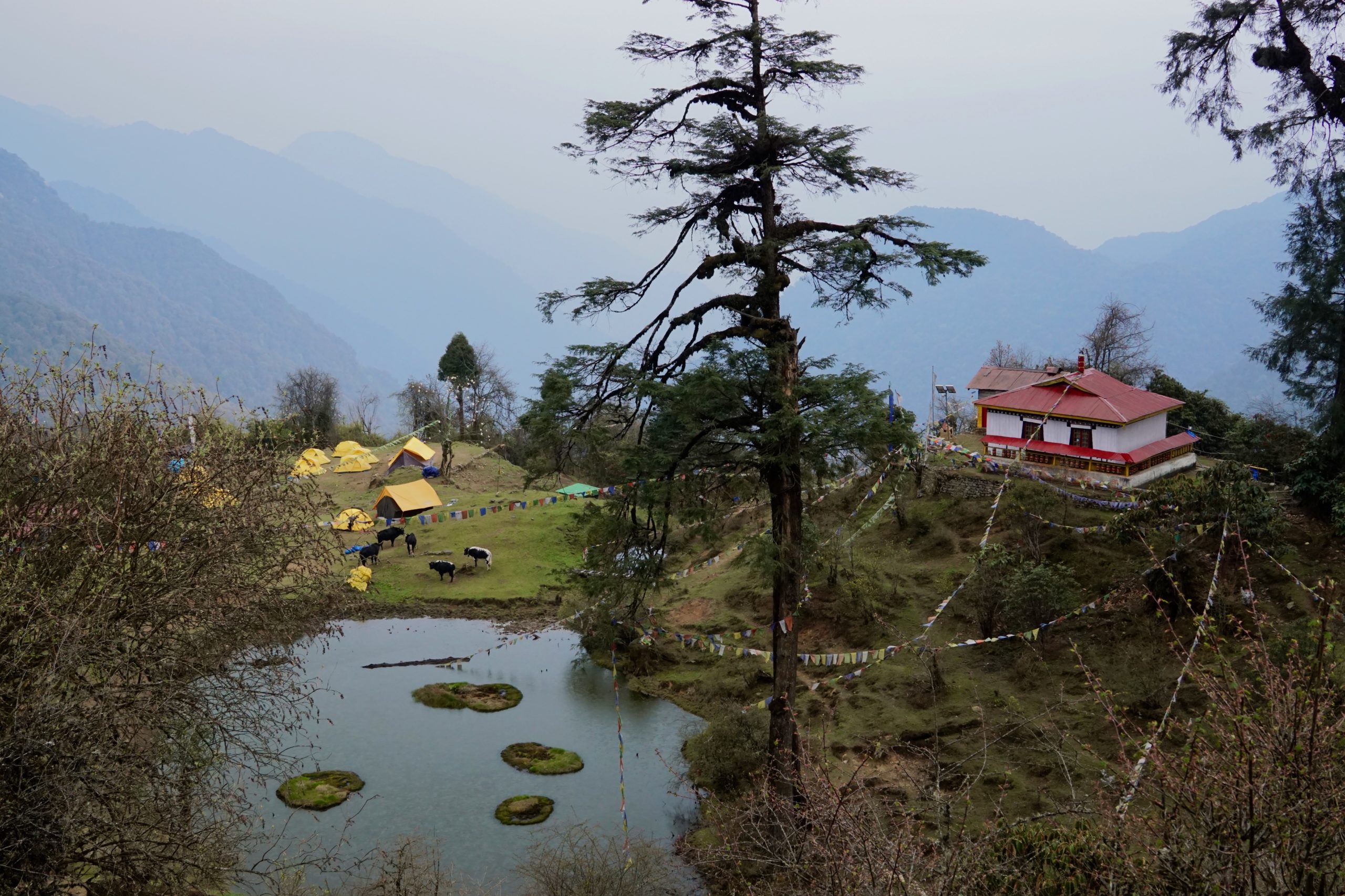
Deorali had a small shade and a chorten. We were greeted by a dog that was happy to have some biscuits while we sipped tea and petted him. We crossed quite a few trekkers from other groups and reached Dzongri at 2.00 pm. The dog followed us as well. Dzongri was busier than it was in 2008. The trekker’s hut at Dzongri looked like it had been taken care of. There were two shops as well. We ordered some noodles and tea from one of them while waiting for the others. Mayank also bought a pair of gloves.
Mayank posing in front of Dzongri trekker’s hut.
The team eventually arrived an hour later. Gagan gave us a mildly disappointing news. The staff did not get a spot at Dzongri to pitch our tents. We had to trek another kilometre up north to a place called Doring. In contrast to Dzongri, Doring did not have any shops. It was also an open meadow unlike Dzongri’s camping spot in a valley that is naturally shielded from the winds. One the positive side, the view was truly stellar. In my opinion, it was a blessing in disguise.
It was already getting late. We pitched our own tents so that the staff could set up the kitchen and prepare our evening snacks. By the time we were done, it was already 3.30 pm.
Mayank resting at Doring while the supplies and tents were getting offloaded.A herd of mules grazing at Doring.
That evening, I had some noodles that the staff had prepared. My stomach wasn’t digesting the food well. It often happens when our bodies are suddenly exposed to an atmosphere with lower oxygen. I took some medicine and skipped my dinner. Usually, such problems subside in a day.
Our day started before the break of dawn. We made a file and walked towards Dzongri La. Mayank and I stopped at the adjacent hill top and set up our cameras. This hill was not crowded as all other trekkers—including those from other groups—proceeded to Dzongri La. It also served as a practice for our summit day. I had beautiful views of Mt. Pandim towards my right, Mt. Kabru and Black Kabru right at the middle and Kanchendzonga peeking between them. The sun hit the peak at about 5.15 am. That gave me an idea of the time at which I had to be there at Viewpoint 1 two days later to catch the best view.
Black Kabru obscuring Kabru group.The first rays of light on Kanchendzonga.
Unlike, my last trip, the weather gods were smiling on us. I hoped they kept smiling for the coming days as well.
That whole day was spent lazying round. It was our acclaimatisation day after all. A couple of trekkers decided to rest instead of climbing to Dzongri La. They headed out and took some photographs of the meadows and the vista that surrounded us. I kept sleeping throughout the day and only woke up to have food. The staff had made paratha for breakfast, rajma-rice for lunch, samosa for snacks, and dal and halwa for dinner.
Virul (an account manager working for a leading cloud provider) and the dog that had followed us from Deorali. He named the dog Oreo.Oreo sandwiched between Mayank and Virul.
Rajdeep had recovered well. He was in high spirits after viewing the sunrise. On the other hand Gagan and Sneha had developed a bit of cold, while Aditya felt a bit of muscle fatigue. I gave Aditya and Rajdeep a tablet of diclofenac each.
Our campsite at Doring. (Pic: Mayank)
Chapter 9: The road I had not taken fifteen years ago
We left Doring at 8.30 am and headed for our next campsite—Thansing. I had some poha for breakfast and packed some more of it for lunch. From here on out, I would be trekking on a route I hadn’t seen before. We walked over meadows that was occasionally covered with very short juniper bushes. At times, we came across patches of snow, too. We even stopped at a snow-covered pass to see Kanchendzongha peek through the ranges.
The group descending through the snow.Mayank and Dipankar waiting for the group to catch up.
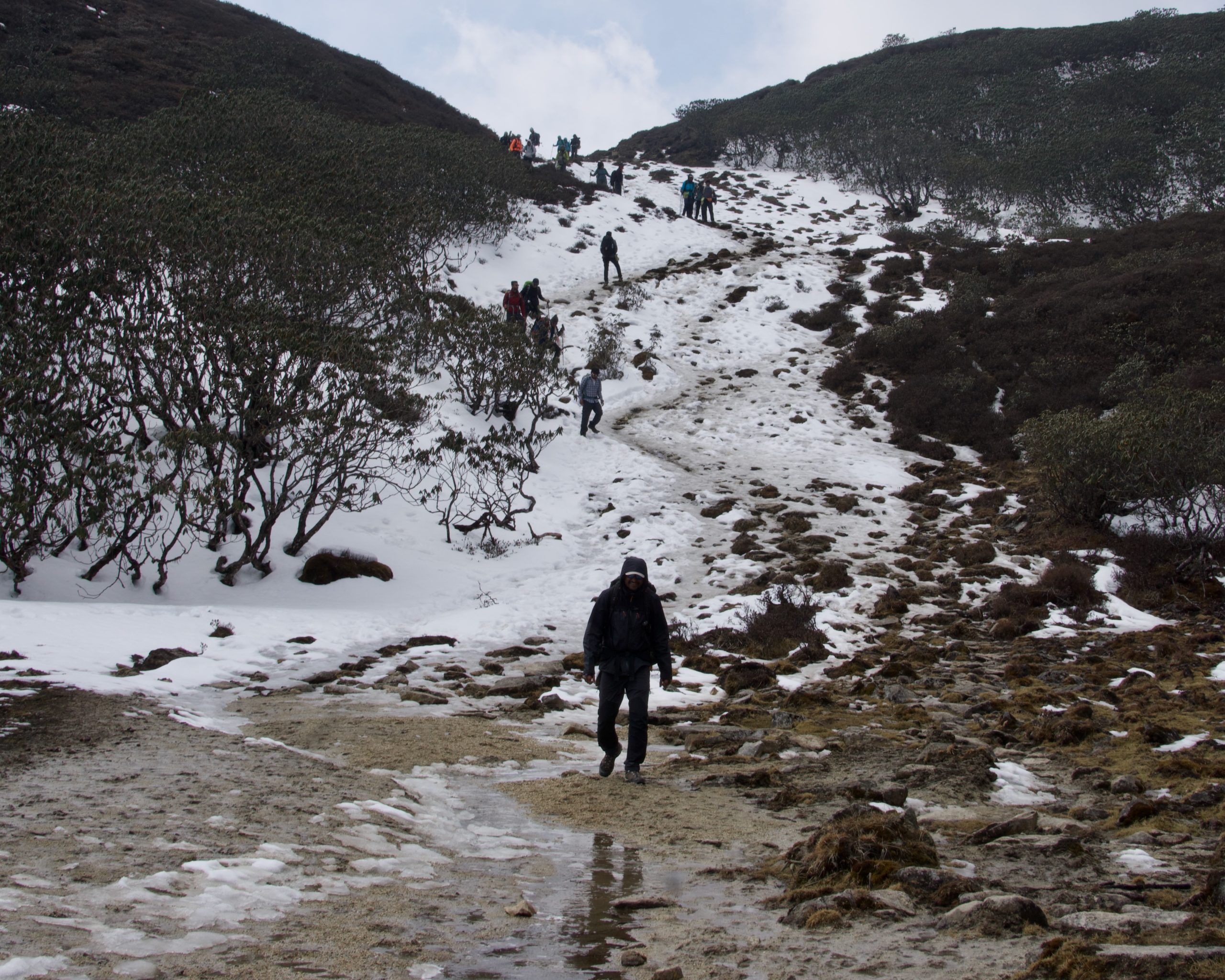
Snow had melted in places that were exposed to the Sun. In places, it had compacted into slippery ice. Descending on ice is usually very treacherous. I was using my trekking poles to anchor myself as much as possible through these sections. Later, I would get to know that a lot of our fellow trekkers had slipped and fell on their bum. For some of them, it happened multiple times. We were descending fast. The last stretch to Kockchurang was steep. I couldn’t run my way down as the trail was rocky and covered in loose soil. (In case you didn’t know, the best way to descend is to run down. It reduces a lot of impact on one’s knees and minimises the number of one-legged squats that might lead to fatigue.)
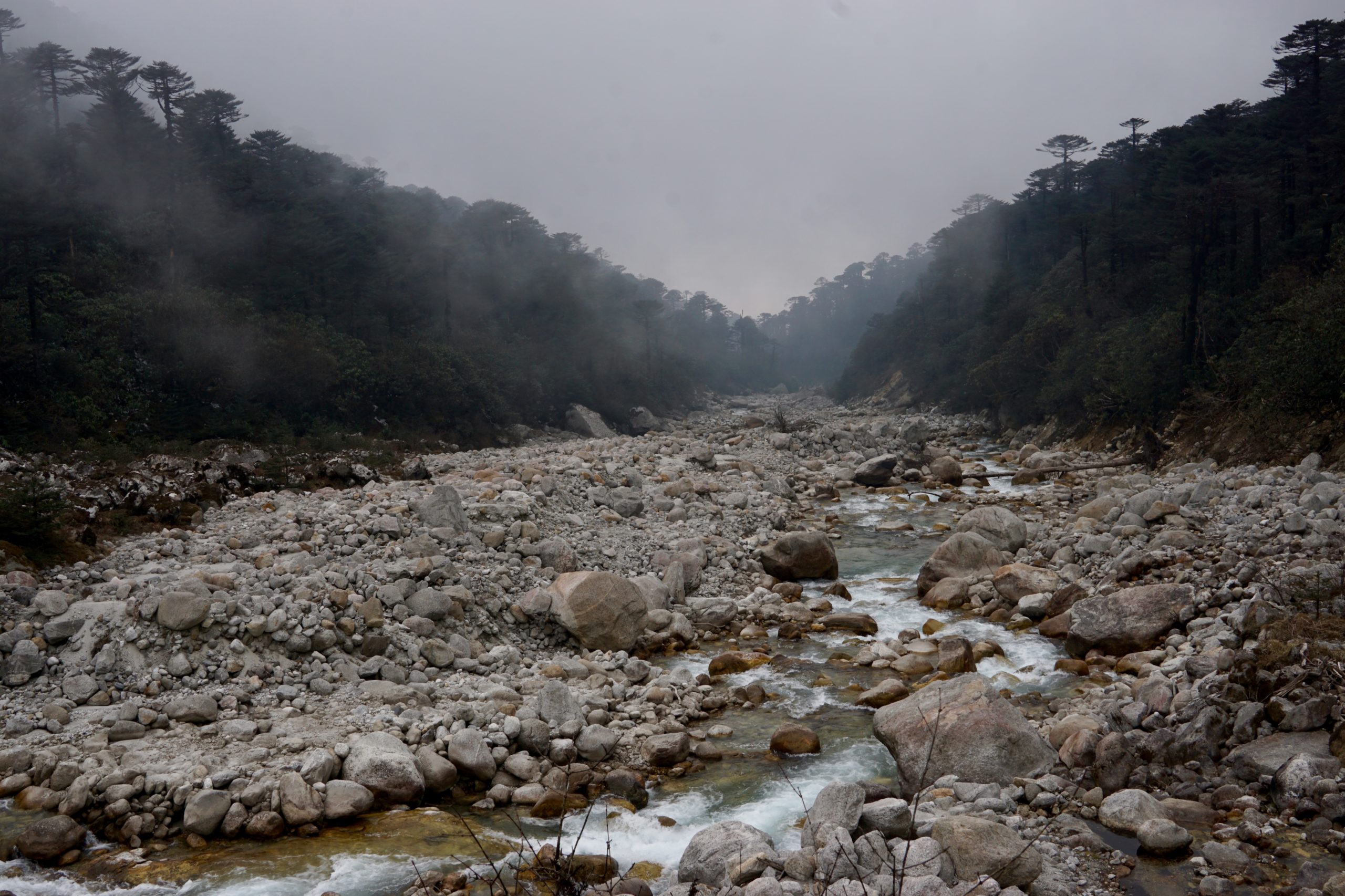
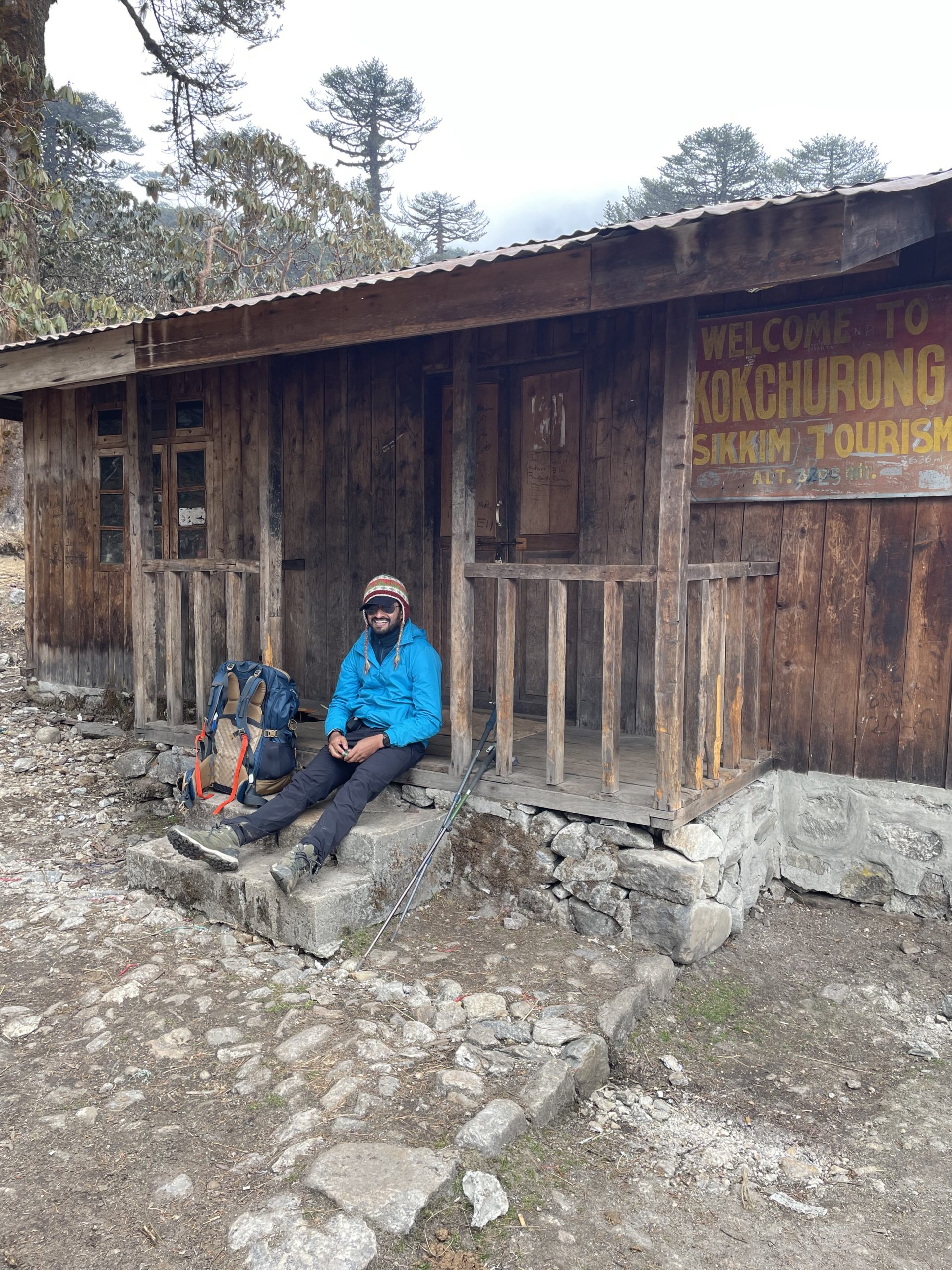
Dipankar—an Ironman-certified triathlon coach and a triathlete himself—was ahead of Mayank and me. We reached Kokchurang at about 11:15 am. Our kitchen staff—Mohan and Harsh Mohan—reached soon after and asked us to wait until we all had regrouped. Dipankar had already gone ahead.
Mayank and I spent quite some time walking around Kokchurang. The trekker’s hut felt like it was abandoned. It was not dilapidated like the one I had seen in Bakhim. Most itineraries followed by trek organisers do not have an overnight stop at Kockchurang. I guess, the mule and yak herders and trekkers who do the Goecha La trail during the winters stopped there. Sometime later, our fellow trekker’s started to arrive in small batches. We sat inside the main room of the hut and had our lunch. By the time we were ready to leave, it was 12.45 pm already.
Harsh Mohan and Mohan waiting for the team at KokchurangKokchurang trekker’s hut is located on the banks of Prek Chu.Mayank resting in front of Kokchurang trekker’s hut. (Pic: Ashwin)Inside the Kokchurang trekker’s hut.
From Kockchurang to Thansing, the vegetation changes again. The descent introduced us to deodar trees once more. From there on out, we had to climb alongside Prek Chu river—who had made an appearance once more—and cross it twice.
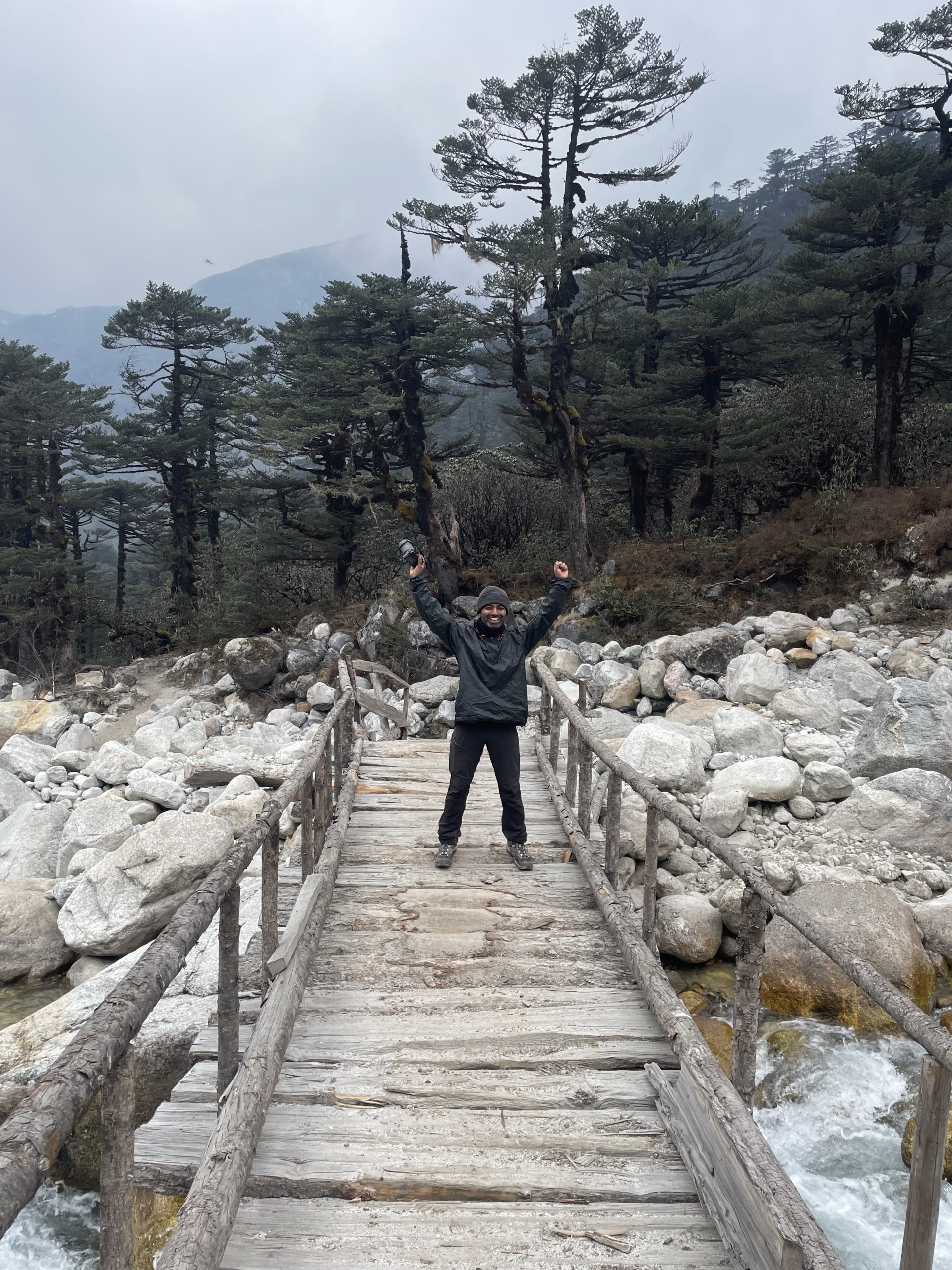
Me on the wooden bridge across Prek Chu. (Pic: Ashwin)
The stretch just prior to Thansing appeared less like a trail and more like a construction site. A couple of years ago, a glacier burst had washed away all trails and vegetation and had left behind moraine.
There was a small canteen at Thansing. It was run by a man called Gopal Limbu. He stocked Maggi, Wai Wai, packaged chips, and biscuits. He also hung dried meat in the kitchen. He said that it was meant for his personal consumption but he wouldn’t mind cooking some meat if someone told him in advance. I had some Wai Wai, omlette and tea while our staff was busy setting up our tents. I ended up going back to this canteen multiple times that day and the next day. There is a certain satisfaction in having soupy Wai Wai with omlette in cold mountains.
That evening Gagan gave us a briefing about timings. Back in our tent, Mayank and I had made an estimate and deduced that based on the speed of the group, we had to leave latest by 12.00 am in order to trek the last eight kilometres to Goecha La Viewpoint 1 and get a glimpse of first rays on Kanchendzonga. It was hard to convince others who were expecting that we would be leaving after 2.00 am.
Finally, the group left at 12.45 am. We made a single file, switched on our head lamps and headed out. Koushik decided to stay back and sometime after a kilometre or so, Aditya succumbed to exhaustion and decided to head back to Thansing. En route, Sneha also felt severe exhaustion and sat down. She had developed symptoms of AMS. Gagan had Dexamethone (dex) injection in his med-kit. Sneha was a doctor and was able to administer it herself. Rajdeep also showed signs of exhaustion. He had developed a congestion but still pressed on. We kept walking in a file, occasionally climbing small rocky mounds and crossing streams of water. The slower folks were leading the pack to ensure that we were all moving together. As I walked on, I realised that a layer of frost had accumulated on my down jacket. The sky was clear and the temperature had fallen quite a bit. I hoped it remained so.
We reached the trekker’s hut at Lamuney at around 2.00 am. I was worried with the pace of the group and wondered if we would reach our destination before sunrise. I had no clue of the the terrain surrounding me. It was pitch black. After another two hours of walk, we reached Samiti Lake. Dipankar made a suggestion that it would be wise to split into groups else even those who could have made it to viewpoint before sunrise wouldn’t be able to. Yu Hang lead a faster group right into a two-kilometre-long steep climb. Mayank was the fastest in the group. I just kept following him. Occasionally, I looked back only to slowly see the headlamps spread out. In no time, we were walking through ankle-high deposit of fresh snow along the ridges.
Just as I reached Viewpoint 1 (Pic: Ashwin)
I reached Viewpoint 1 at around 4.45 am. The few of us who had broken away from the group with Yu Hang were the only ones on the flat snow-covered land right in front of the steep wall-like face of Mt. Pandim. This gave all of us ample opportunity to set up our cameras. The consistent exposure to cold air to operate my camera made my fingers numb. A couple of trekkers from a different group joined us and struggled to find a spot for placing their photography equipment. Well, the early bird gets the worm. Right at 5.15 am, the sun hit the Kabru peaks followed by Kanchendzonga. The weather gods had truly blessed us.
Kanchendzonga just before sunrise.The first rays of sun hit Kanchendzonga and caused the ice to evaporate.Sun hitting the Kabru peaks.
Viewpoint 1 slowly got crowded as time went by. Many had missed the sunrise. But even then, the sights were truly spectacular. Rajdeep reached about an hour later. He was the last one in our group to reach. He was fully exhausted and could barely speak. Meanwhile, Sneha had recovered quite a bit. She was back to her jovial self—participating in the photo sessions. The dex shot had done its job.
Posing with Kanchendzonga in the background. (Pic: Shankar)
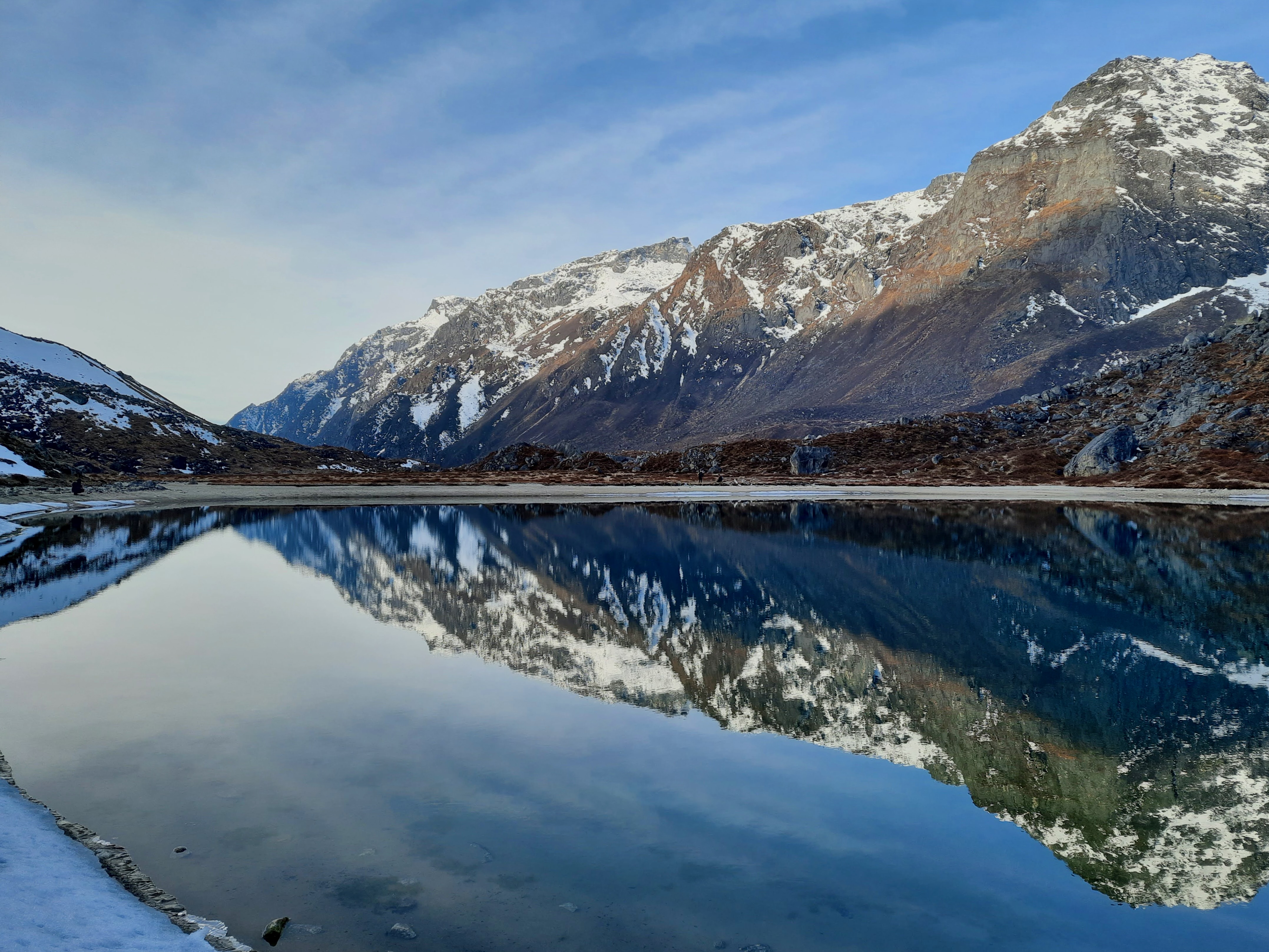
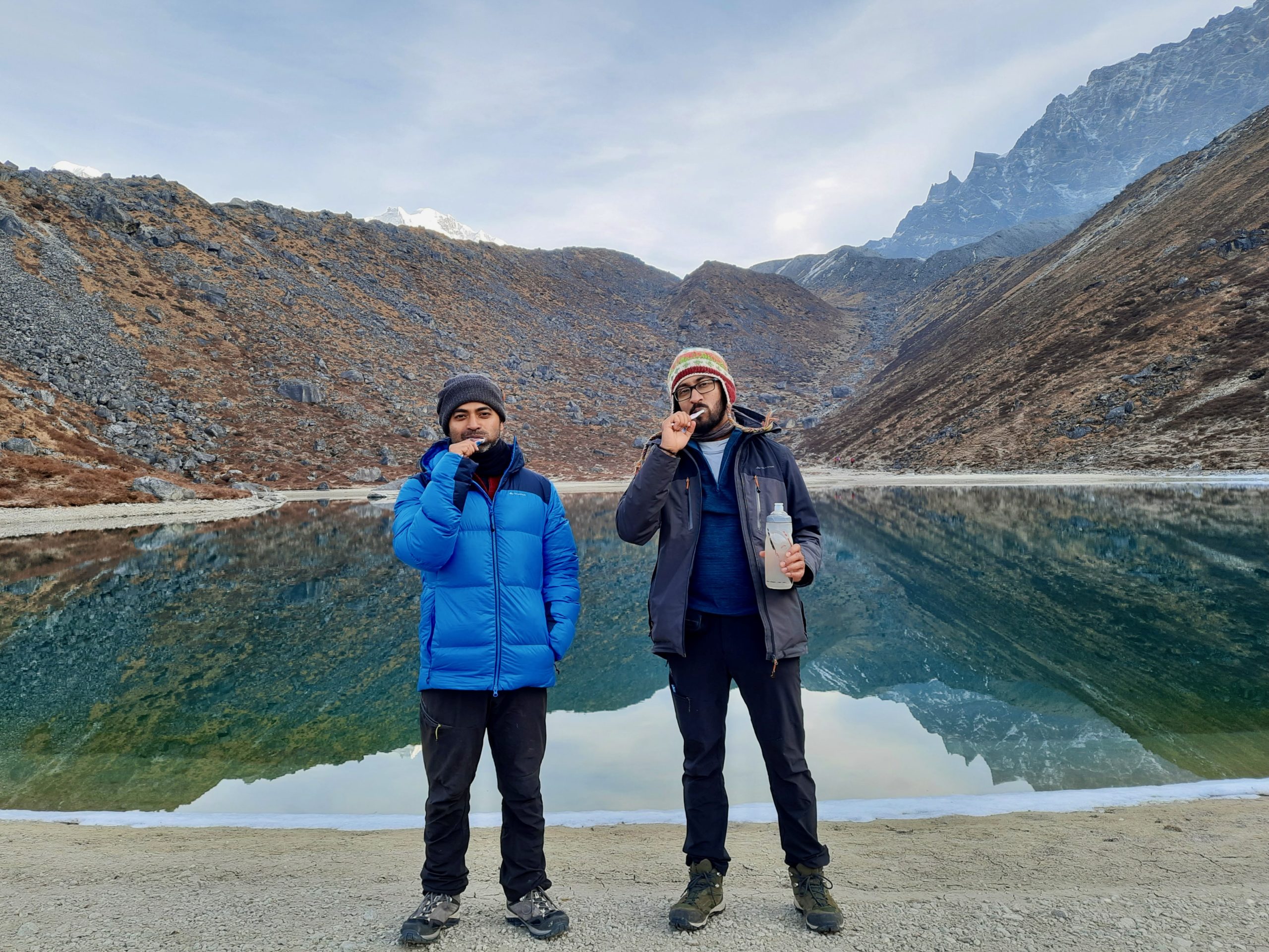
Mayank and I headed back towards Samiti Lake. I had this juvenile idea of taking a photograph of us brushing near the lake. Needless to say, we had been carrying our toothbrush and toothpaste all throughout the night.
Reflection of the surrounding mountains in Samiti Lake. Me and Mayank brushing at Samiti Lake.
I really got to see the hiking trail on my way back. The route seemed longer while returning—maybe because I was absorbing all the views around me. I realised that Lamunay is a better place to camp instead of Thansing purely based on the view it provides. (In case you didn’t know, TTH’s itinerary includes a camp at Lamuney.) The mountains on the either side of the valley framed Kachendzonga right in the middle. On a clear full moon night, it would be a sight to behold.
Gagan enjoying a well-deserved break after he had safely guided all of us to Viewpoint 1.These stacks with egg-like rocks on top were as tall as us.
Mayank and I got back to our tent at 9.30 am. Rajdeep reached around 12.30 pm. He was completely exhausted. I took him to Gopal Limbu’s shop. A couple of cups of tea and a hearty bowl of Wai Wai later, he felt much better.
Rajdeep and me with Gopal Limbu.
Chapter 10: Heading back to civilisation
It was already the eighth day of our itinerary. I had some roti and potato fries for breakfast and packed some vegetable rolls for lunch. We left at 8.30 am and traced our way back to Kokchurang. From Kokchurang, we took a six-and-a-half kilometre trail that led us to Phedang. It was a rolling trail, covered in rhododendron trees. The trekkers who would start sometime in Early May might see them bloom. Occasionally, we trekked on stretches that were covered in snow—some of which had compacted to form ice. This trail was not wide enough for mules and yaks. As a result, transportation of our supplies had to be done via Dzongri.
The trail from Kokchurang to Phedhang passed through these rhododendron forests.Gouresh (an IT professional from Hyderabad) posing on a wooden bridge over a stream.Some parts of the trail was still covered in snow.
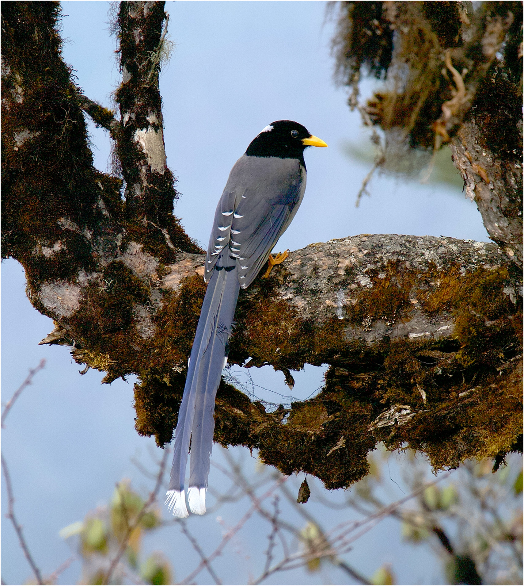
We reached Phedang at 1.15 pm. As soon as we had settled in, it started to drizzle. A couple of Himalayan magpies flew around and I kept trying to capture a photograph. We all had a number of rounds of coffee and tea and waited for the rain to subside. I did not wat that long, though. I put on my rain cover and left Phedang by 2.30 pm. I reached Tsoka at 4.00 pm. There was this one patch of land overlooking the Tsoka monastery where I was able to get cell tower. I took the opportunity to speak with my wife, mom and sister before heading towards our camp.
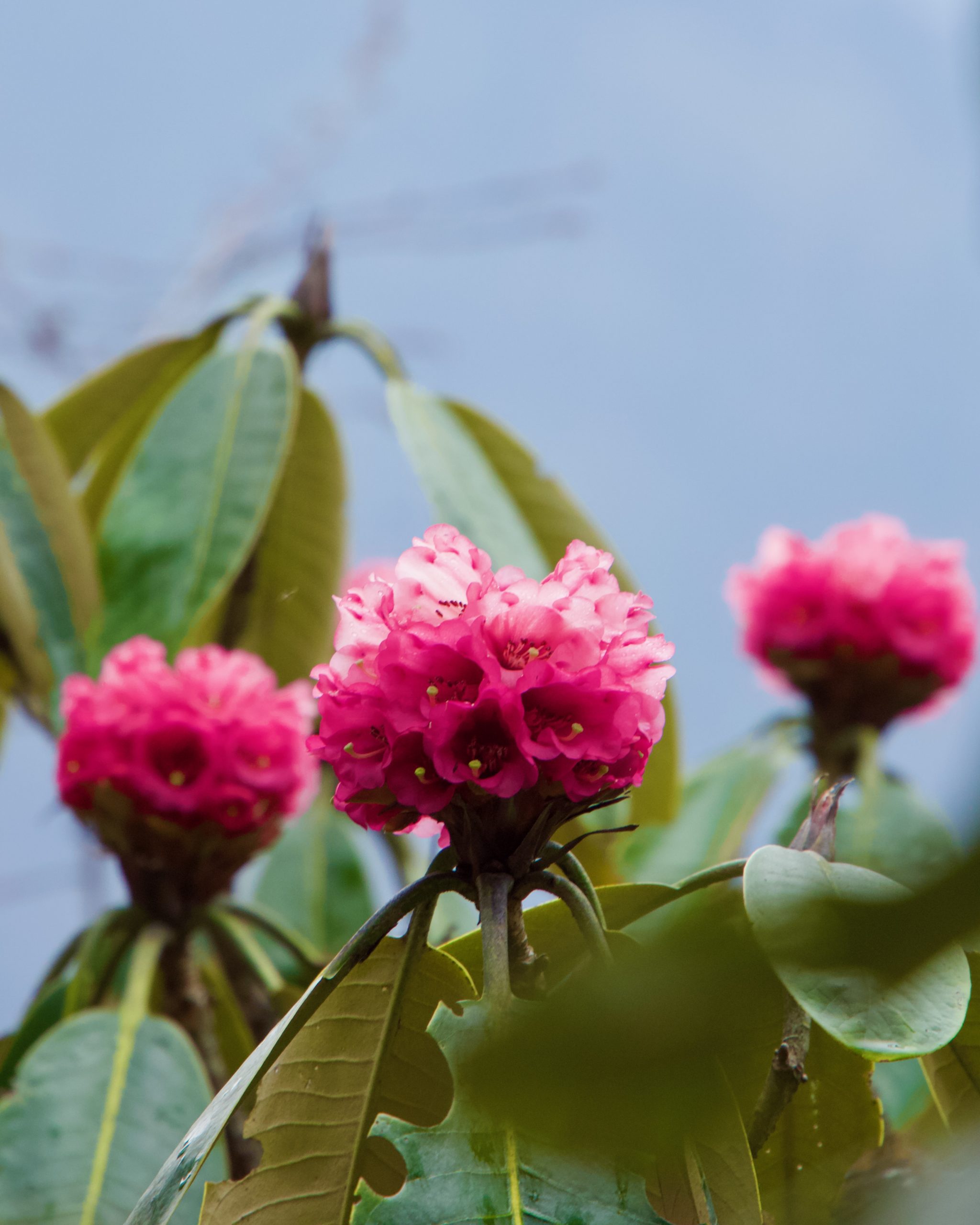
The shop/trekker’s hut at Phedang.Himalayan magpie.A pink rhododendron……and a white one.Our campsite at Tshoka, Tshoka lake and Tshoka monastery.I have a fifteen-year old image of myself in front of this trekker’s hut at Tshoka. I wasn’t smiling in that picture. (Pic: Bibhas)
After our dinner, the kitchen staff served us a cake celebrating our successful completion. This was our final night at a campsite. Everyone was elated and shared their trek experience. That night Mayank showed me how he usually took star trails. Unfortunately, my camera was too slow to process long exposures.
This is the best I could manage with Mayank’s instructions and my camera.
The next morning we made a final push towards Yuksom. Mayank and I followed Dipankar and took a nice shortcut to Bakhim. As soon as we crossed Bakhim, the wet temperate forest welcomed us. The descend to the suspension bridge over Prek Chu and then the subsequent ascent was no easier this time either. As I got closer to Yuksom, the weather became more and more humid. Somewhere around Tsachen, I crossed the next batch of trekkers led by the Indiahikes team. I wished them luck. In the end, no matter what the level of preparation is, there is an element of luck that is involved. The mountain gods would have to be pleased, the weather gods must bless the day, and our own body needs to behave within manageable limits in an environment that we are not accustomed to.
Mayank, Rajdeep and me on our way back posing on the hanging bridge over Prek Chu.
I reached the Indiahikes base camp at 2.15 pm and headed straight for a shower. It had been eight days since I had washed myself. It felt so good to put on a set of clean clothes. I was quite hungry and went to a shop right across the street to have some thukpa and chili chicken. As the other trekkers emerged out of the backyard that marks the entrance to the trail, we clapped for each of them. Finally, I saw Rajdeep emerge out of that backyard. He was quite overwhelmed by what he had achieved. “Who knew that this unassuming backyard would lead to one of the grandest trails in India?”, Ashwin remarked.
Epilogue (the real one)
We all parted the next day. Most of us headed back to Siliguri. Some headed towards Gangtok. I had to meet my wife and embark on a road trip the next day.
There are a couple of leanings that I would want to share. This trek is strenuous and long. I would not suggest this as anyone’s first trek—even if you are very fit. It is preferable to have the experience of at least another multi-day trek before attempting this one. That way you would know what gears, packing system, food and hydration strategy works for you. In case one wants to abandon the trek and return, there is no other way but trace back the same strenuous route. In fact, while descending somewhere near Bakhim, I crossed a trekker who had suffered from exhaustion and was being evacuated by two of his staffs. The other part is about fitness. There are many aspect of fitness and the singular one that is important for such a trail is cardiovascular endurance. We had two members who were power lifters—one of them being Rajdeep himself. They were absolutely fit but had a hard time from the fourth day onward.
I was personally happy with my performance. I wrote in in my earlier blog, “Someday I might revisit the trail. For sure, I wouldn’t be doing it in six days.” Well, I have revisited the trail and I have finally done it—this time in ten days! It felt good.
]]>0Sauvik Biswas<![CDATA[Tour de Self: From Udupi to Bangalore]]>https://sauvikbiswas.com/?p=59082023-01-06T14:32:10Z2023-01-03T07:14:47Z[Read more...]]]>Day 0: Preparing for Udupi
24th December, 2022
I rode all the way from my house to Mittal’s, where we both dismantled and packed our bicycles with bubble wrap, duct tape, some cardboard, and Styrofoam. It took us over two hours to do so—mostly because we didn’t have everything in place.
I had packed the following for my trip—2 jerseys, 2 bibless shorts, 1 bermuda short, 1 t-shirt, 2 bottles, 2 extra tubes, 1 multi-tool, 1 patch-kit, 1 set of tyre levers, 1 head light, 1 tail light, 1 five-litre bag strapped to handlebar, 1 saddle bag, and 1 top-tube feeder bag. Mittal had a similar setup, only that he had another hanging top-tube frame bag to accommodate some additional clothes.
Mittal had gotten the contact of a driver who drove an eight-year old, beat-up Chevrolet Enjoy. (In case you have to contact him, here’s his number—73488 15224.) His vehicle was perfect for accommodating two bicycles. He dropped us at Majestic Terminal 2A at around 7:30 PM. The bus, Airavat—the seated luxury class buses of Karnataka State Transport (KSRTC), eventually arrived at 9:30 PM. The luggage space of these buses are quite large and can easily hold dismantled bicycles. The only thing that we had to make sure was that the frames and wheels were well secured with the bus. The bus conductor took an extra 500 rupees. He just wanted to make some money. Honestly, it’s far better to have the bus conductor on good books than follow the rules, especially if you have expensive equipment to transport.
Sakleshpur—Mangalore stretch on National Highway 75 (NH75) is presently not in a very good shape. In fact, while planning our ride, we were specifically advised to use a different route for the ghat climb. The barrage of night buses, coupled with the poor tarmac, caused the bus to lose about an hour en route. By the time the bus stopped at Udupi, it was late by an hour and fifteen minutes.
Technically, this is Day 1; after we had taken our cycles out of the bus.
Day 1: Udupi to Ujire
25th December, 2022
We rode to the Krishna Temple Complex from the bus stand. It was a good landmark to start our ride. The complex also houses a darshini-syle eatery called Mitra Samaj. It is said that this place is the originator of the Udupi-style breakfast joints that we see all around Karnataka. Some even claim that the place is the originator of Masala Dosa. I had a plain dosa and Mittal had a bowl of mini idlis before heading out. A number of kids and adults surrounded us, asking questions about our trip (that was yet to start!), and our cycles and gears—quenching their general thirst for knowledge about two middle-aged men in Lycra.
The famous Krishna Temple at Udupi.Kids surrounded us, as if we were some kind of aliens!In front of Mitra Samaj after having our breakfast.
We headed off to Malpe Island. En route, we stopped at Stella Mary’s Church. Being Christmas Day, the place was decorated and had a nice sculptures and arrangements depicting Nativity. We stopped at Malpe beach and readjusted some of our belongings before heading towards the Malpe-Mattu road.
Stella Mary’s Church en route to Malpe.Fishermen unload their catch and transport them off to the markets from this fishing harbour.On Malpe bridge, with our cycles overlooking the harboured fishing boats.
The Malpe-Mattu road is something that must be enjoyed on a cycle or bike. This 7.5 km of tarmac is accompanied by the sea on one side and backwater on the other side. The best view is undoubtedly an aerial one—something that can be only achieved using drone shots.
Malpe-Mattu road with the backwaters on its east and the sea on its west
The stretch from Mattu to Muluru is what we can consider a typical coastal village. Kaup lighthouse, situated on this stretch, was closed. Mittal stopped and finished the carrot and cucumber he had been carrying in his jersey pocket. (A strange choice of portable fuel for a cycling trip.)
Boats parked and weather-proofed.This is not a shack but a mandap of Bhoota Kola ceremony. (Thanks Dheeraj for the info.)At Muluru beach.
Mulki is situated halfway between Udupi and Mangalore. We rushed through the wide, shade-less NH66 for about 15 km before turning east to catch State Highway 70 (SH70). It was already afternoon and was time for lunch. There aren’t that many places in SH70 for lunch. We stopped at a small shop called Kamath that was essentially four shops rolled into one. It ran an eatery, sold daily grocery items, repaired electronic goods, and dabbled in real estate. In hindsight, we should have had our lunch while we were still on NH66. We would have had more options. At Kamath, we both had some pulao. I had a cup of tea while Mittal had a glass of ragi juice, as he charged his phone that had ran out of juice. I checked the map. We still had 70 km to cover. There was no way we could reach there by sunset.
Fortunately, we had fresh legs and the rolling terrain helped us relax our legs during the mini descents. Somewhere along the way, we crossed a Jain procession. When I asked an old man, he explained that a new temple was being inaugurated. He also gave a some other information but I found it difficult to understand his mix of Hindi and heavily accented Kannada.
A Jain procession.The first view of the ghats.
By the time we had reached Guruvayankere, it was already 5:30 PM. We stopped for some tea and to fix lights on our bicycles. Fortunately, we only had 10 km to go before Ujire. I wanted to ride as far as possible into the base of the ghat but the locals couldn’t really assure us of any lodging places beyond Ujire. It turned dark pretty fast after sunset. That stretch of ride was quite challenging as the roads were narrow and there was a constant barrage of buses and cars passing by.
Ujire has only four lodging options near the junction. Most people go to Dharmasthala. It’s about 8 km from Ujire. But for us, that would have been a detour. After checking all four lodging options, and getting disappointed by the condition of the rooms (one did not have proper roof!), we got a room at Rajleela residency. At 1100 rupees, it was quite expensive for the amenities it provided (or lack thereof). The hot water tap broke while Mittal was using it. The disgruntled caretaker plugged it with some rag and a branch.
That night we had dinner at Sheethal Garden Restaurant. The bar area was quite untidy but the food and the service was great.
Day 2: Ujire to Belur
26th December, 2022
We left our lodge at 7 AM. I wanted to hit the ghats as early as possible. Ujire to the base of the ghat at Charmadi is about 15 km. The terrain rolled with some short punchy climbs thrown in, reminding us that we were approaching the Western Ghats. The vegetation changed, too. Kakkinje, a settlement about 4 KM from Charmadi marks the beginning of the reserved forest area. We stopped at Charmadi to have our breakfast—dosa for me and idly-vada for Mittal—before hitting the slope.
Nidigal bridge—the true beginning of the ghats.River at Nidigal.The climb!
The 25 KM long climb averages at around 4%, but that’s a deceptive stat. The first three-quarter of the climb that circumnavigates a hill is steeper. It was tiring and we took short breaks en route. Somewhere along the way we took a long break and had some roasted peanuts that Mittal was carrying. There aren’t any shops along the climb where one can buy food and water. The only sources of water I encountered were some natural streams. I stopped at one such large stream to refill my bottles. I also saw two trailers that sold pineapple and ice-cream to people who stopped at the view point on top the first hill. From there, it was a long and much-needed descent to the start of the next hill at Attigere. There is a temple here. Many travelers, including bus drivers and conductors stop here to offer some flower and incense. It’s not a good place to stop, though. The traffic piles up as the road is narrow and there is no way to circumvent the stopped vehicles.
As I rode through the beautiful scenery, I crossed a number of waterfalls that had dried up completely in the winter. The only signs were the erosion marks on the rocks and signboards that warned visitors not to get too close to take photographs.
Someone wrote this for the cyclists!We took a long break here.The temple and the vehicle pile-up at Attigere.
I reached Nisarga Grand—the first eatery on top of the hill—about thirty minutes earlier than Mittal, who even took a short nap along the way. Here we had the strange combination of veg noodles, veg fried rice, and curd for our lunch.
Our lunch stop. Before we had our lunch.
We had a lot of time to cover the rest of the 50 km to Belur. Once we had crossed the hill top settlement at Kottigehara, the vista changed, and so did the vegetation. We rode through beautiful roads sided with terraced rice fields, banana and coconut plantations. At times, these were punctuated by coffee estates.
Somewhere in the midst of coffee estates.
Barring a a bit of jam at Mudigere, the ride was quite pleasant and enjoyable. We reached Belur and even managed to get ourselves a lodge before sunset. For 700 rupees, Mallikarjuna Lodge gave us an excellent place to stay. That night we went to Guru Comforts for our food. The first two starters were great but then the rest was not.
A church before Belur.
Day 3: Belur to Shravnabelegola
27th December, 2022
We saw a number of school students at Belur Channakeshava Temple. They had come on excursions from different schools and were identifiable by their uniform and specific colour and style of caps unique to their school. Mittal and I took turns to visit the temple while the other guarded the cycles.
The gopuram of Channakeshava Temple.The temple itself.A sculpture of the Hoysala Crest
We headed towards Yagachi reservoir. Unfortunately, the dam is inaccessible to the general public. Disappointed, we took some photographs from outside and headed towards NH373 for Hassan.
One of the gates of Yagachi reservoirThe public is not allowed to go beyond this gate.
Till Hassan, the terrain was beautiful with nice greenery all around. We passed through some stretches surrounded by dense foliage over nice rolling terrain. Everything changed the moment we hit Hassan ring road.
I saw these strange decorative items by the side of the road.Windmills!
There wasn’t any greenery. The road was dusty. On top of that, there were ongoing repair works and construction that made our ride quite less enjoyable. Once we were back on NH75, we stopped for some lunch at Pathanjali Restaurant. The food was not at all good. I had to scrape off the potato mix of the masala dosa. The paneer dish that Mittal took was too oily and had too much of cornflour coating.
Mittal met some villager’s and chatted up at one of our rest points.A man-made canal near Baragur.
The usual way to enter Shravanbelagola is via Channarayanapatna, turning onto SH7 and then getting off on SH8 and continuing to Shravanbelagola. Mittal did not want to go via that route and decided to take smaller, village routes. So, we ignored the Channarayanapatna junction and moved ahead on NH75. The first route we found was unsuitable for riding our bicycles. Instead, we took another one via Bediganahalli. It was a nice change of scenery. Especially, it was something that Mittal needed as he was quite bored of the highway. For most part the route was fine, barring a kilometer of so before it hit SH8, where it was all dug up. We got off our cycles and walked instead.
Mittal’s expression tells a lot about the condition of the roads. Well, not that you can’t see them.
We did not reach Shravanbelagola by 4:30 PM as we had originally planned. It was not dark yet, but Vindhyagiri entrance was closed. This meant we would have to leave late the next day if we had to visit the temple.
Shravanbelagola’s namesake—”White Pond of the Shravana”. The gopuram / gate of the lake.
That night we had dinner at a shady bar. The bar at Dayvik Comforts only served drinks and gave some tables to sit. We had to arrange for chicken starters, biryani and peanuts from elsewhere.
Day 4: Shravanbelagola to Bangalore
28th December, 2022
We had a long day ahead of us. We had to cover about 130 km to reach IKEA Nagasandra in Banagalore. We had already asked the Chevrolet Enjoy driver to pick us up at 7:00 PM. It didn’t help that we couldn’t leave early. We packed everything, got ready and waited for the Vindhyagiri gates to open at 7:00 AM.
Devotees had started to gather as early as 6:00 AM. Tea shops served tea and biscuit to those who needed to freshen up.
The route to the temple is a flight of stairs cut into a monolithic rock. The place is about 1000 years old. The main attraction is a giant statue of Bahubali, the son of first Tirthankara, Rishavadeva. In spite being a millennium old, the statue looked pristine. This place was also crowded by school children on excursion.
One of the three arches. Right after sunrise on Vindhyagiri hill. A view of the town from atop.The basadi (temple) on Vindhyagiri.School children on excursion being escorted by teachers.The monolithic sculpture of Bahubali (a.k.a. Gomateshwara).
We came down to our lodge, Raghu Lodge, and checked out. For 700 rupees, the place was value for money. They also ran a restaurant on the ground floor. I had the best idly of the trip there; they were piping hot and were so soft that they broke with the lightest of pressure.
We had to get on NH78. But first we had a nice scenic ride on SH8 till Hirisave. Picturesque roads, laid-back villages and rolling terrain—what more could we ask for. My mantra for the day was not to grind at any cost. My legs weren’t that fresh and we had a lot of distance to cover.
Mittal posing in front of a house on SH8.This beautiful lake was right before SH8 joins NH78.
Once we were on NH78, we were greeted with familiar, boring roads. At least it was mostly downhill till Kunigal. If one follows NH78, like we did, it bypasses Kunigal town. There aren’t any shops for food or water on that 10 km long stretch. The bypass is also on an elevated land with barricades on either sides. I was feeling hungry and Mittal had a bit of stomachache. This situation reminded me of the last day of Mettur trip. Near the end of the bypass, we stopped at a small restaurant. I gave Mittal some medicines while he had a packet of curd. I also picked up a couple of packs of ORS drinks for him at the next available medicine shop.
Kunigal bypass.Stoneworks!
It was all climb till Soluru town. At Soluru, Mittal suggested that we bypass Nelamangala and instead take any set of available internal roads to reach our destination. Maps didn’t show any motorable roads, just some paths marked for pedestrian usage. We got off at around 5 KM before Nelamangala toll and headed into the villages. The roads (or should I say, paths) weren’t that great. This is where misfortune struck. While walking off from an elevated place onto a path, Mittal placed his cycle quite hard and his rear tube had a pinch puncture. We stopped at the sides to replace the tube and fill it up with some air. He needed enough to hit the main road and get to a petrol pump or a bike repair shop where he could inflate it to pressure. The drop also caused the bearing cap of his rear hub to come lose.
In a village near Nelamangala, right before the puncture.
Once we were on the Nelamangala—Peenya stretch on NH48, it was already 6:30 PM. We stopped at a motorbike repair shop, who honestly did not want to cooperate. All we needed were a pair of spanners to fix the hub. After a bit of coercing, the owner agreed and handed some spanners to us.
We attached the lights on our cycles and rode towards IKEA. That 10 km stretch on NH48 service road was probably the most unpleasant ride of the entire trip. Mittal had earlier experience of riding on that road which is why he wanted to bypass this stretch as much as possible. Vehicles always drive on the wrong side of this road and drivers, in general, have no regards for other users. We reached IKEA on time. It took us about 30 minutes to dismantle everything, unpack some of our bags and place everything in the vehicle.
Our cycles, dismantled and placed in the car.
Overall, I would say, this was a nicely planned and well-executed trip.
]]>0Sauvik Biswas<![CDATA[Twenty Twenty-One]]>https://sauvikbiswas.com/?p=58432022-07-15T09:08:10Z2022-02-23T09:37:36Z[Read more...]]]>It feels strange to write a retrospective of the year that was after one-and-a-half months of 2022. It has been a significant year in my life. There were three things that marked important changes in my life.
Living with my mom after two decades
I had left my parents’ house in 2002 to pursue my undergraduate degree in Aerospace Engineering at IIT Kharagpur. That was right after my senior secondary school, and right after I had stepped into adulthood. One thing led to another and I ended up completing my Ph.D. in the same department after nine years. I would come home once every semester, spend a week and get back to my hostel room in the campus.
In 2011, I relocated to Bangalore and joined Airbus. Alongside my usual day job, I was also playing in my band and cycling around outskirts of Bangalore and some parts of South India. I even managed to take a month off every year—usually in December—and visit interesting places; often on a shoestring budget. After these trips, I usually got the last week of December and the first week of January to spend some time with my mother and sister.
Every year, my mother and sister would come to Bangalore and stay with me for a month or so. We would often plan a trip to some place in the southern part of India. Unrestricted movement meant that we all had this notion in the back of our minds that we could visit each other any time we wanted.
No one had anticipated that such a notion would become impossible overnight. In March 2020, the entire world, including India, and my locality, went into a lock-down. I spent the next eight months stuck in an apartment, alone. The evening video calls with my mom and sister kept me sane. It was so excruciating that when December came and the restrictions had eased out to some extent, I decided to head towards North-East India.
When the second wave hit India the next year, things were even worse. In the last two weeks of April and first two weeks of May, there wasn’t a day when I didn’t receive the news of demise of someone that I knew. So in late May, I packed my work laptop and headed home—back to Kolkata.
In the last year, I have spent over six months in Kolkata. It has helped me connect with not only my mom and sister, but also my uncle, aunt and my cousin who stay very near to our house. It has also helped me restore my sanity by easing off my anxiety.
Changing job and switching industry after 10 years
After completing my formal education, I moved to Bangalore. I joined my first job two months later at Airbus. Airbus Engineering Centre India at that time was only four years old. It was (and probably is) a great place to work and grow. During my ten-year stint I took up different jobs and roles in the Airframe department. However, as time progressed, I saw a critical problem.
The Aircraft design industry in India is far from developing a product—and I am not even talking about a competitive one to boot. The design sector works like centers of competence. However, since the business model of a cost-centre is that of a shared asset, the cost factor kicks in. To remain cost-competitive, a number of low-volume, high-complexity jobs cannot be taken up. These kind of jobs have low visibility horizon and for a product company, it makes less sense to have them anywhere but near the heart of the product.
As a result, the kind of work that is executed in India is mostly around support (including R&D), operations, and maintenance. The best place to grow in such organizations is to move closer to where the product is manufactured. Unfortunately, I did not want to move out of India. There were verticals where I could have grown but the scarcity of opportunities (in case you didn’t know, commercial large jet airliners operate as a duopoly) meant that the growth—in terms of position, responsibility, and compensation—would be very slow.
The pandemic had hit the aircraft industry really hard. Airbus laid off 17,000 people globally. A small percentage of employees in India were also impacted. A number of experts and executives who had spent a lifetime were also impacted. That’s when it hit me that company loyalty was a myth—even when the company that prided itself in sharing these stories of generations working together. It’s understandable. There’s no employment if there is no business.
During my North-East trip, I started to introspect what I was good at, what I would enjoy doing, and what has a good growth opportunity in India. It’s like that Ikigai venn diagram; just a bit more pragmatic.
In May 2021, once I was in Kolkata, I put myself to a long and arduous study and preparation schedule. Two of my juniors and ex-colleagues—Alok Raj and Shivani Sahu—became my guides. They had executed successful switches into two different domains. I had zeroed in on Software Development and had shared my CV with whomever I could find. In the end, it was my old friend and bandmate Sudipto who convinced my current hiring manager to give my candidature a chance. Coming from a different industry, that good word from him and push helped me land the interview rounds. After that it was a matter of preparation and execution in the interviews themselves.
Staying with my mom and sister really helped me with the preparation. Not only was I free from the worry of day-to-day chores but also I did not have to deal with the anxiety that the proverbial prison-cell in Bangalore had brought me.
I was open to any sub-domain but I am happy that I am in Networking. It gives me ample opportunity to learn. Now I have an auxiliary goal, too. To become as knowledgeable in computer science as a graduate in the next two years.
Getting married and ending the solo stint of my life
My decision to get married came after I had settled some open points in my life that I had written about in a 2019 post. Sometime in mid 2018, I started dating with the prospect of finding the right person. I had dated one girl in 2018, three girls in 2019, and two in 2020. (The dates I had arranged for in 2020 were virtual owing to the pandemic.)
I am happy that I had gone through that phase. It gave a lot of clarity on what I wanted. I do not have strong preferences or opinions about most things in this world (but have very strong opinions for a couple of things). I learned that the equation in each relationship is different. There are very few things one can carry over into the next relationship.
I learned that holding a mundane conversation and just enjoying each others company is far more important than trying to find commonalities in upbringing or sharing hobbies. It was because of the pandemic that I was able to meet my fiancé. The pandemic also gave us ample time to spend with each other. This courtship period is the gift of the circumstances and I am thankful for it. I realised that things will change. My life’s day-to-day schedules and long-term priorities will change. There would be shared activities that we’ll enjoy; there will be ones that we’ll loath; and then there would be ones that one of us will enjoy while the other loathes. All these would be part of the learning and adjusting process.
If I look back, the 33-year-old me would have had a hard time adjusting to a married life. People who are and have been close to me have even said how rigid I was in my views. They have commented that they didn’t think that I would ever get married. Time, travel, some good books, 3-year-old stint at a people-facing job, and nine months of extreme isolation has transformed me.
In the end, all aspects of living is a gamble, including finding a life partner. I am happy with my choice. I am sure that my wife is happy with me, too. If I may re-iterate what my elders and my married friends have told me—it’s a lot of work. I am happy that I had a couple of years to reflect and prepare myself for it.
]]>4Sauvik Biswas<![CDATA[Day 16: Back to Guwahati]]>https://sauvikbiswas.com/?p=57012021-01-16T07:23:46Z2020-12-20T17:05:00Z[Read more...]]]>Due to an oversight by my Hotel’s manager, I had no reservation to Guwahati. He was unable to contact any of the drivers last night. Like most people in the hills, they had gone off to sleep early. I woke the Hotel’s manager up at 5:00 am in the morning and walked towards the Sumo counter. In reality, one or two seats are always empty in each vehicle and the booking agents at these Sumo counters are always on the lookout for last-minute bookings. The key was to reach early. I got a rear seat. If you are tall, I would advise not taking a rear seat for long journeys in the hills. The knees would scrape against the middle seat when the vehicle would sway while navigating switchbacks or when it would rattle up and down while traversing over bad roads. Fortunately, I am not that tall.
We started at 6:30 am. The Sumo took a break at 10:30 am at a desolate dhaba situated some fifteen kilometres from Balemu. (Hotel Paljor: 26°58’20.1″N 92°08’08.0″E.) It was too late for breakfast and too early for lunch. Most cab and bus drivers have tie-ups with such eateries and would only stop their vehicles at those joints. I had a large bowl of Maggi noodles with an omelette. That was all they had on the menu that I could classify as breakfast items. The alternative was to eat a heavy rice meal.
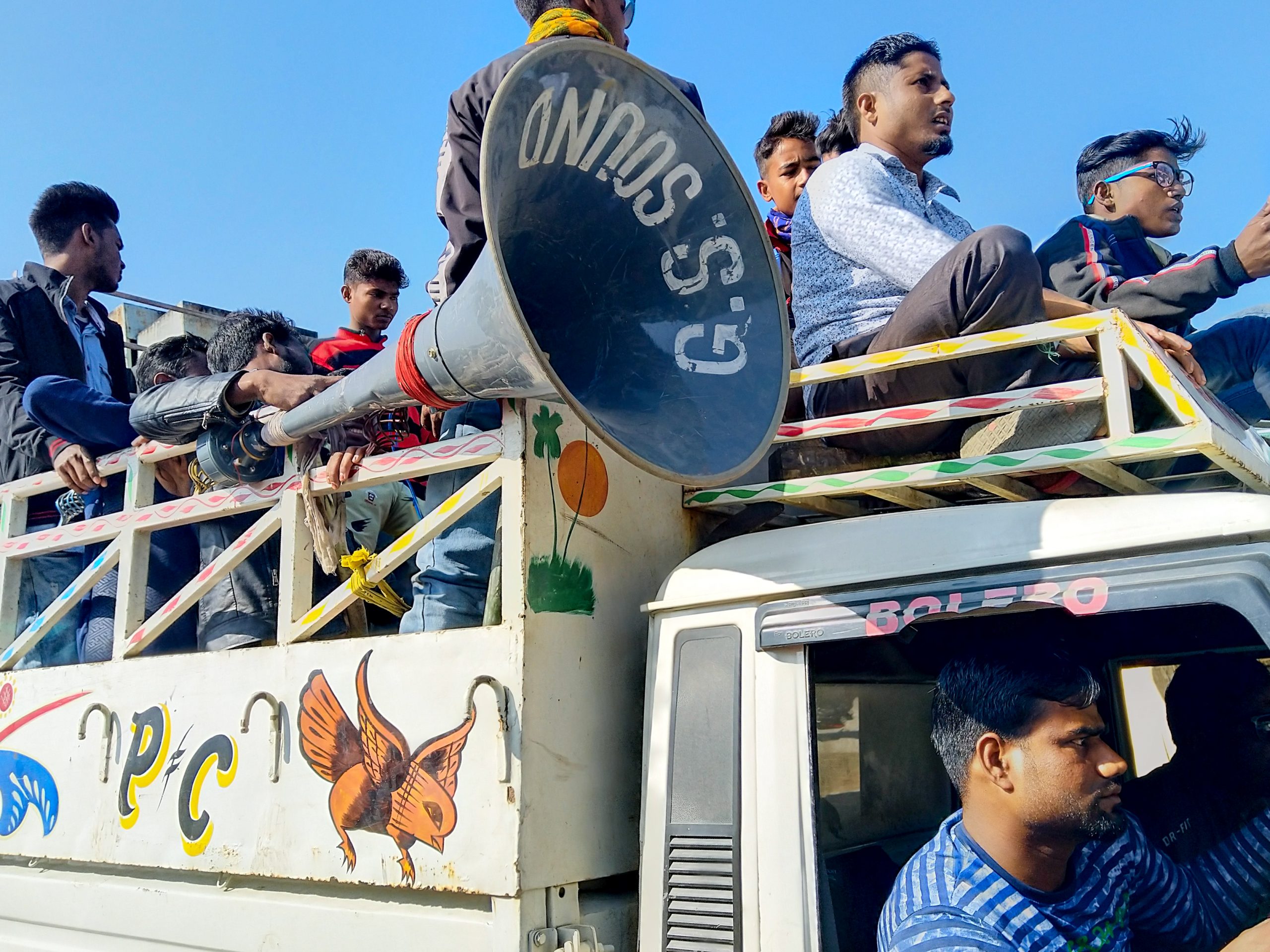
Once the Sumo entered Balemu, the terrain changed. Undulating hills gave way to flat rice fields, coconut groves, and banana plantations. There was no particular checking for outgoing vehicles at the Balemu checkpost. Our driver got down and made a ritual entry in the checkpost log books before heading into Udalgudi district of Assam. Interestingly, a large number of people had gathered at Bhairabkunda—situated on the borders of Assam, Arunachal, and Bhutan—for picnic. It was a Sunday, it was winter and the skies were clear—in short, perfect time for a picnic.
Such trucks loaded with picnic-going gangs and obnoxious sonic weapons drove on to the banks of river at Bharabkunda.
The Sumo dropped me in Paltan Bazaar at 3:00 pm. I checked in at Mayur Hotel situated right opposite to the ASTC bus stand. It was the same hotel that I had stayed in 2002 with my father during my IIT-JEE entrance examinations and then with my family when I had come for admissions’ counselling at IIT-Guwahati later that year.
I also paid a visit to Sagar Ratna Restaurant. This was one of those places that I remembered for its dosa and chutneys from my first backpacking trip with Nandy in 2014. I was too hungry to objectively evaluate if the dosa was better than the one I had in 2014. (As if I remembered how it tasted six years ago!)
The green mint chutney was missing this time. They gave extra coconut chutney and sambar.
Subhajit was also in Guwahati. He had decided to temporarily move away from Bangalore and had flown in while I was in Tawang. He had his paternal house there and his company had extended their work from home policy well into 2021. That night I ended up accepting an invitation from him and had dinner with him and his sister’s family. They had prepared Boroli Fish. This particular fish is found in the freshwater streams near the foothills of North Bengal and Assam. I don’t remember much about this fish but when I told my mother, she recounted that she had cooked it many times for us back when we were in Cooch Behar.
With Subhajit at his Sister’s house.
And that marked the end of my trip. I had my flight back to Kolkata the next day.
Fin! (This Maine Coon is Subhajit’s niece’s pet.)
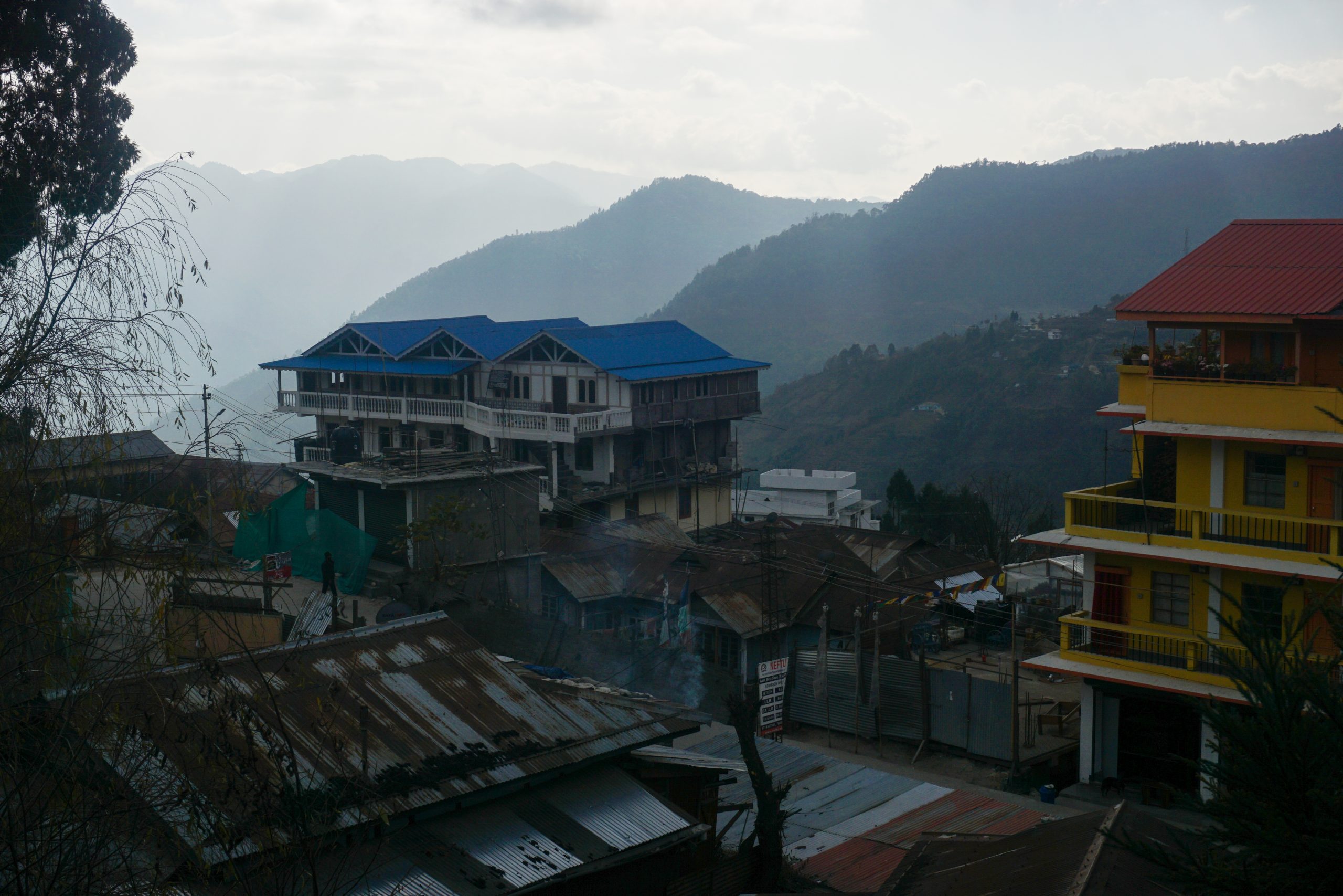
]]>0Sauvik Biswas<![CDATA[Day 14-15: Bomdila]]>https://sauvikbiswas.com/?p=56982021-01-15T16:36:08Z2020-12-19T16:40:00Z[Read more...]]]>Dawa came to see me off for one last time in the morning. It was unusual of him to wake up that early. We both had our morning tea with Sangi Thema before bidding them goodbye.
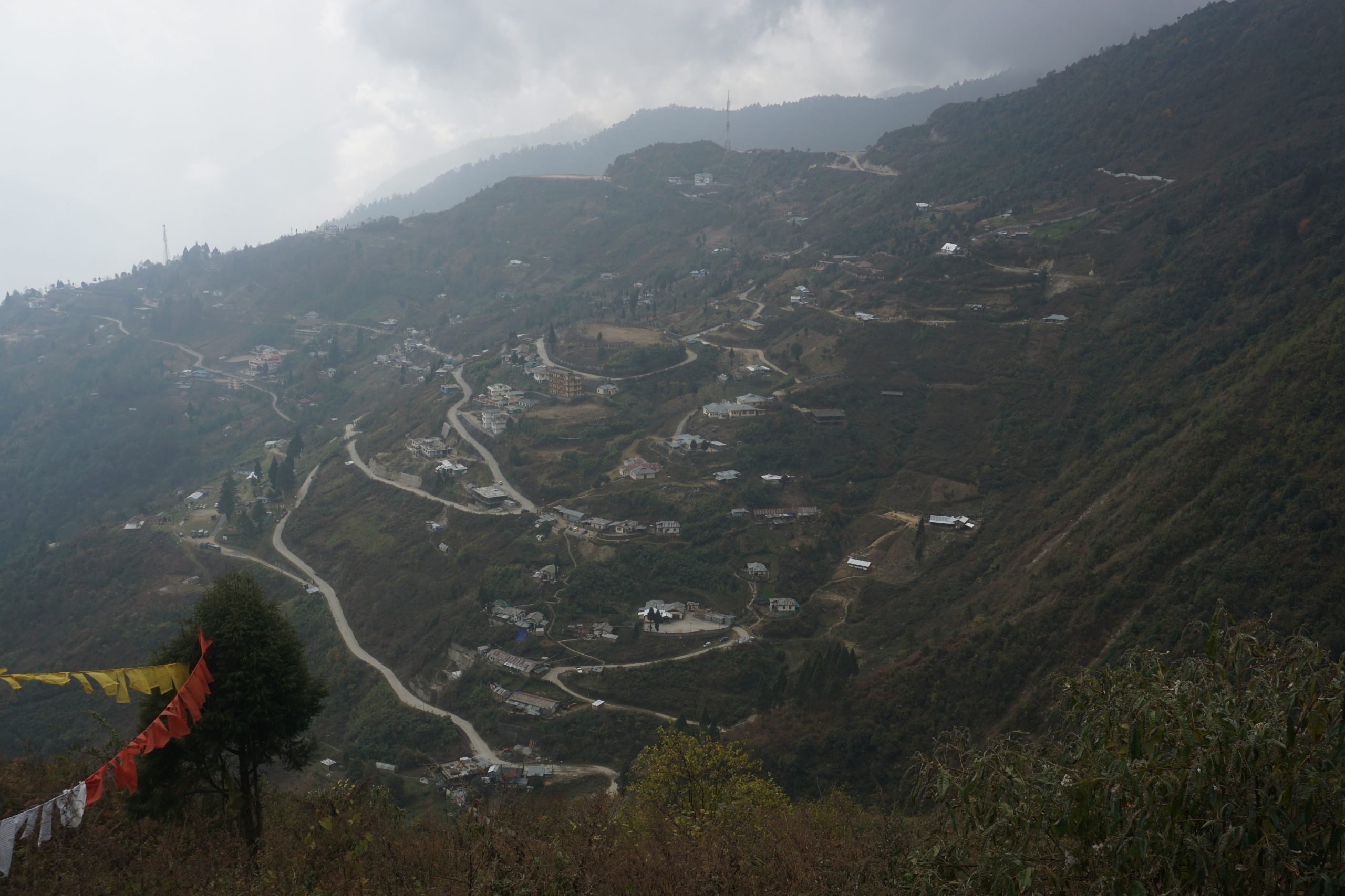
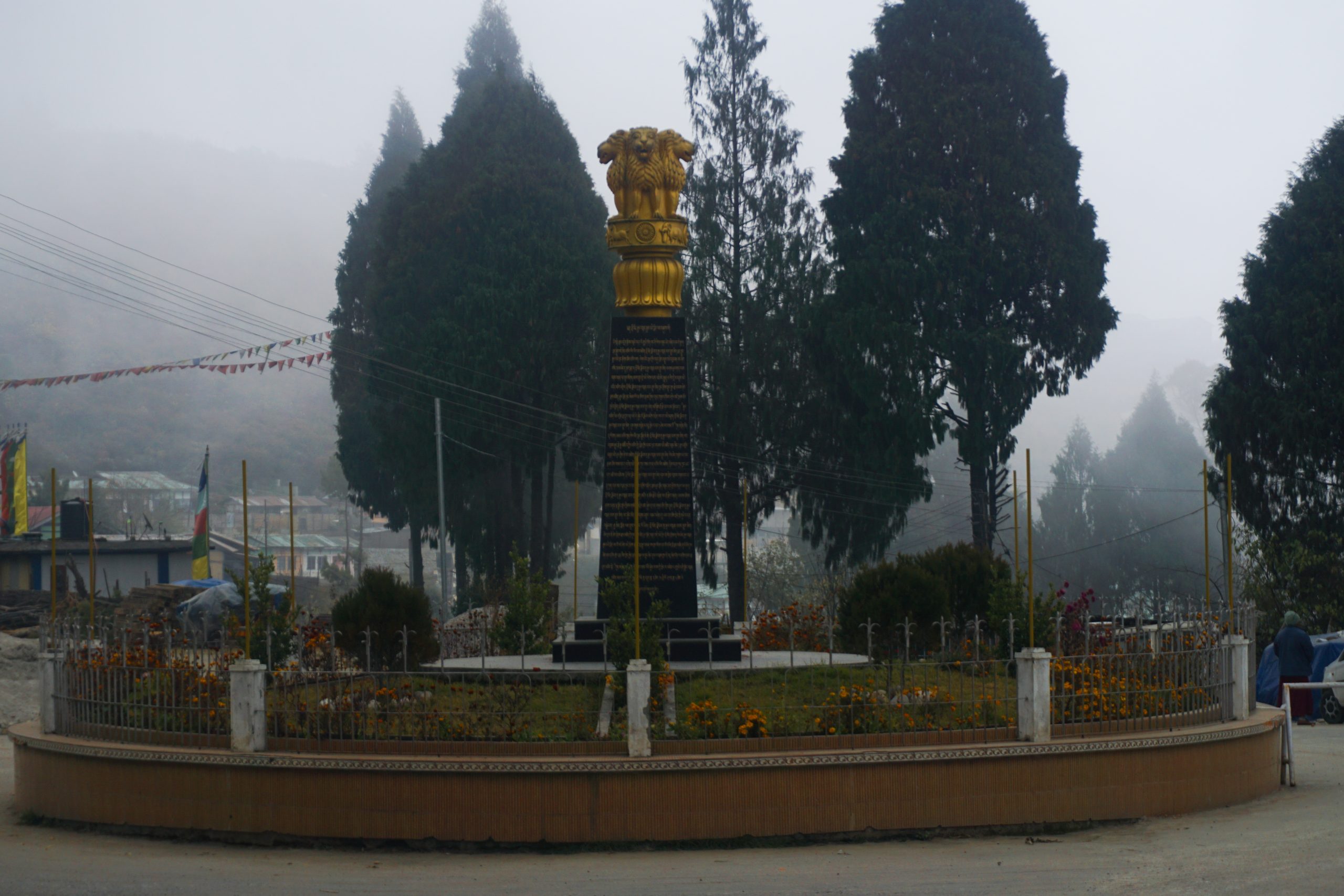
Bomdila is situated at a higher altitude than Dirang. Our Sumo snaked its way up through the switchbacks and military settlements for the next hour or so to reach the Sumo terminus opposite to Bomdila Stadium. These Sumos shuttle between Dirang and Bomdila a couple of times a day and charge INR 200. A lot of people travel to Bomdila as it is the administrative headquarters of West Kameng District.
The first board for lodging that crossed my eye was that of Lungta Residency. Upon inquiring, I found out that it was costly for my budget. I tried keeping my per day accommodation cost well below INR 700. It’s easy to burn through the total budget fairly easily in a long trip if I am not careful. For me, a lodging place is strictly for resting at night. I prefer spending most of my time outside. Even at night during such trips, I have ended up chatting with random strangers in front of a bonfire. I prefer spending much of the budget on sampling local food. The woman at the reception was helpful enough to point me to a different hotel nearby—Hotel Tashi Den—that was within my budget. While exiting from Lungta, I met a group of bikers from Kerala and Bangalore. They were headed towards Dirang. I suggested them to make a detour to Mandala Top as it was a fascinating place that many motorbike-packers miss.
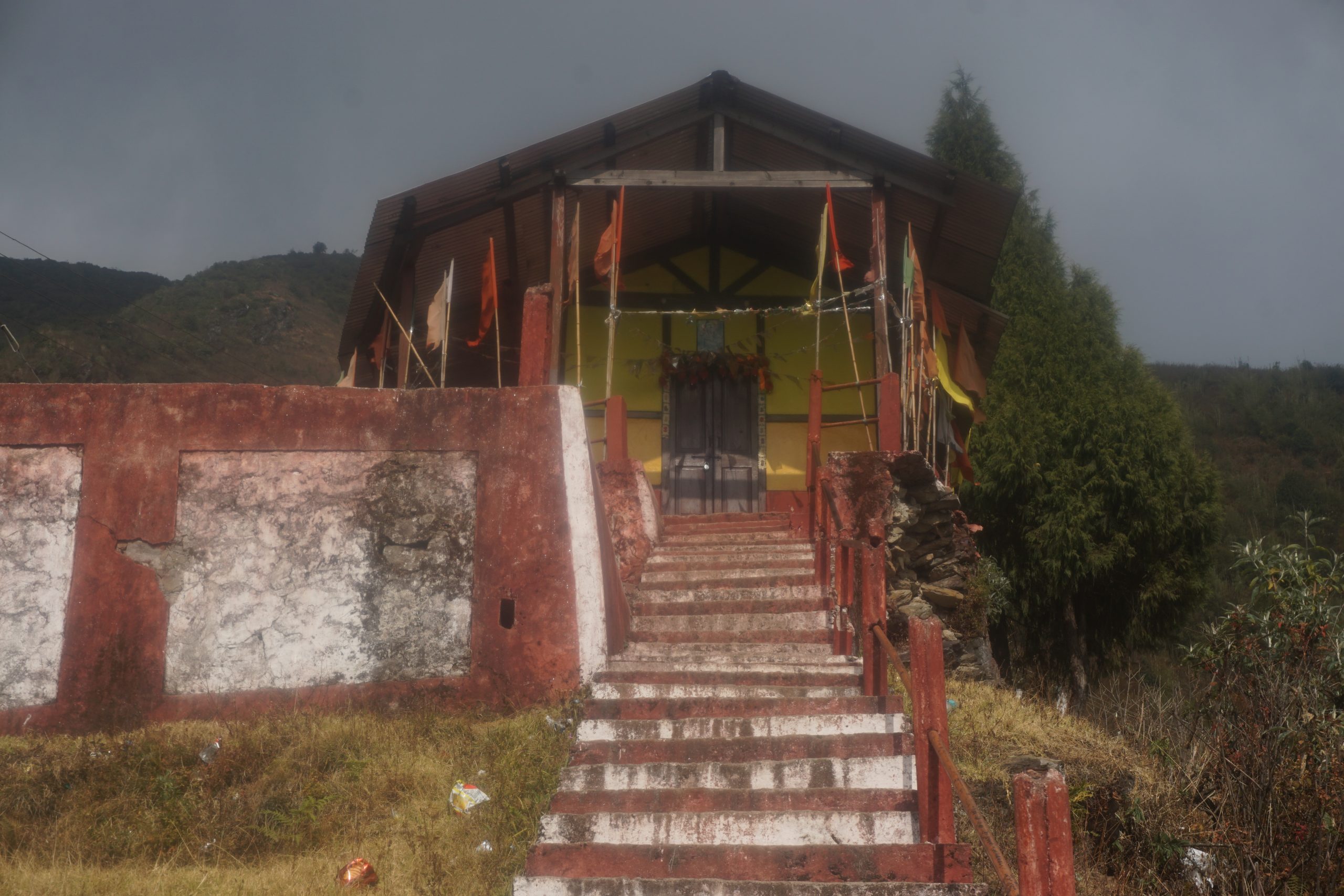
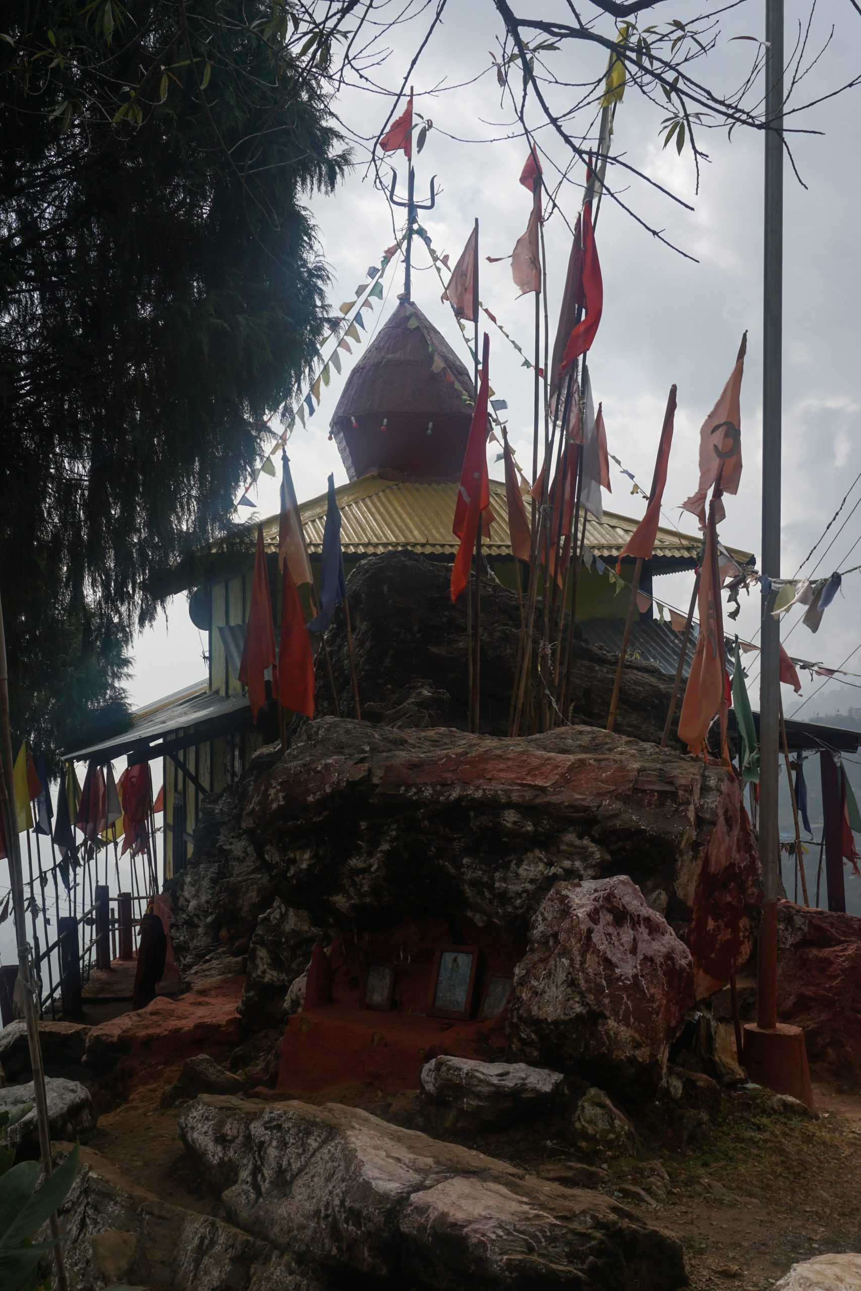
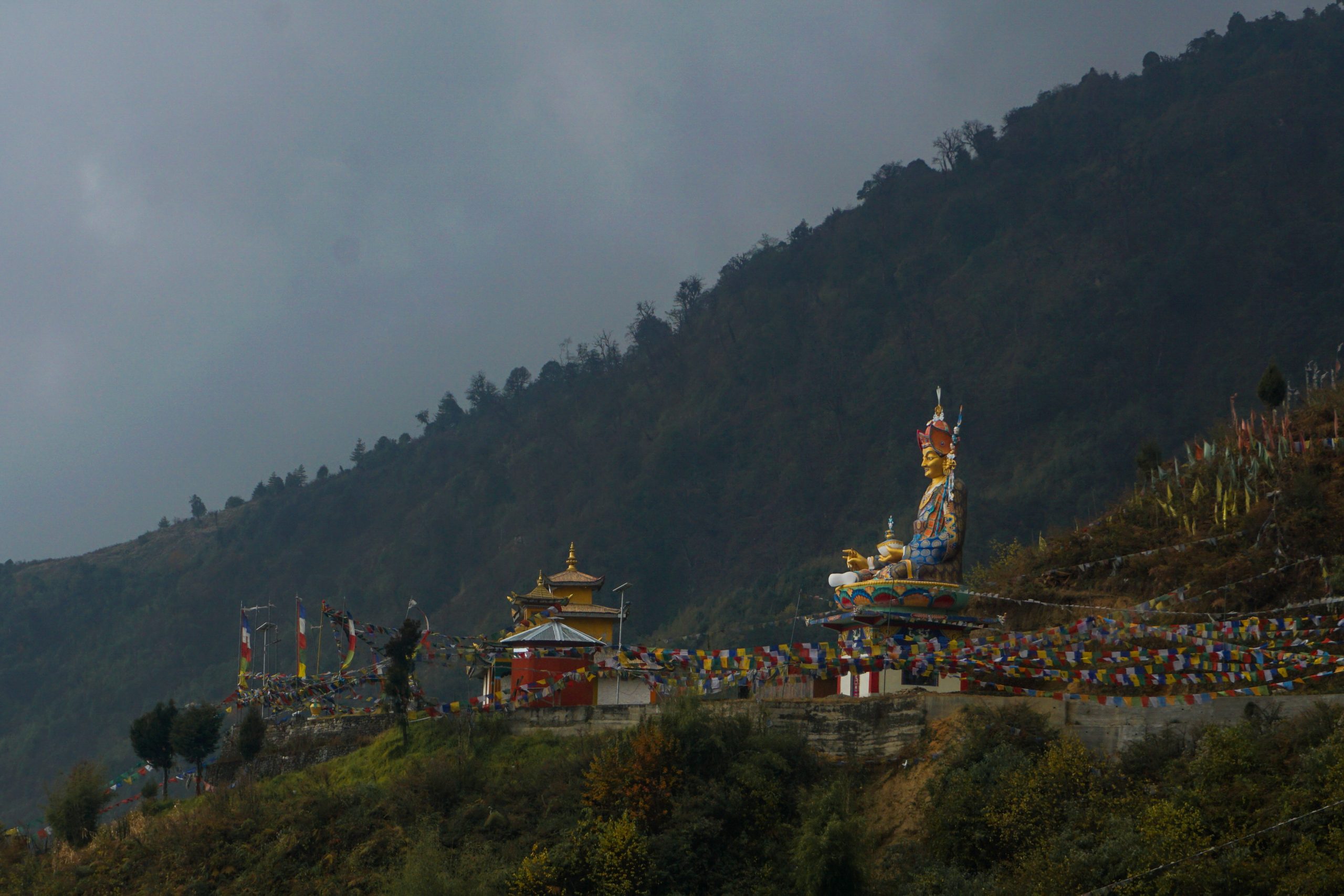
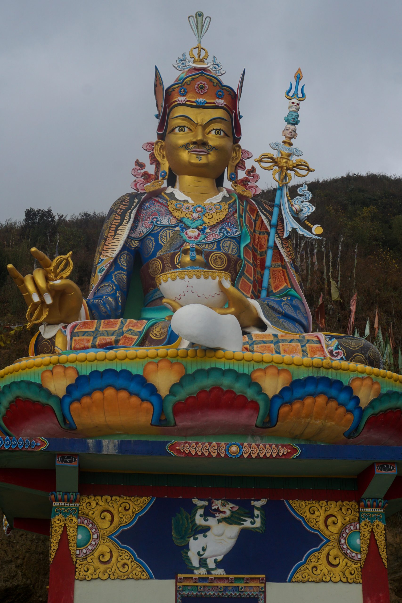
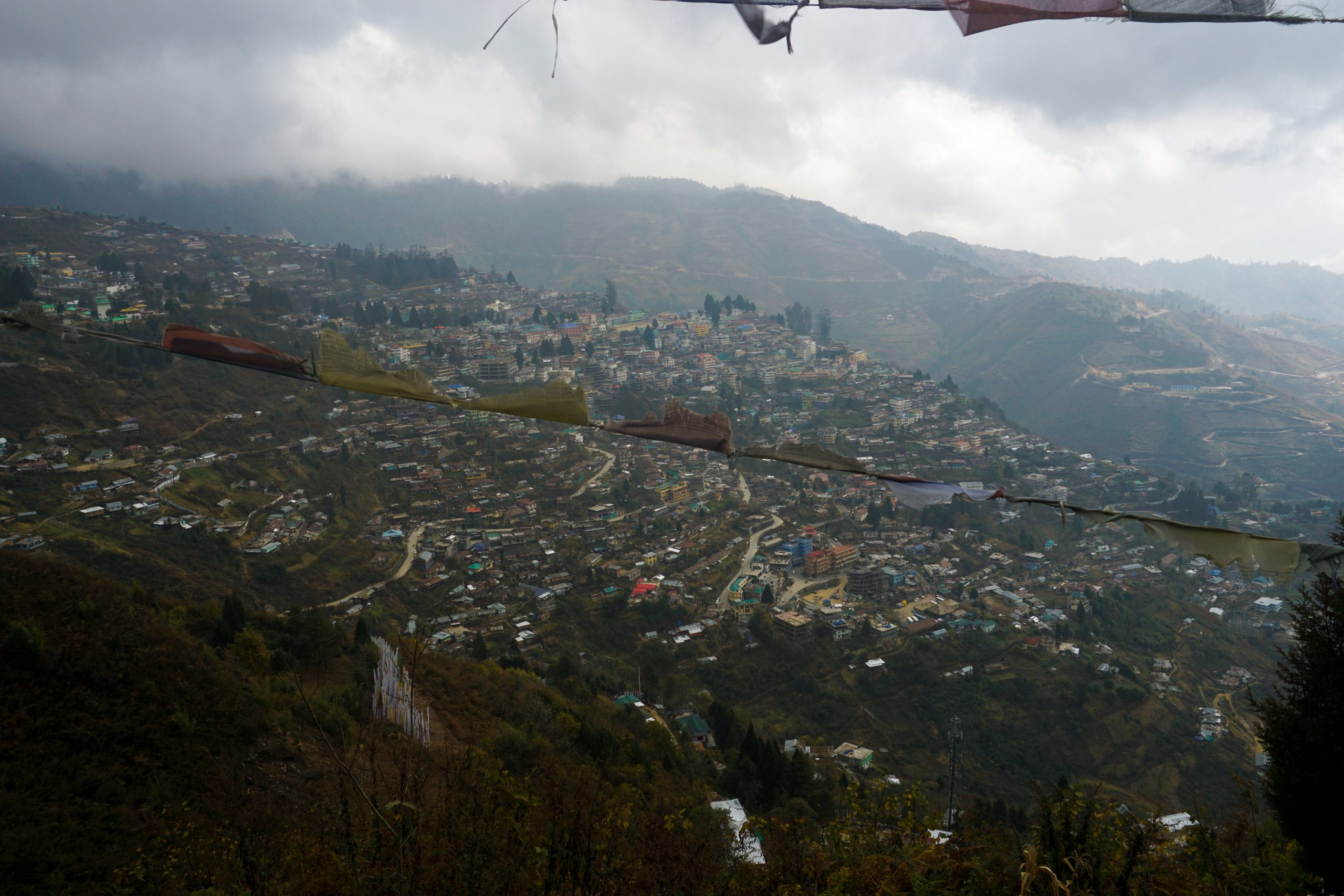
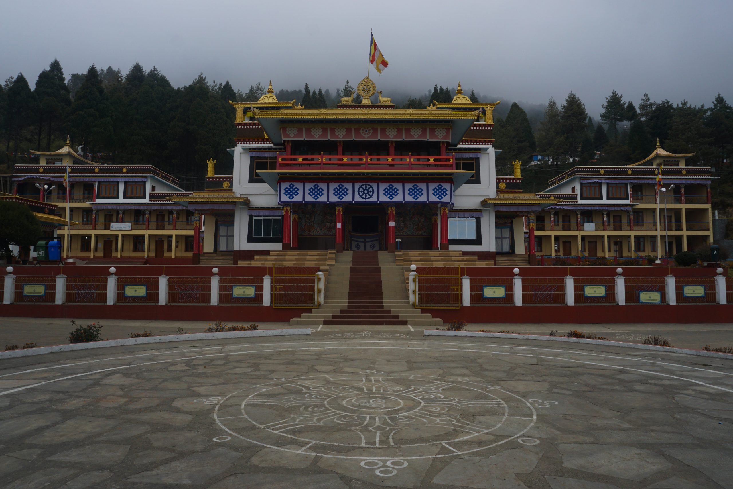
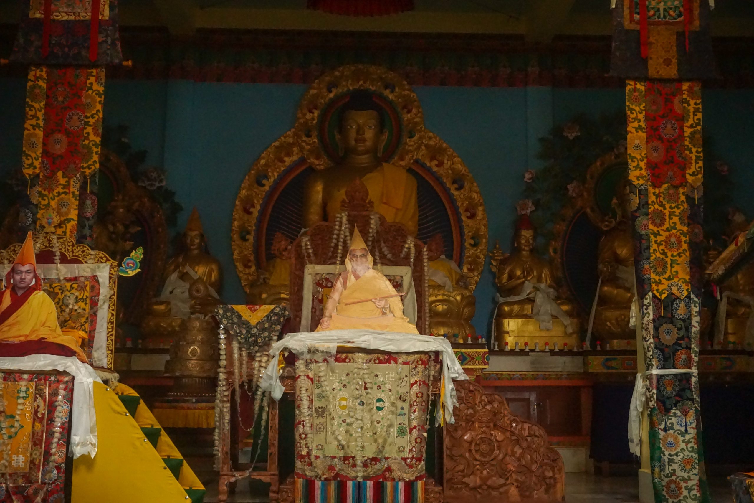
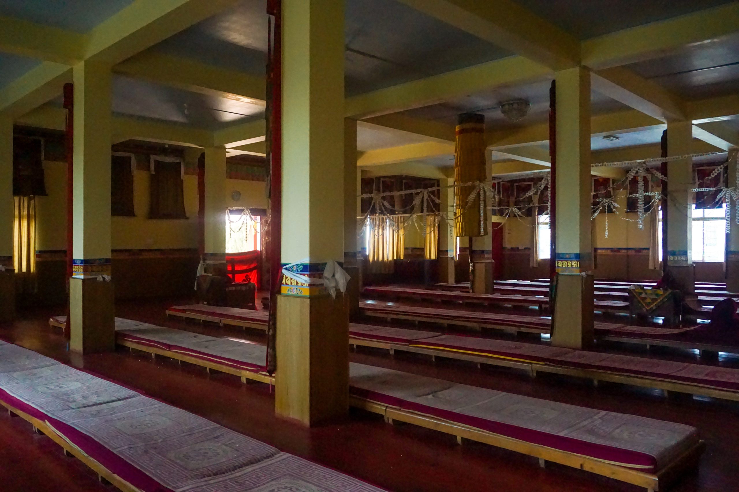
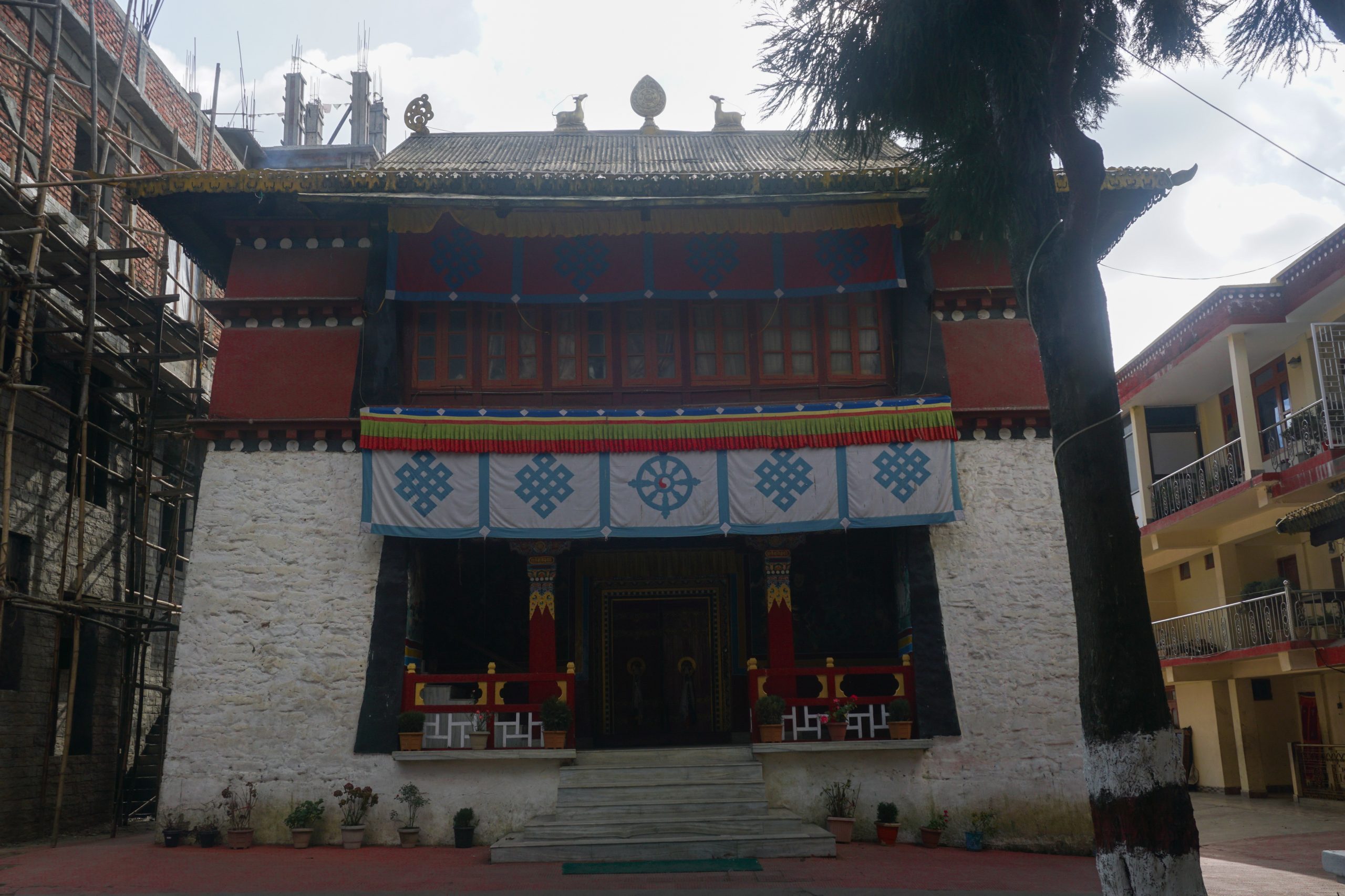
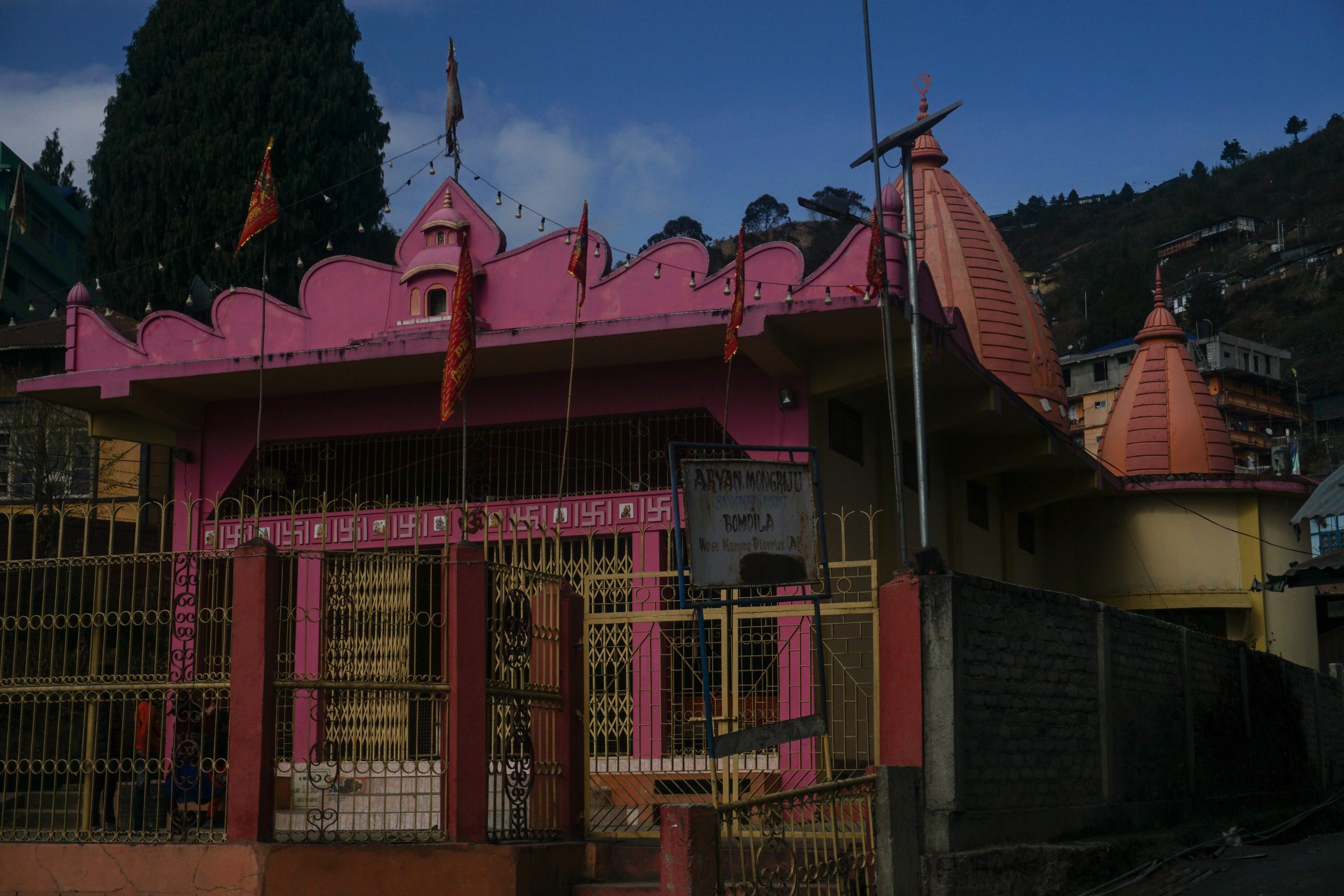
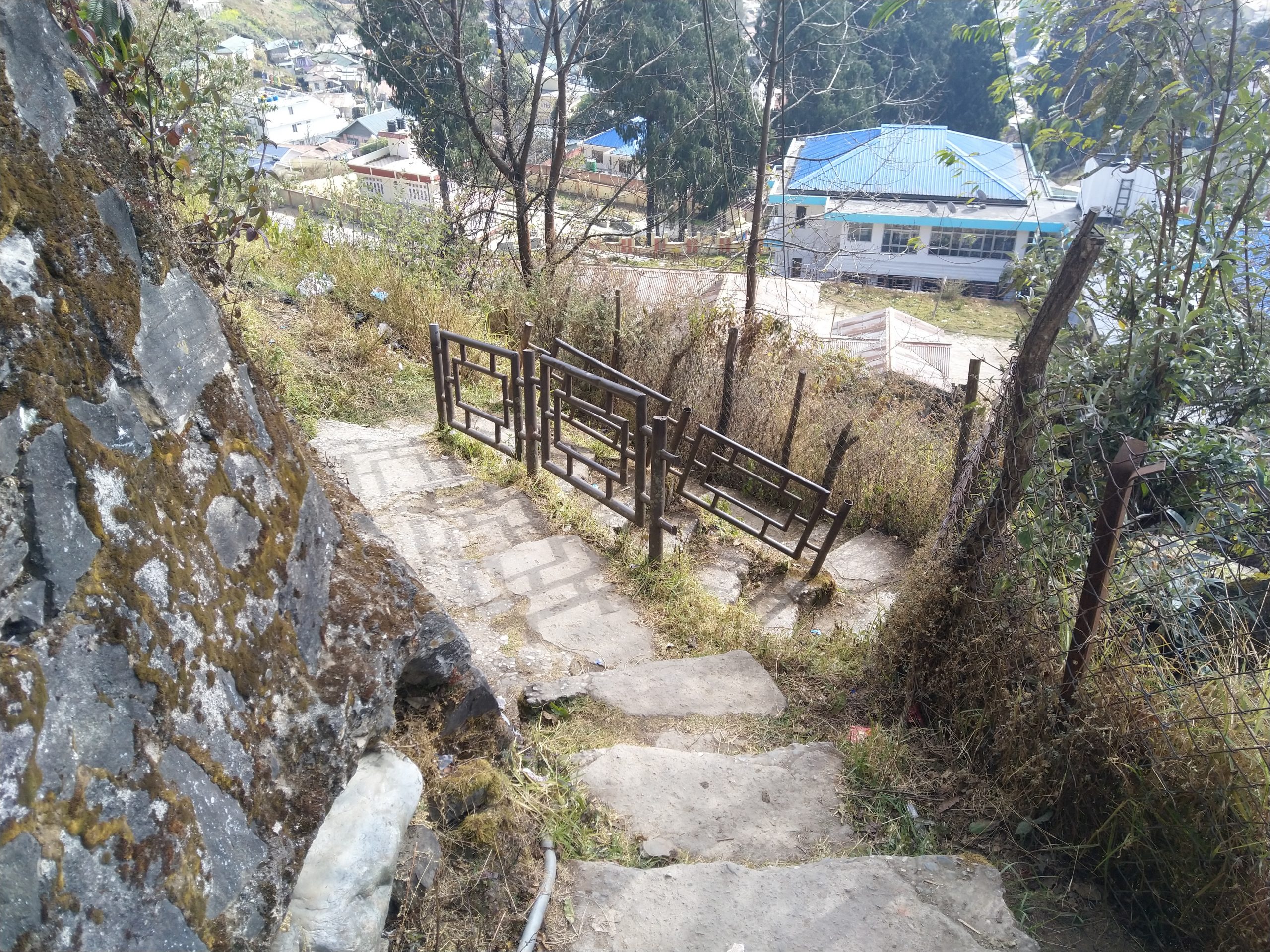
I was quite early and the hotel room wasn’t ready. Instead, I had my breakfast and left my big backpack at the hotel while I ventured out into Bomdila Market. The first thing that caught my eye was a large statue of Guru Padmasambhava on the slopes of a hill. In order to go there, I had to cross the market and reach a church at the end of the market. A fleet of stairs circumvented the Bomdila Independent Vinyard Church and led me to a Nag Temple. I stopped there for some time, had some water and continued climbing the stairs through the slopes of two hills. From the market, it was a long way to the statue.
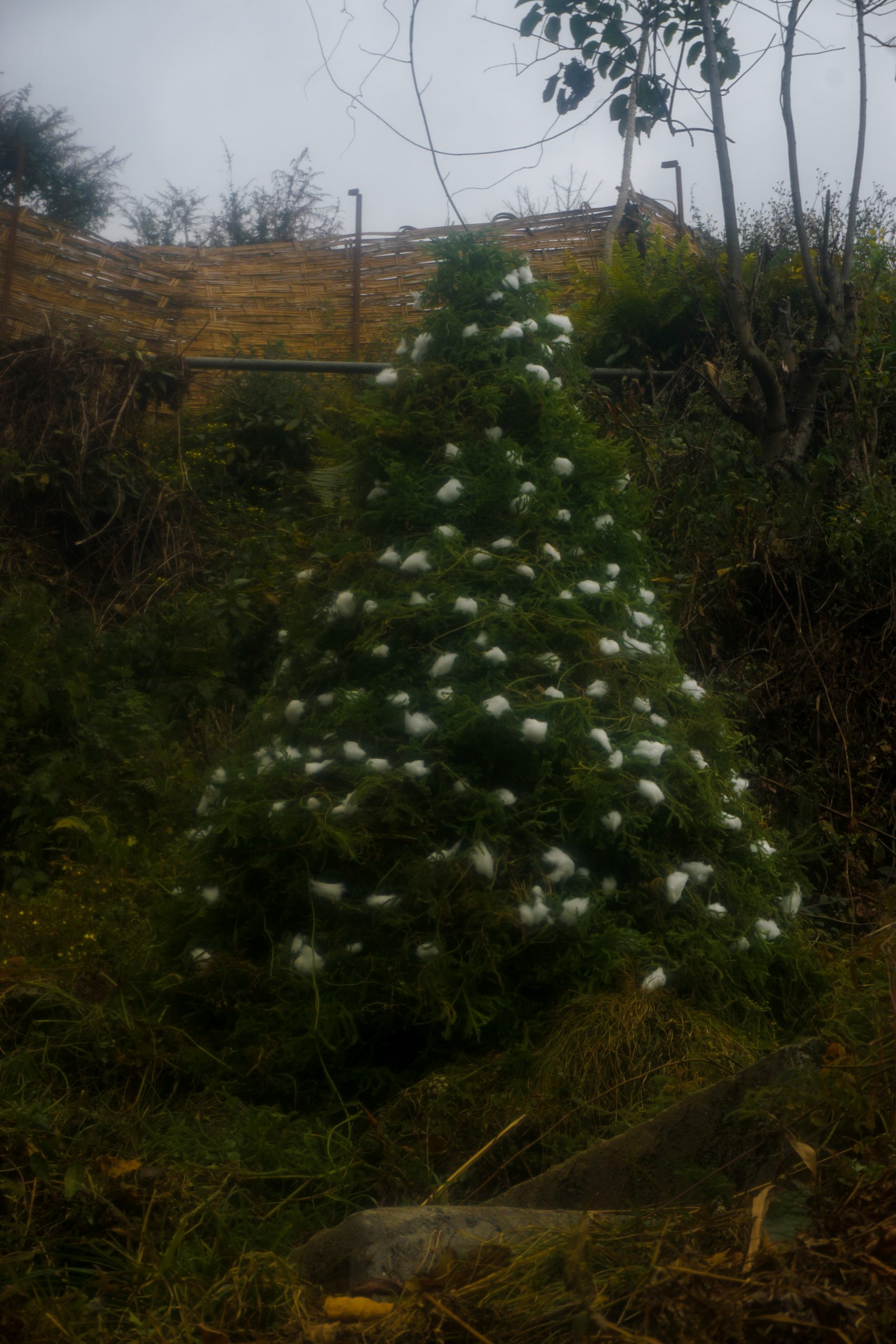
A Christmas tree in front of Independent Vineyard Church. I believe the cotton balls are placeholders for snow that Bomdila usually receives from Christmas week onwards.Stairs leading to the Nag Temple.Nag Temple from behind.The stairs form much of the trail.View of the statue and the monastery from the trail.
The statue is located in a small monastery called Rigzing Woselling (27°16’08.2″N 92°24’34.4″E). Over there a number of monks and their families were preparing for a ceremony the next day. For the past three years the monks had meditated. They had also not cut their hair during that time. They were preparing an offering of jaggery, wheat flour, and butter. A family member of a monk gave me a packet of Lays chips as prasad—it was earlier placed as an offering in front of Buddha!
Guru PadmasambhavaMonks and their family members preparing an offering of jaggery, wheat flour, and butter.There was a lot of packaged goods kept as offering inside the prayer hall.More offerings arranged for the ceremony the next day.View of Bomdila from the statue…
The upper monastery was visible from the idol. I must say that it was not a straight forward route to that place. Luckily one of the monks showed me a marker on the trail—a concrete slope from where I had to to take a detour upwards in order to reach Bomdila Monastery. The trail entered the monastery from behind. While entering, I encountered a number of young monks playing near the rear gate. As soon as the school bell rang, they rushed back—lunch-time was over.
Elder monks were studying for their Buddhist Philosophy examination.The younger ones enjoyed playing in the sun.Bomdilla’s Gaden Rabgyel Ling (GRL) Monastery aka Upper GompaBuddha Statue and the current Dalai Lama’s cutout in the prayer hall.GRL’s prayer hall was the largest I had seen during my trip.An Ashoka pillar near the entrance of the monastery. The inscription recounts the destruction of 1962 and wishes for peace.
I wasn’t able to stay much longer as fog started to cover Bomdila. (I came back again to the monastery the very next day; this time using the walking trail from the Sumo stand.) I returned back to the hotel. The temperature started dipping rapidly. The weather app on my mobile showed that the nighttime temperatures for the past two days were sub-zero and it would be no different that night. Thankfully, I had a heater in my room. I don’t remember when I had dozed off while watching some Hindi-dubbed Telugu movie.
I had postponed all my shopping for the final day. As luck would have it, it was a Saturday and Bomdila Market remained closed on Saturdays.
I had a hard time finding the Lower Gompa. It was marked on Google Maps but wasn’t there in reality. In the end, a local helped me out. For the sake of my readers, it is right next to the Craft Centre & Ethnographic Museum (real coordinates: 27°15’44.5″N 92°25’12.9″E).
Lower Gompha.The prayer hall had a large cutout of the Dalai Lama inside.
Three kids—two in fourth standard and one in sixth—were playing near the giant mani wheel inside the gompa’s premises. I took this opportunity to know a bit about them. Ishak was a Christian, Sanju was a Hindu, and Tsering was a Buddhist. The religious composition of the population changes as one moves further South, deviating from a population that largely follows Tibetan Buddhism near the northern borders. The kids enjoyed football but most of the times they spent their time playing battle-royale-style games like PUBG and Free Fire. Sanju was especially interested in my camera. I showed him some controls with which he was able to click some good photographs, including mine. I took them to the market and bought them some churgam or chhurpi (hard cheese made from yak’s milk) from a farmer’s marketplace that was open even on a Saturday.
Isak Tamang, Tsering Tashi, and Sanju Gurung.Sanju clicked this photograph of mine while fiddling with my camera.
While I was able to visit the Gompa, I wasn’t able to visit the Ethnographic Museum. It was closed due to COVID-19. In fact, it was not the only place I was not able to enter. After a long walk to the military barrack, I was denied entry inside the military campus. Bomdila Memorial was closed for civilians as the pandemic-induced restrictions in military areas hadn’t been lifted. (It was still five kilometres from the checkpoint.)
With nothing left to do and a quite a lot of time to spare, I walked around aimlessly in Bomdila clicking photographs.
I saw these mounted bovine horns on one of the houses at the end of Bomdila Market.Mural on the Circuit House.A drinking water fountain near the Staduim. Bomdila staduim and its VIP gallery.This temple near the Police Station was visible al throughout as I climbed up towards the military barrack / Upper Gompa. It was built in the memory of another Mr. Biswas.Unlike Dirang or Tawang, most shortcuts are well paved. Also unlike those places, many shortcuts are truncated by fences erected around private land.The APSTC counter was closed. It had been so since the start of the pandemic.View from Bomdila’s Market.Buildings with colourful roofs in Bomdila Market. The shops on the ground floor were closed on Saturday.Self explanatory!
That night I had an unpleasant altercation with the hotel manager. I had asked him thrice to reserve a seat for Guwahati. When I inquired at night, I found out that he did not do it. Had he not taken the responsibility, I would have done it myself. I had crossed the Sumo stand innumerable times that day. I should have made him do the booking in front of me. It was not an alarming situation as I had a night’s buffer before my flight and I could take some alternate routes to reach Guwahati in the worst case scenario.
]]>0Sauvik Biswas<![CDATA[Day 12-13: Villages around Dirang]]>https://sauvikbiswas.com/?p=56592021-01-15T18:07:30Z2020-12-17T16:51:00Z[Read more...]]]>In the next two days, Dawa took me to three villages—Chug, Sangti and Thembang.
Chug and Sangti
Dawa wanted to show me Chug. It’s slightly inwards from Rama Camp and is famous among Dirang locals for its picnic spots. He had not been there before and had only seen images shared by his friends. When we reached there, we realised that we came at the wrong season. Instead of the beautiful flowery meadows, we were greeted by barren lands—all dried up post-harvest. Dawa was confused—was it the same place where his friends had been to? He asked a local who confirmed that it was the same place. However, picnics were prohibited. Merry youths in inebriated state would often break liquor bottles and scatter shards of glass in the fields and meadows, thus creating a hazardous terrain for locals and farmers.
Chug had a number of settlements. This one was called Changpa as written on the signpost.These lovely roads reminded me of those I’ve cycled on when passing through the villages around BangaloreVillagers at Chug separating corn from cobs. They’ll be converted into flour and alcohol.
We rode back, picked up momos from Rama Camp (because Dawa had heard that momos from Rama Camp were really good) and headed towards Sangti.
Sangti was known for its kiwi, orange, pear and apple farms as well as a college. Unlike Chugh, it was a well known picnic spot—even among outsiders. There were a number of guest houses as well as camping tents on a private property on the banks of river. Unfortunately, the road that connected Dirang and Sangti was in a poor shape. Dawa said that it had been so for the last couple of years. Some kind of political tussle had prevented the road from getting paved with bitumen.
Sangti village gate. Notice the poor condition of the road. Whenever a large vehicle overtook us, we were greeted by a puff of dust.Dawa posing on an empty farmland.Sangti village. The colourful canopy is an open dining tent on the camping ground.
We didn’t face any trouble entering the camping grounds. It was not tourist season and the owner did not mind. While we were making ourselves comfortable, I observed a Nagaland-registered SUV and its passengers pack their things up and leave the camping grounds. They were probably the only tourists there.
Sangti river passing through Sangti valley.This shade and footbridge over a canal of Sangti river’s waters was made by the camping ground owner for his clients.
Honestly, the momos that we got from Rama Camp weren’t that great. We had better momos the previous day at Dirang. Nonetheless, we basked ourselves in the Sun before heading back to Dirang.
Dawa posing with the momos we got from Rama Camp.
Dawa wanted to take a bath at a hot spring in Dirang, but it was too late. The aperture of the valley is not that much—the Sun hides behind the mountains by 3:00 pm in the winters. Both daylight and temperature drops rapidly from then. We had to postpone our plans for the next day.
Thembang
The next day, I went out for a stroll along the river and reached Dirang basti when Dawa called. I asked him to pick me up from there. Dawa had some nieces and nephews at Thembang for whom I picked up some chocolates and chips.
Dirang basti from the main road.We stopped for tea at Munna Camp—a couple of kilometers from Dirang basti.
While riding on the road to Thembang, Dawa pointed out some of the forest areas that belonged to his extended family. We stopped at Sanggey Ling Chorten. The chorten was right beside the road and this is where most tourists stop, take a look around and move on to Thembang. However, this hides the route to a much more revered shrine higher up the adjacent hill. Dawa led me to a route that started outside the boundary of the chorten. I climbed a fleet of steps that led me to a small prayer hall maintained by the villagers of Thembang. Dawa showed me an underground stream. Plastic glasses were kept nearby so that visitors could use the water to clean their hands and mouth. I learned from Dawa that this ritual is always followed before entering the prayer hall of a gompa and that there would always be some sort of a water source before the entrance.
The gompa. It’s maintained by the villagers of Thembang.The shrine inside the gompa.Mani prayers are painted on rock faces everywhere..The locals worshiped this footprint of a lama who was related to the first Dalai Lama. The small stupas are made in memory of the deceased.Dawa posing in one of the alcoves.
Thembang is an old village. It was established sometimes in the 12th century. Dawa’s uncle stayed inside the dzong (fort) of Thembang. The village itself is fortified and the only way to enter or exit was through either of its gates. Dawa recounted tales of fight he had heard from his grandmother—like those between villagers from Rupa who would attack the village but lost as they couldn’t enter the village fort. At dusk, a villager would call out for anyone outside and close the gate. Dawa’s uncle’s house was not so old. The Sino-Indian war of 1962 destroyed Thembang. Yet, the construction reminded me of the old temples I had seen in Uttarakhand. Inside, it was one very large room with partial partitions that separated the private sleeping area from the kitchen-cum-sitting area.
The northern gate of Thembong……and the southern one.Kids playing cricket with Dawa.This is how maize is boiled before the fermentation process to create baang-chhang or aarak.With Dawa’s family.
I really enjoyed the food and the hospitality provided to me by Dawa’s family. One unique food I tasted was their chili sabji. It was tasty but a tad too hot for me even though the chilies used were of the milder variety. I also had a small cup of the more concentrated araak made from maize.
Radish pickle, Yak-milk paneer (chhurpi) and Chili sabji. I had already finished the dal.
Unfortunately, it was quite late by the time we returned to Dirang market. Dawa’s (and mine, too) wish of visiting hot spring didn’t materialise on that day, either. Instead, we stopped at a moto-repair shop owned by Dawa’s friend and warmed ourselves up in front of a bukhari that the shop owner had prepared. Since I would be leaving for Bomdila the next morning, I had to cancel my plans for hot spring.
My mornings during my stay at Womaling Hotel were spent drinking tea and conversing with Sanghi Thema—the owner of the place—while she and her two daughters wove traditional monpa garments. She flew frequently to Bangalore. Her son—Monpa Tertung Kunjum, now in primary school—was a Rinpoche at the Bylakuppe Monastery in Karnataka. Rinpoches are considered to be lamas who remember their past life and thus are revered among Tibetan Buddhists. An entire room of the hotel—adjacent to the one I was in—was converted to a prayer hall and a shrine for him and Dalai Lama.